Trail Report - Tour D'Abyss - Mt Evans and Bierstadt - Colorado
Including The Sawtooth
5.2 Miles Round Trip
2787 feet of elevation gain
Date Climbed: August 10, 2019
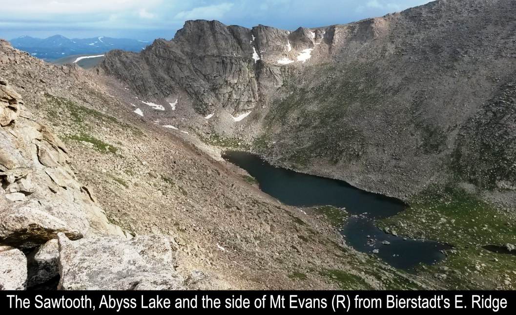
The Tour D'Abyss!! - Technical Class 3 Route! - This classic Colorado hike begins by dropping into the Abyss Basin
off the Mt. Evans Road, crosses the basin to ascend and climb the gnarly East Ridge of Mt. Bierstadt (14,060'),
descend and cross the awesome ledges of The Sawtooth, and finishes by ascending the South face of Mt. Evans (14,264')! ... AMAZING
day in the mountains with an AMAZING friend, my brother Tommy Neville, doing AMAZING rock scrambling and climbing.
To begin the Tour D'Abyss, you first have to drive up the Mt Evans Rd. This road is a bit more sketchy than the
road up Pikes Peak. Careful! When driving up the road, your parking area is at the big switchback at 13,300'. From
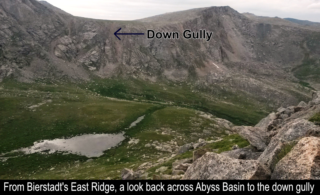
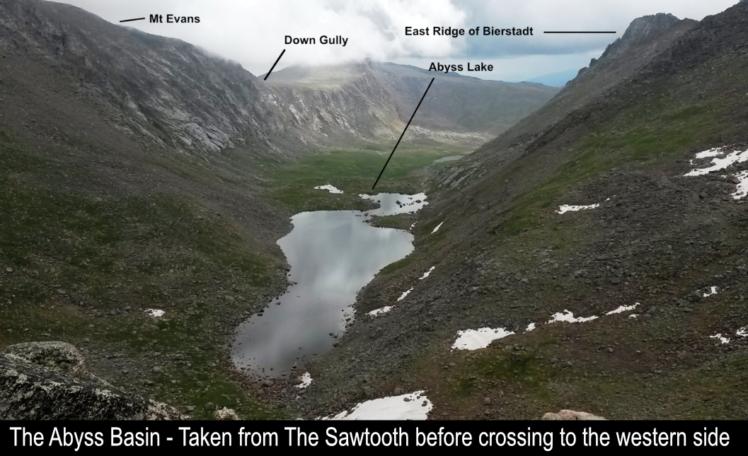
there, head down the hill to the entrance to the down gully to the Abyss Basin. We arrived just before Dawn and
started on our way.
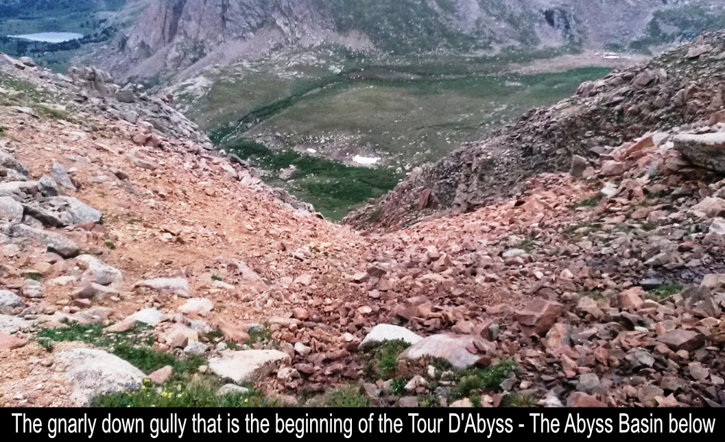
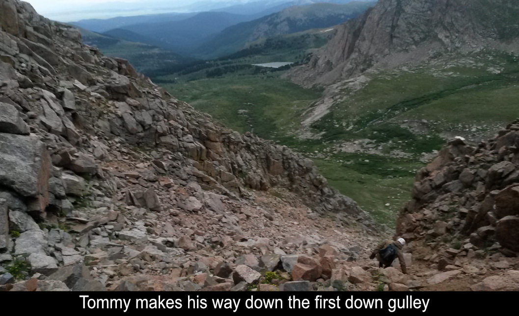
The down gully to The Abyss Basin is loose, but not so steep as to be a big problem. It just takes some careful
foot placements and you're down in no time! Tommy and I took a small break at the bottom of gully. Apparently
there is a trail across the basin, but we didn't see one. The area is flat and easy to cross.. that is until
you come upon a wet area with a bunch of willows near Bierstadt's East Ridge. A mistep and ker-plunge! ... I now
had a wet foot and we hadn't even started climbing yet! Great thing I had read other trip reports about this
area and had brought an extra pair of socks!
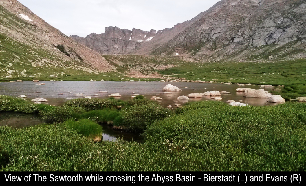
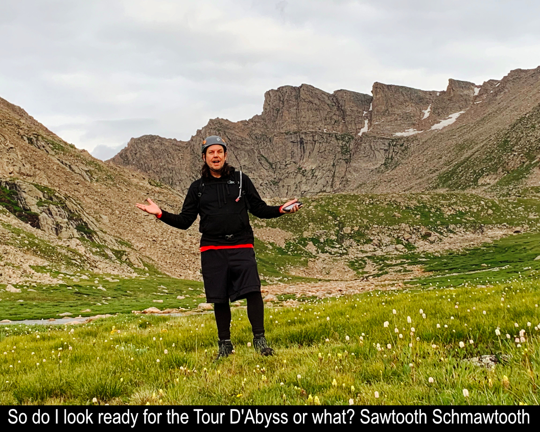
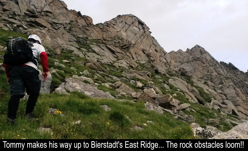
Once across the wet area of the Abyss Basin, it is time to climb to the crest of the East Ridge of Mt Bierstadt. It's
about 800 feet up ... pick your path and head up the grassy slopes to the ridge. A couple of younger climbers blew
by us on the way up the ridge. It turned out to be a great thing as we spied them taking the technical route first!
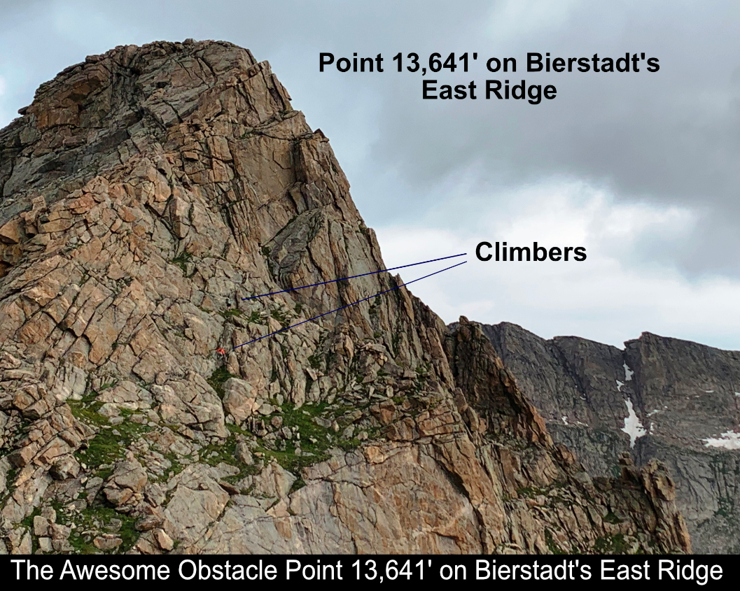
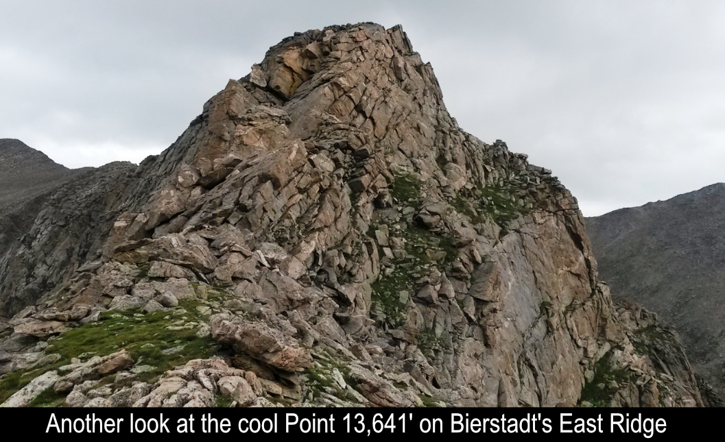
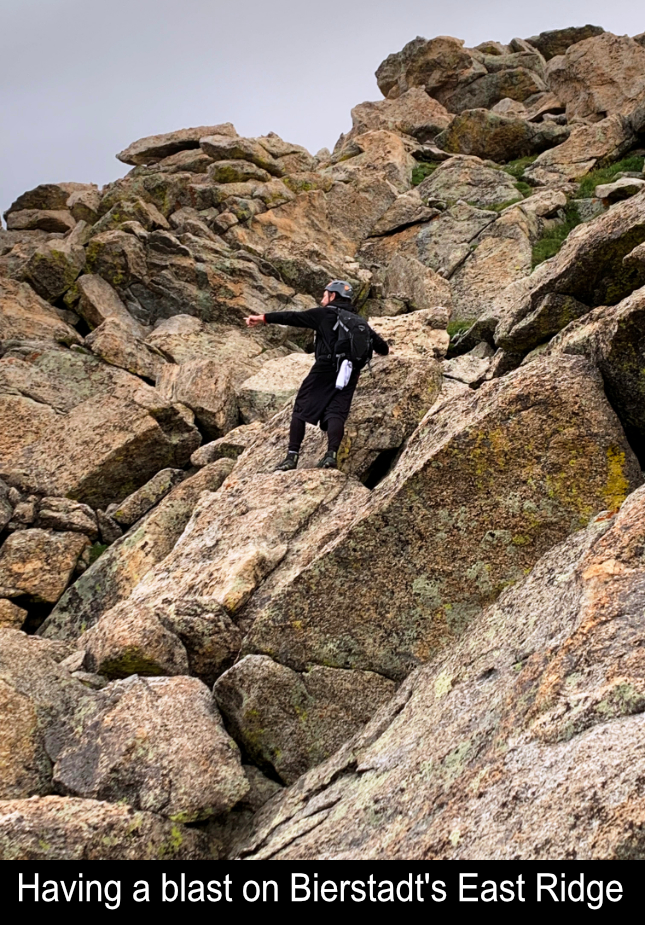
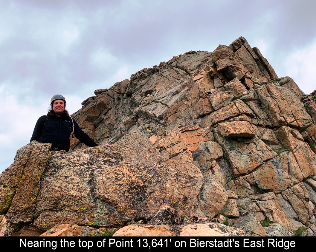
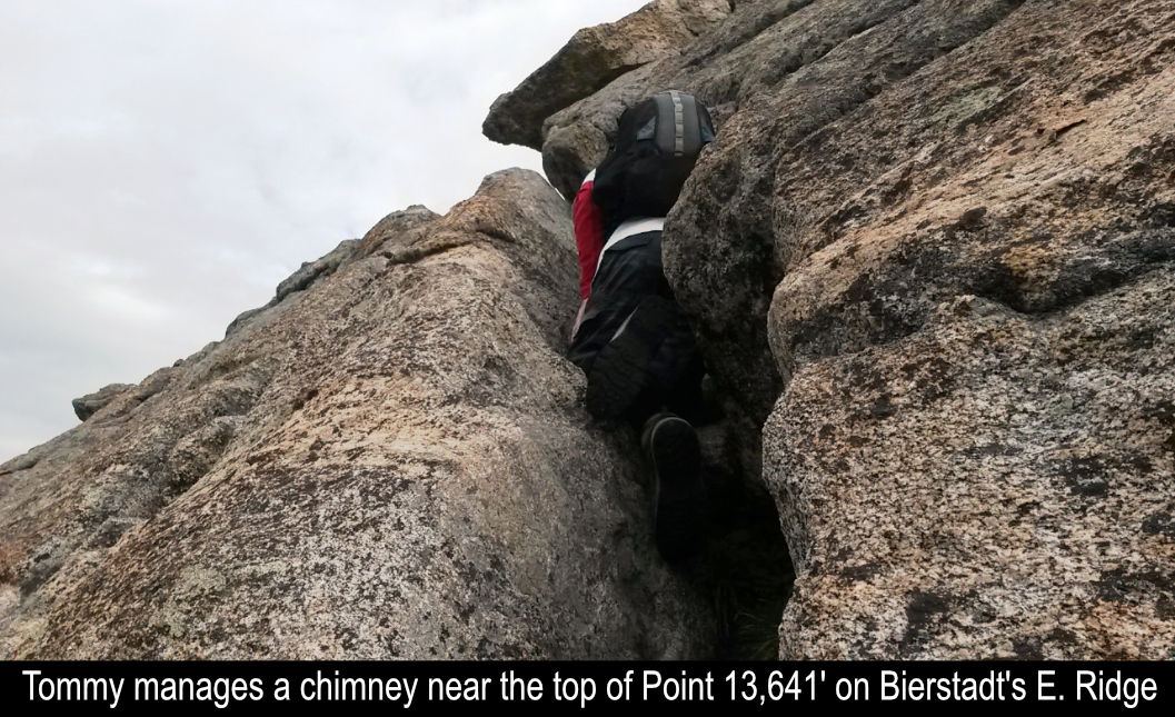
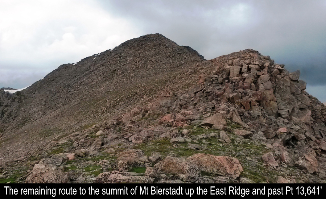
Next, the REAL FUN begins!! Point 13,641' is a killer rock hump along Mt Bierstadt's East Ridge that provides awesome
rock scrambling. There are definitely some exposed areas, so not for the faint of heart, but boy was it thrilling! There
is a small grassy ledge on the right (north) side and a rock ledge switchback which takes you to a chimney and then
on to more scrambling near the top. Tommy and I had a blast on this section of 'The Tour'.
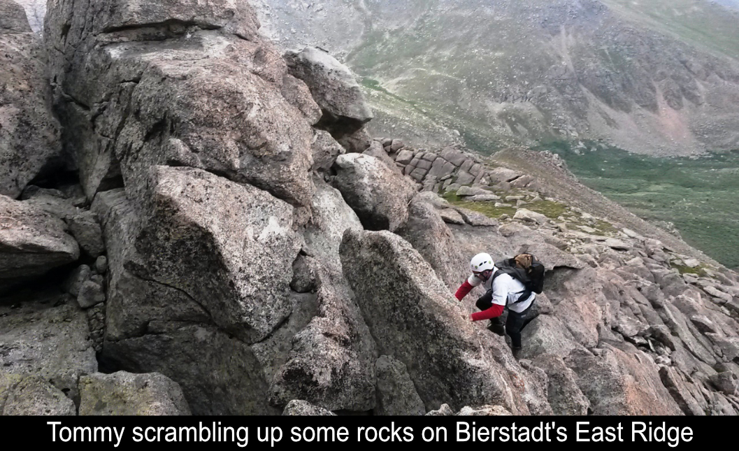
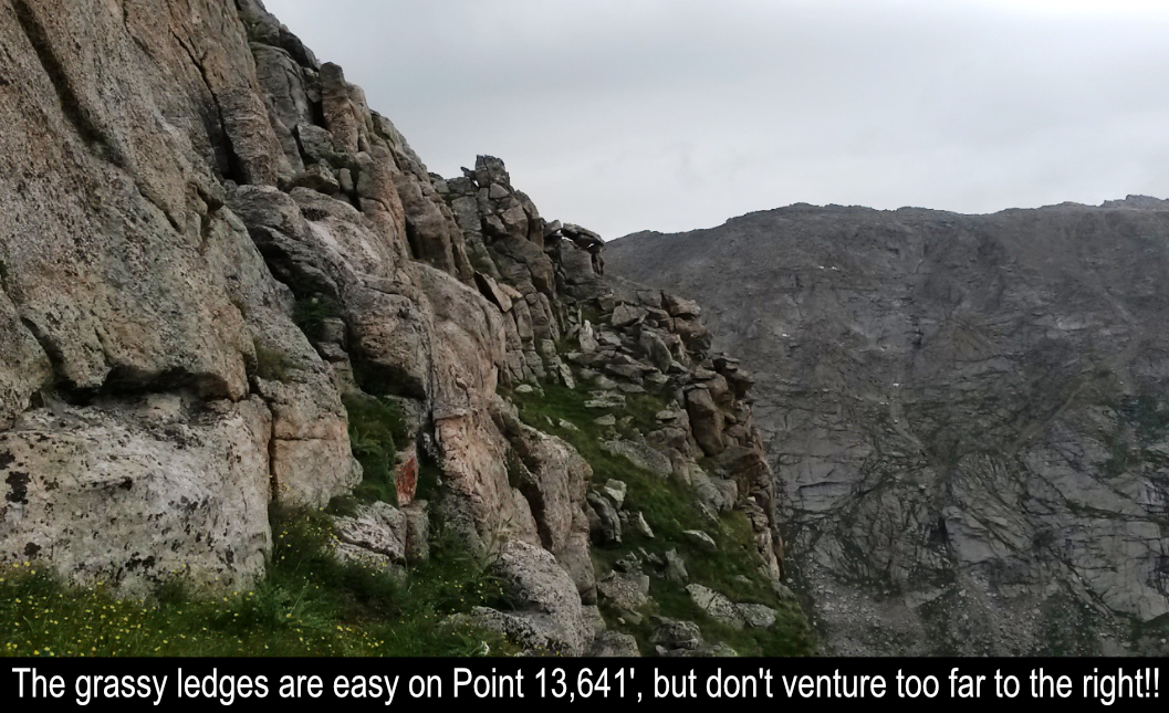
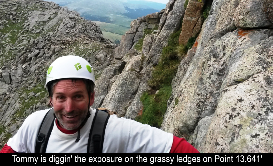
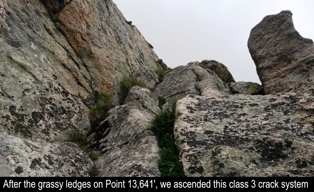
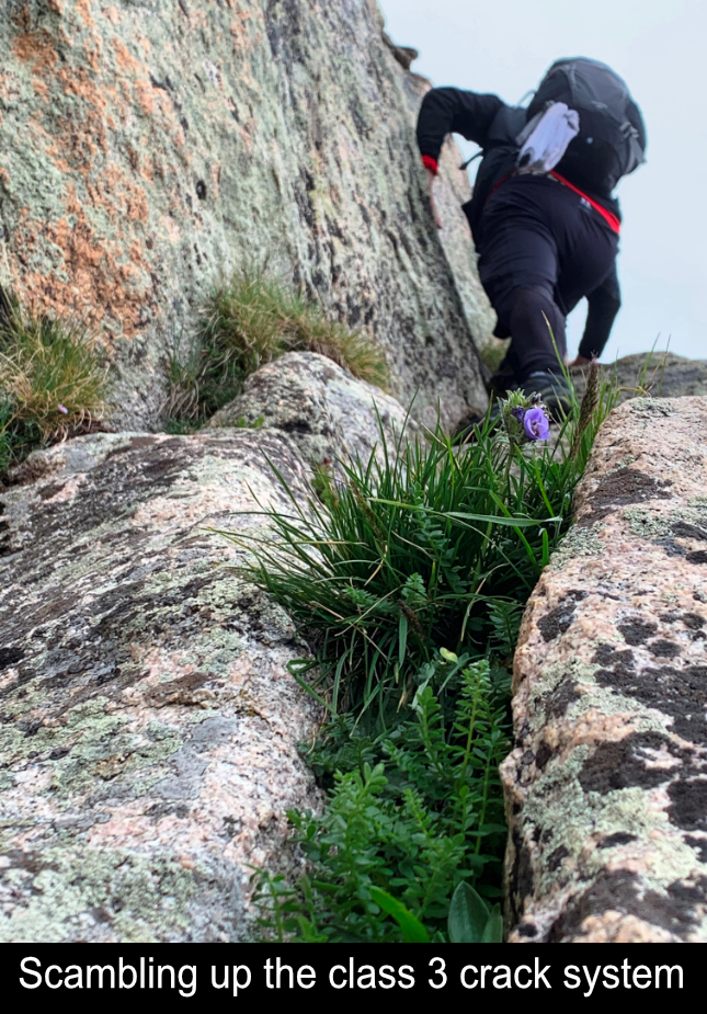
Here's a vid of Tommy coming up part of the exposed grassy ledge system that takes you up Point 13,641' on Bierstadt's East Ridge:
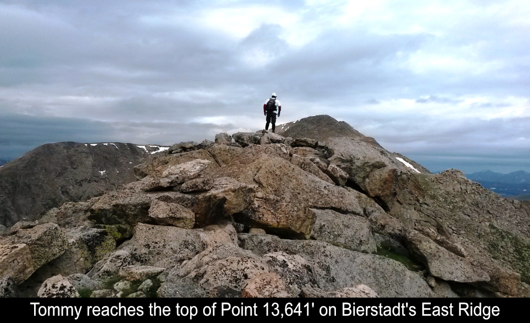
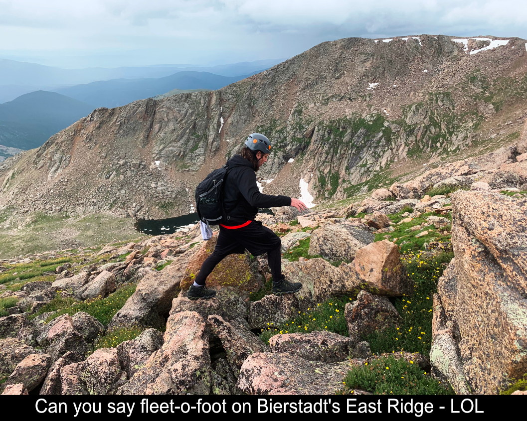
Traversing the top of Point 13,641' provided more awesome rock scrambling and beautiful views down into Abyss Basin
and over to The Sawtooth and Mt Evans. Coming off the top is a little tricky, but the most straight forward route is
directly over the top. Ledges along the left (south) side seemed as if they 'didn't go'. Once past Point 13,641', there
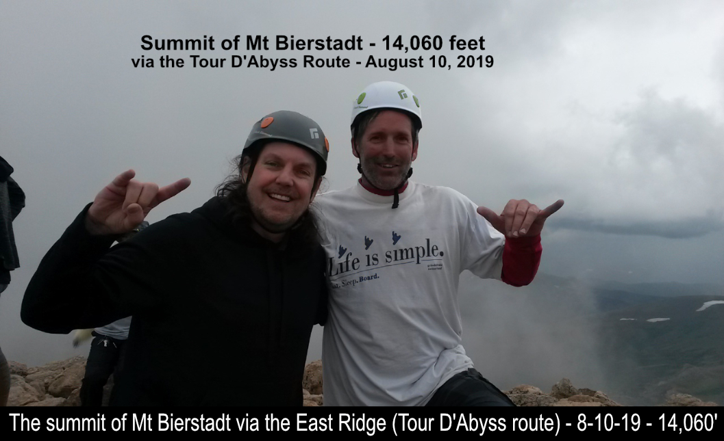
is still plenty of scrambling to the summit of Mt. Bierstadt.

While most participants take the easy route up and down Bierstadt (see my report here for information on that route)... not
only did Tommy and I take the WAY fun (and difficult) route up Bierstadt, but next up, the awesome Sawtooth!!
The Sawtooth is actually the name of the whole mountain (a 13er at 13,780'), but most people think of it as the wicked, class
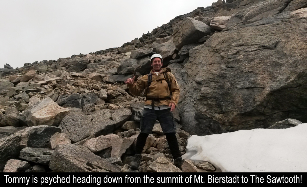
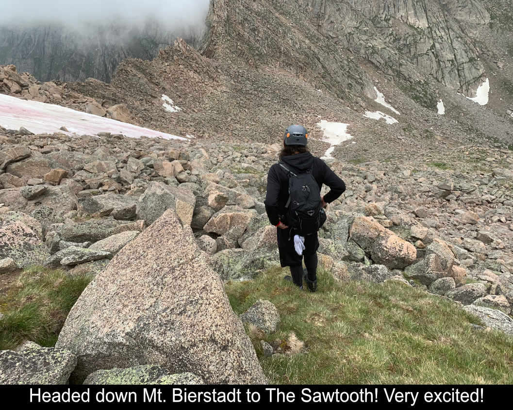
3 traverse from Mt Bierstadt to Mt Evans. To get to The Sawtooth, head down the north side of Bierstadt towards Evans! The
hike down isn't too bad with lots of rock hopping. Near the bottom, before you cross at a notch to the Western exposed
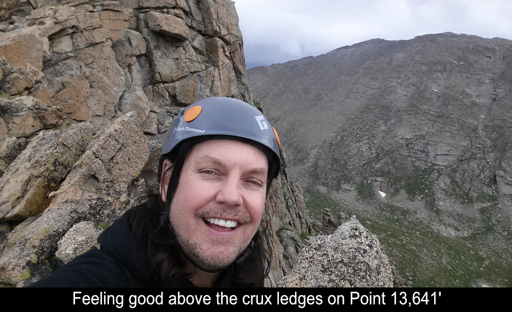
ledges of the traverse, you first have to go over the crux of the route. Basically there is a wall that you have to go
over which you can tackle a number of ways. Straight up is class 3 up a small chimney. Or you climb further down and
around then back up to find the notch for the western crossover.
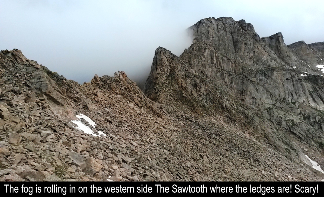
As Tommy and I arrived at the crux chimney, Tommy went first and climbed up fairly easily. Then, just as I was about to
climb the chimney, out of nowhere came a full-on grapple storm! Grapple is basically like hail and snow and ice all mixed
together. Normally the crux wall would be do-able for me, but suddenly there were snow and ice pockets everywhere and
everything was wet! Uuughh... unsure that I could safely manage the crux, I went down and around. It turns out, that
unless you go WAY down and then back up, that the lower traverse still holds exposure and sketchy moves. The particular
route I took was maybe mid-way down ... and the way back up still had a move or two that was a bit scary! ... but fun!! Finally
I met back up with Tommy and we found the crossover notch to the western side.
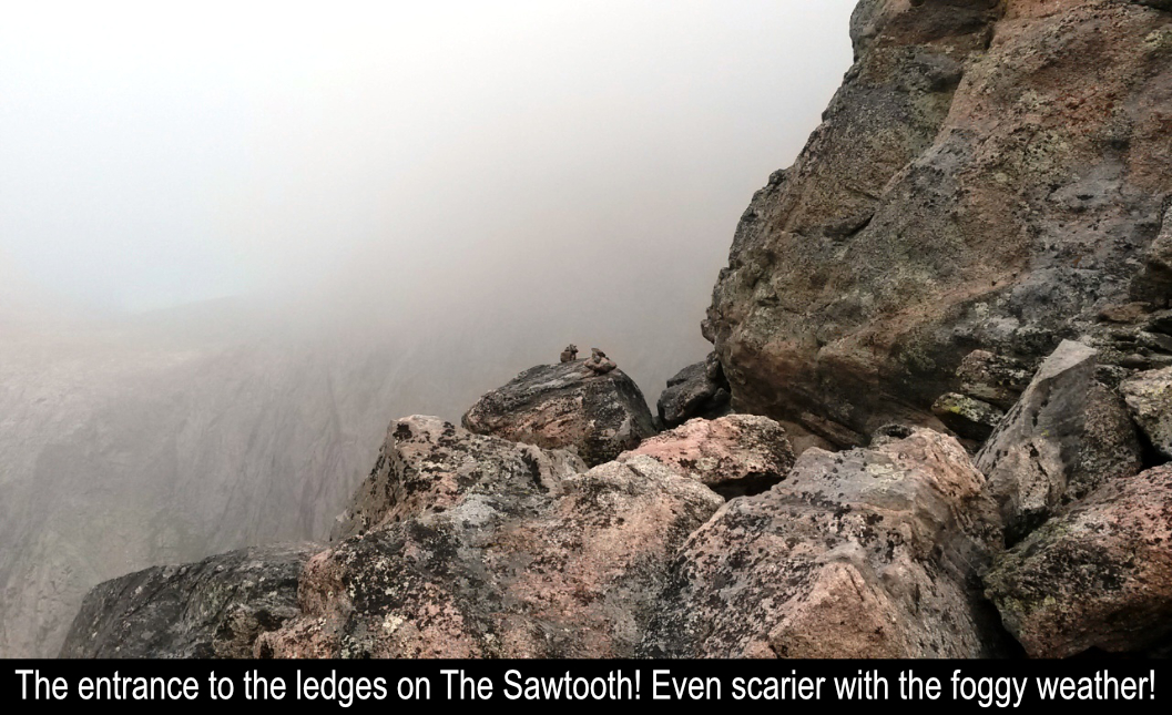
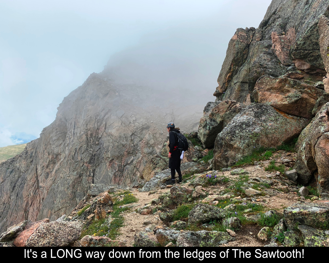
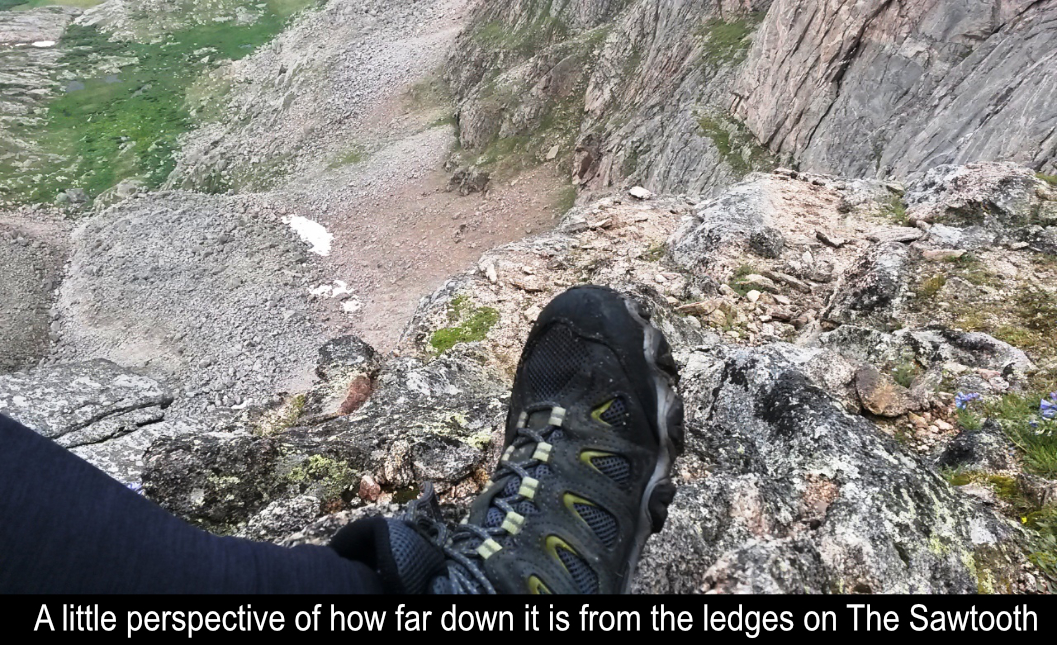
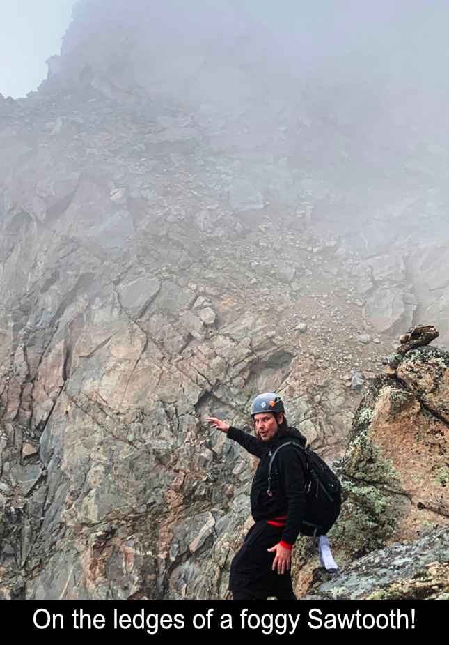
Once through the notch to the western side of The Sawtooth, the exposure is WILD! For the first 200 feet, you're basically
on this rocky sidewalk that is about 2-3 feet wide, with certain death over the cliff to your left (West) side. I had
already read many reports and was ready ... first thing - sit down, double and triple tie your shoes!! ...then tuck the
laces on the inside so there is NO WAY you're going to trip over your laces!! ha ha ha!! The sidewalk is actually fun
and if you take your time, very exposed, but no real danger.
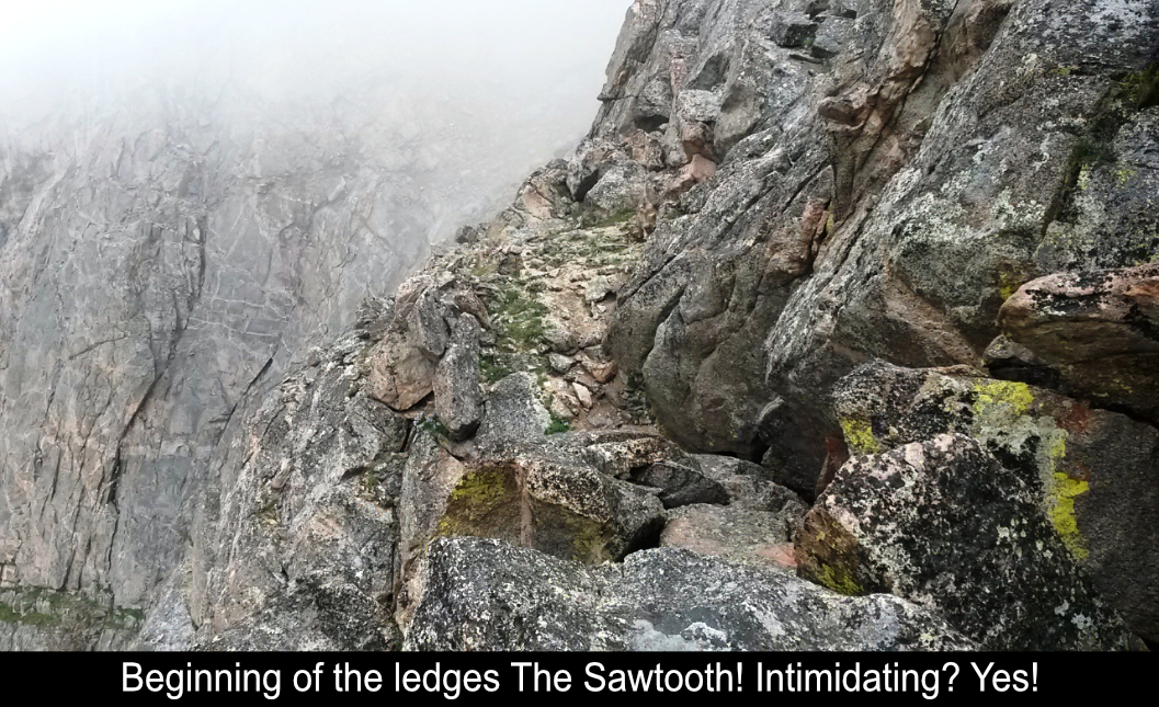
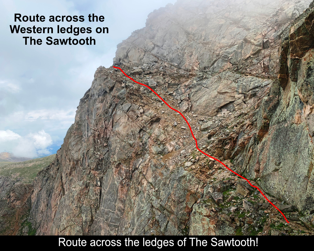
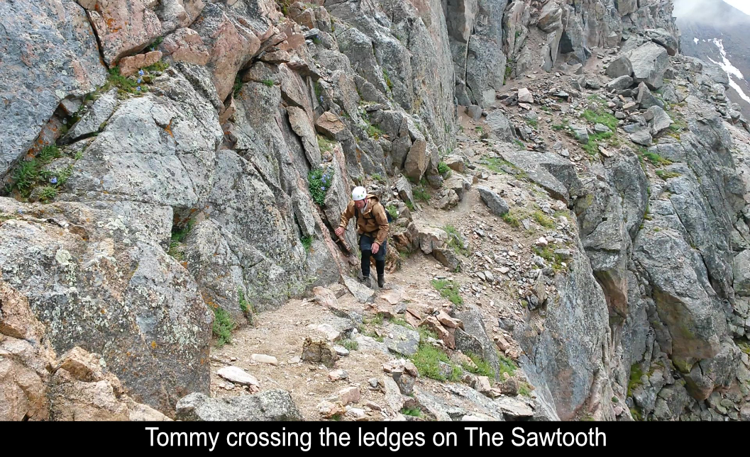
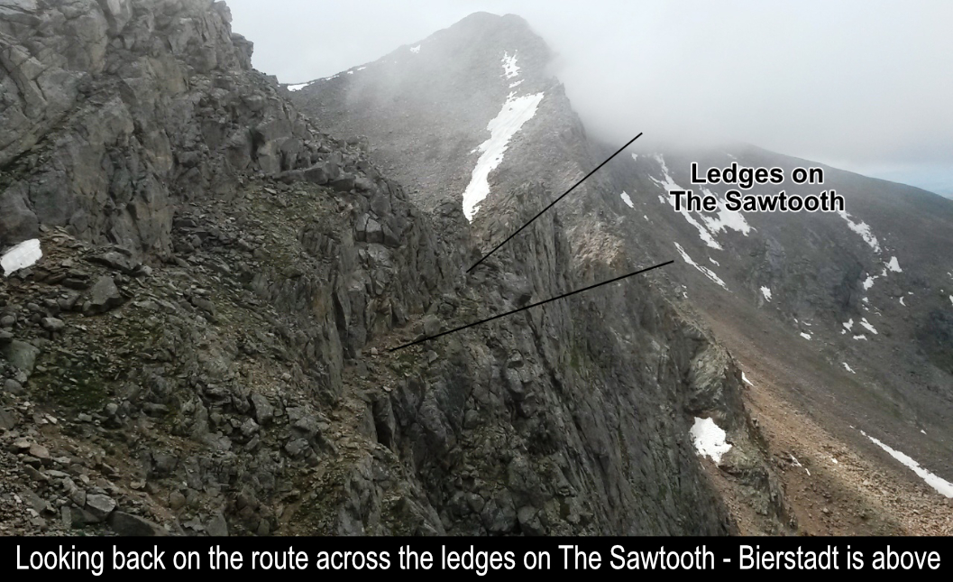
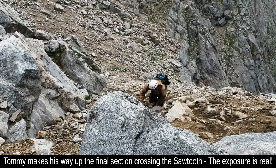
After the first part of the sidewalk, there is a dirt gully crossover which leads to an up-and-out ramp of The Sawtooth. There
are several options to cross this gully but we went a bit up first and then crossed. It felt safer that way. On the up
ramp, we hugged the cliff to the right. Both the gully and the ramp have plenty of exposure too! Upon the exit of The
Sawtooth, the ground flattens out where you can finally see Mt Evans and you know you are finally out of the death
zone!! HIGH FIVE!! We just traversed The Sawtooth!!
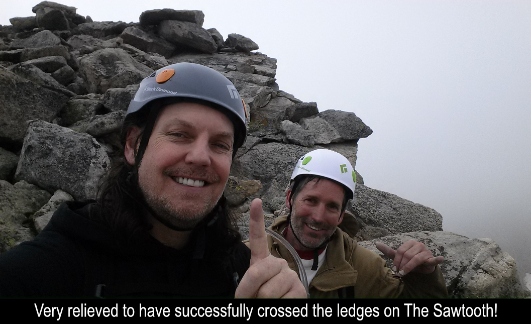
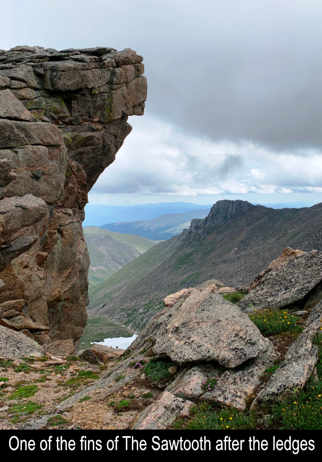
Worth bagging a 13er, you can jump up the rocks after the exit and quickly summit The Sawtooth while you are there, so
we did! Then on to Evans! The path to Evans is clear and you are basically traversing along the side of the southern
side of Mt. Evans. The scrambling is lots of fun but beware!! Mt Evans is a wide mountain north-to-south... and
finally getting to the summit (where all of the cars and people are) is MUCH farther than it first appears! After
the long traverse, spent from two thrilling traverses and the long slog across Evans, we slowly walked up the civilian
path to the summit of Mt Evans!
Here's an overview of the Tour D'Abyss from the side of Mt Evans:
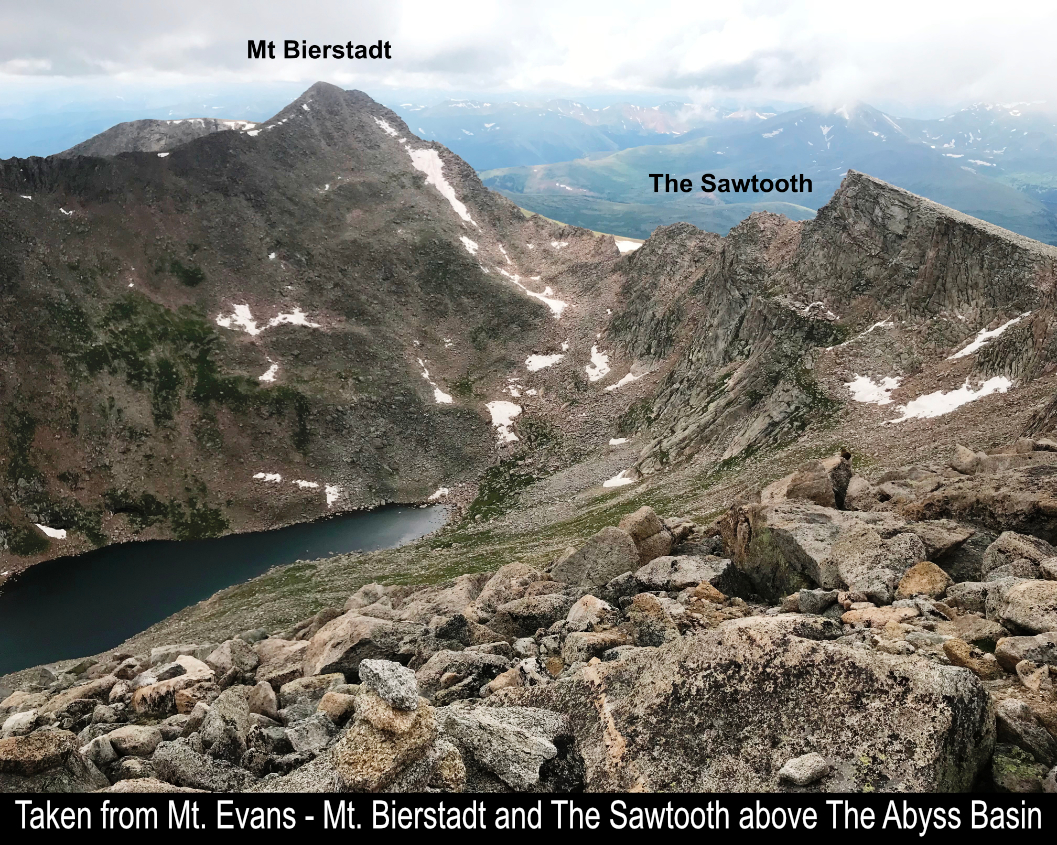

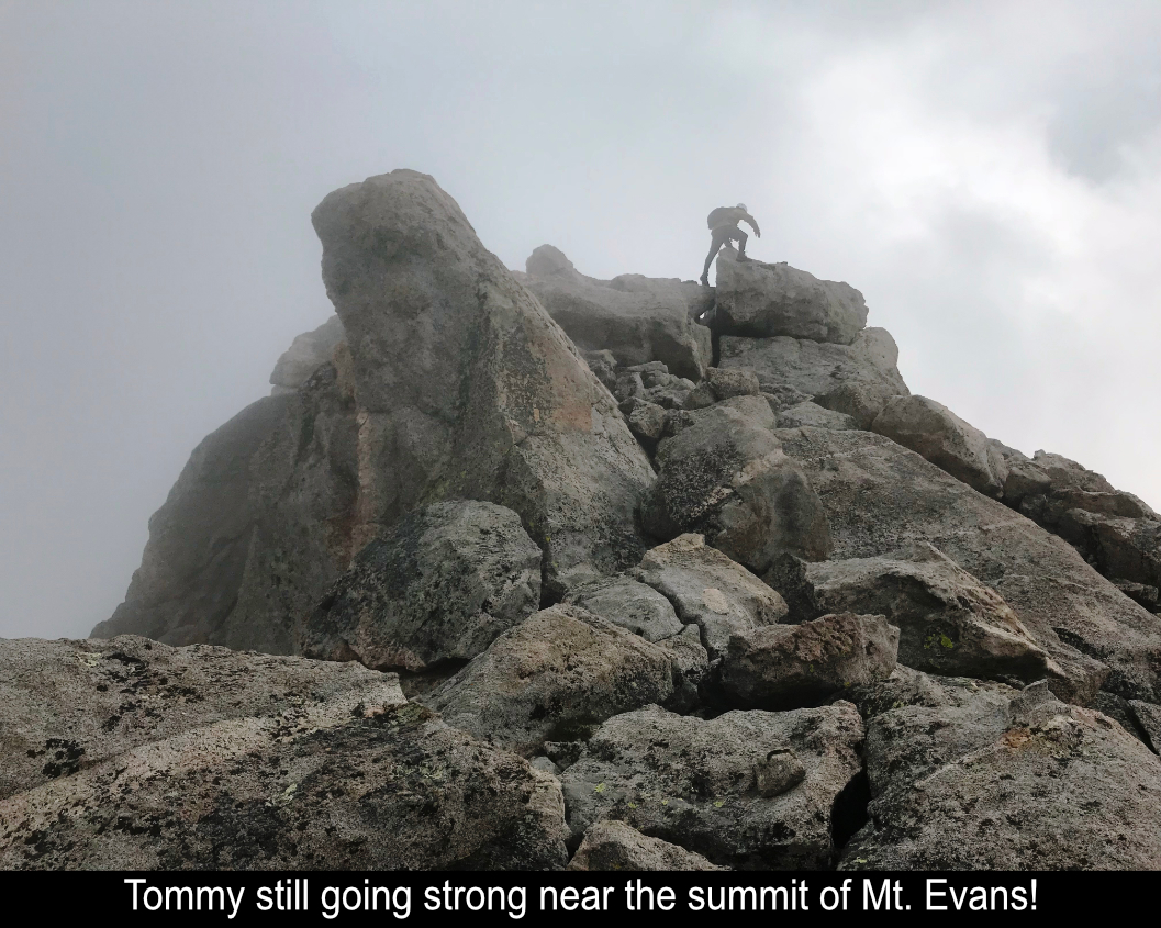
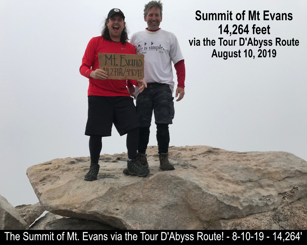
We made it!! Tommy and I had completed The Tour D'Abyss!! A Colorado Classic!! When I set out hiking peaks a few
years ago, I never would have imagined we would pull this one off!! It was so awesome!! If you'd like to do it, just
make sure to be ready for the exposure and LOTS of rock scrambling. Although it's not a long distance or a huge
elevation gain, the hours and hours of scrambling is physically taxing.
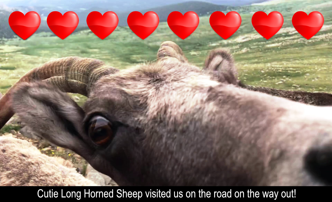
Long Horned Sheep On Way Out!!
Hope this has been enjoyable and / or helpful to anyone reading it!!
Comments
Add Comment:
Name:
Comment:
Comments ReCaptcha (to verify you are actually a person)
Please click the ReCaptcha button below. Sorry to do this but we had robots posting spam messages on this blog and this prevents that.