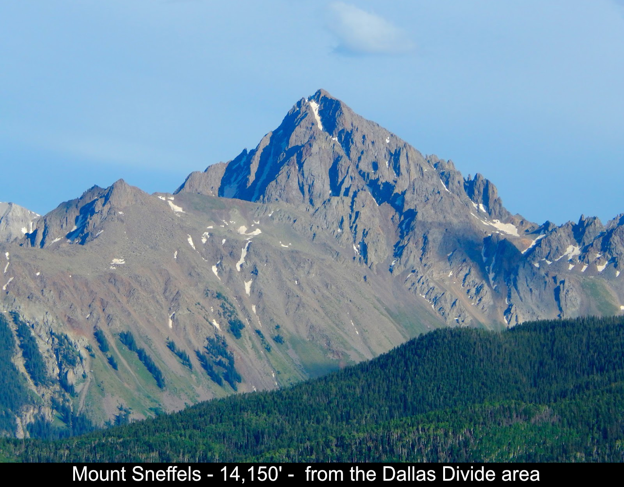
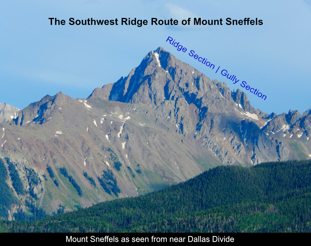
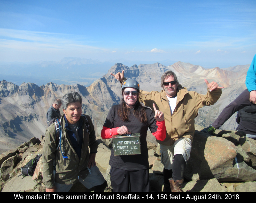
Mount Sneffels! Colorado - 14,150'
Southwest Ridge Route
6.0 Miles Round Trip
2650 feet of elevation gain
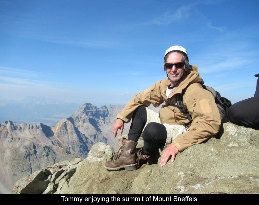
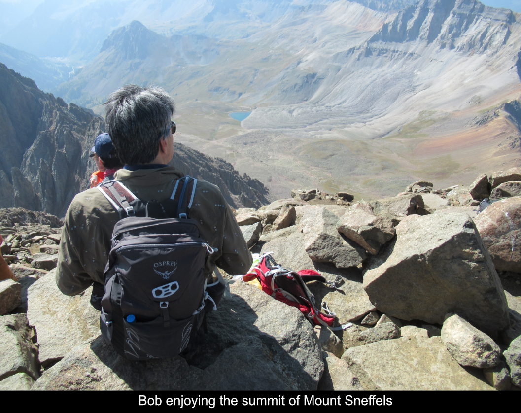
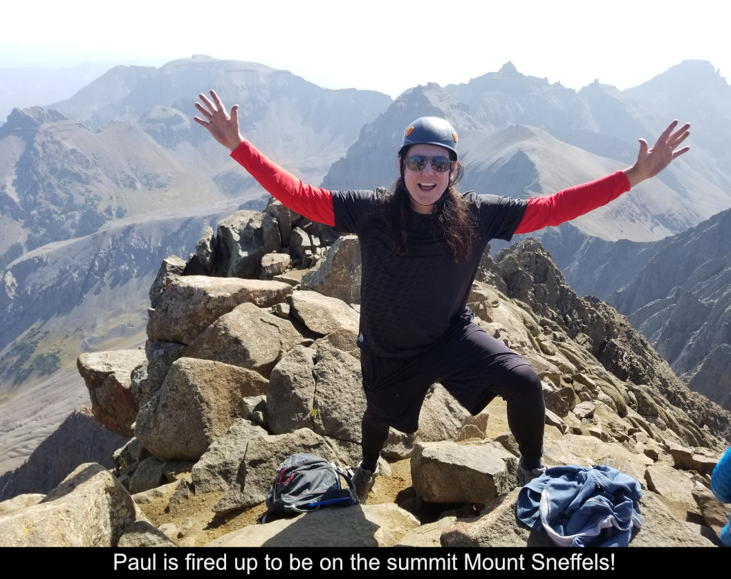
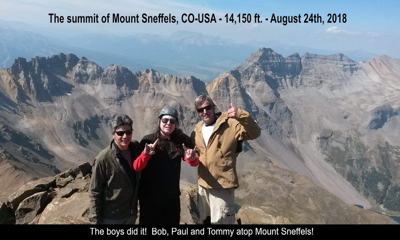
Mount Sneffels!! After a failed attempt in 2016 (bad weather), it was so sweet to summit in 2018!!
Add to that I was able to go with two awesome friends, Tommy Neville and Bob Ward, and we were able to
complete the Class 3 Southwest Ridge route! What a blast! This route only covers a little under 3000 feet of
elevation gain and about 7 miles. It did however take us a good 9 hours as once you're on the ridge, and in
the gullies on the way down, it just takes time.
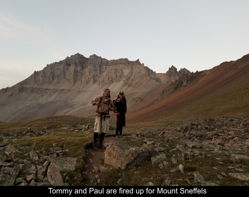
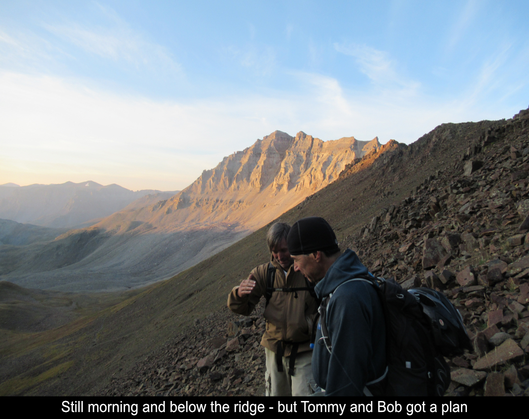
Tommy and I met in Ouray about 3AM and we met Bob at 4AM who was camping part way up the road
to Yankee Boy basin. As info for folks reading this for beta info, the road itself takes a good 45
minutes to get to the lower trailhead (where the bathroom is) from Ouray. So, leave time! Having
been to the trailhead before, I knew that attempting to get to the higher 4WD trailhead was a tough
proposition. Not to mention that not hiking that extra mile would make the hike itself very short in
terms of elevation gain... you gotta EARN these summits!!
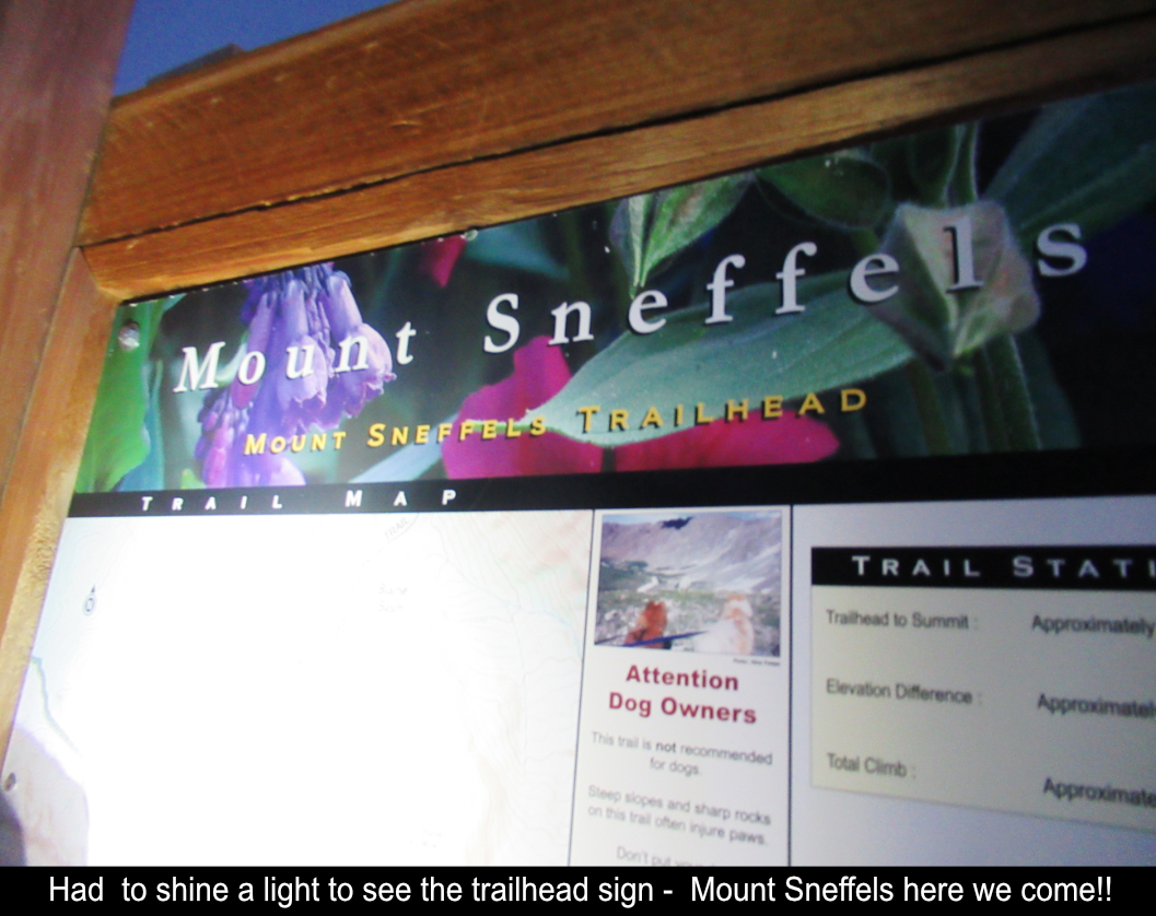
Heading out from the trailhead in the dark, about 1/4 mile up the road, there is a turn off where
you can take an alternate trail that passes a lake. We decided to give this a try. Both the road and
the trail end up at the upper trailhead where the trail signs are located. It was really cool passing
the lake while still dark, so I would recommend the trail instead of the road ... It was still dark when
we arrived at the trailhead. At that point, we asked ourselves "ridge or standard?" .... the decision
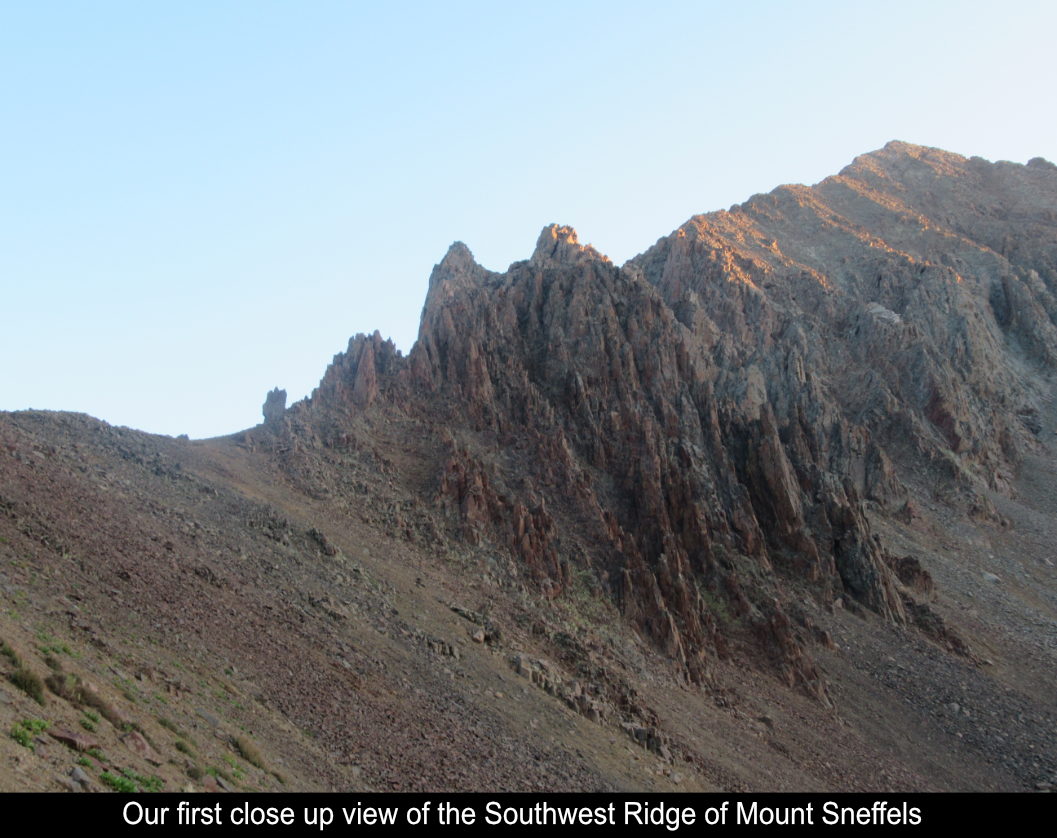
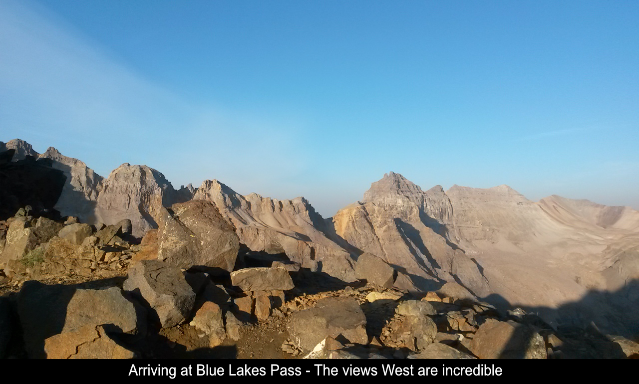
stood... RIDGE!!! So it was off to Blue Lakes Pass where the ascent of the Southwest Ridge begins!!
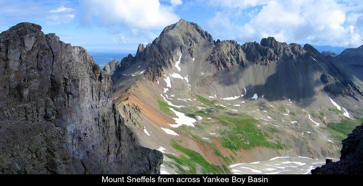
WOW!! The first time you arrive at Blue Lakes Pass from the Yankee Boy Basin side it is UNBELIEVABLE!!
You just can't believe what you are seeing! The pass is also a great place to grab a snack, switch layers,
put on your helmet, and get ready for the ascent up the ridge!!
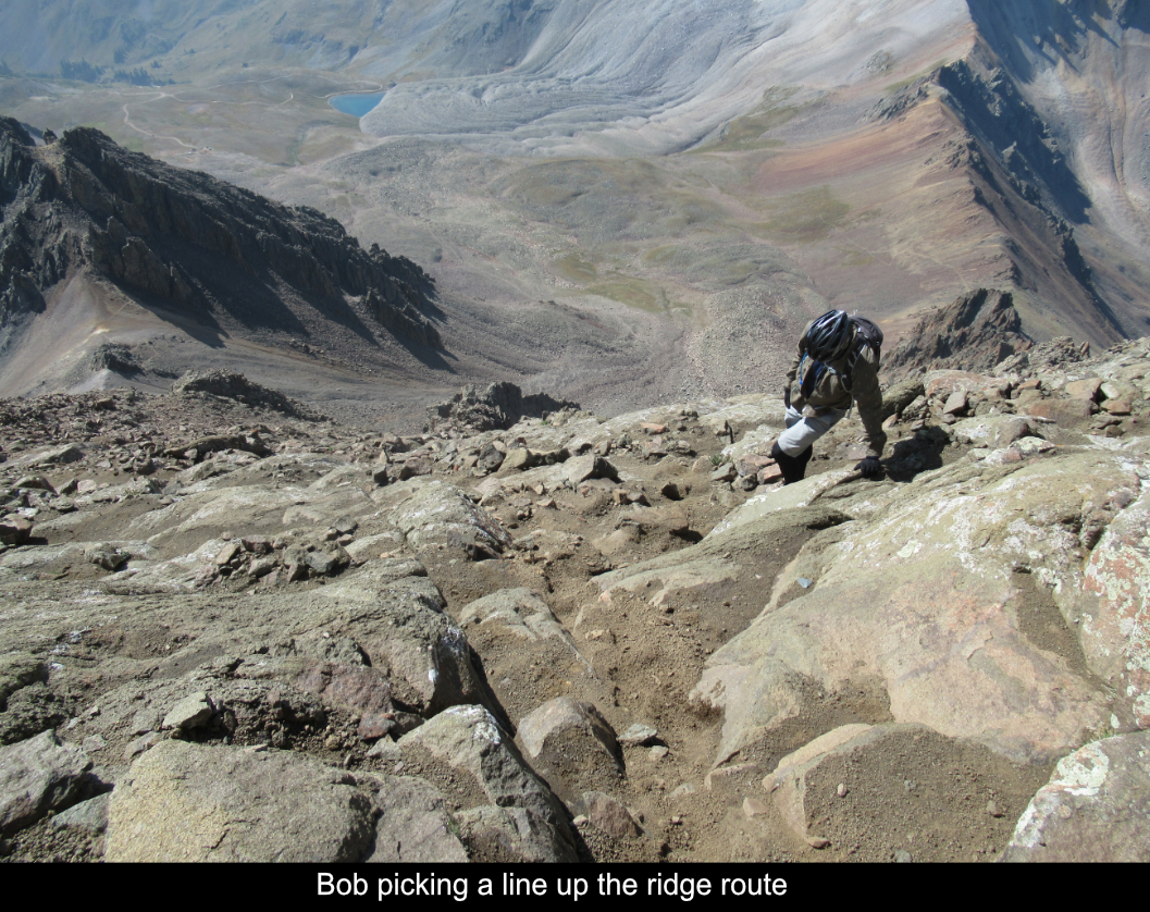
Having studied the route description very closely as well as multiple trip reports I was sure I knew
the route. But I did know this route was going to the edge of the technical range I had been done so far,
so there was some real nervousness as to whether I could make it. Having some great friends who have
mountaineering experience makes a HUGE difference.
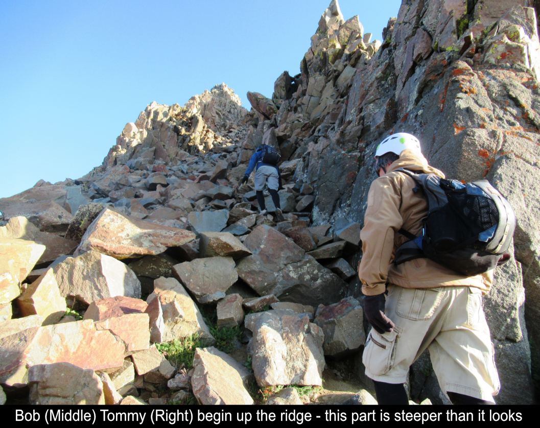
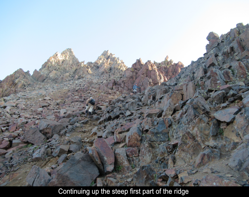
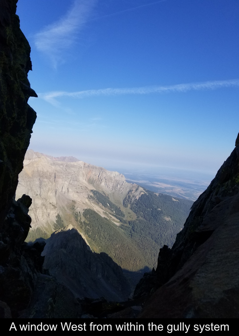
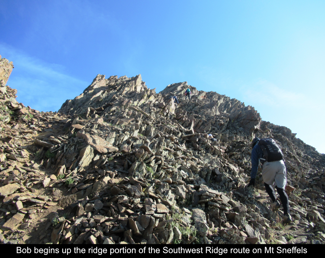
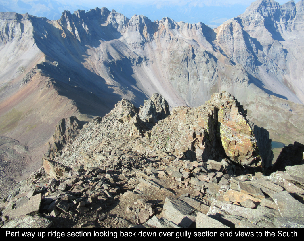
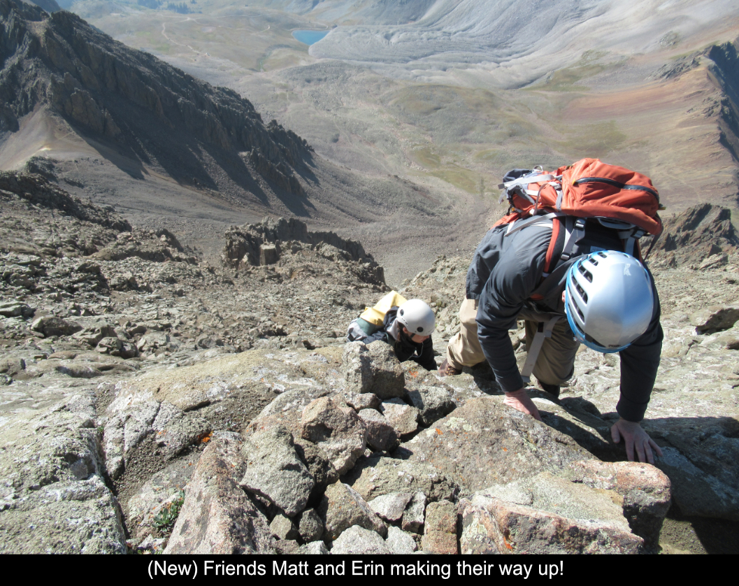
Basically I would break the ridge section into two parts... the gully section and the ridge proper
section. We started up the lower (gully section) over lots of rocks! My observation is that this first
gully (and pretty much all of the gullies) are steeper than they look in the pictures. But while this
sort of shocks you at first, you quickly get used to it.
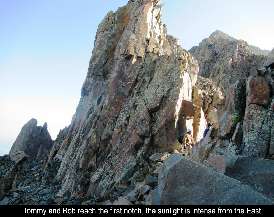
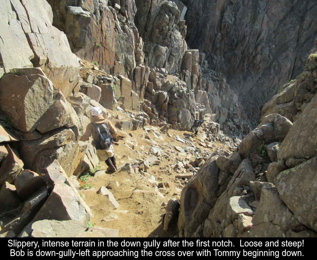
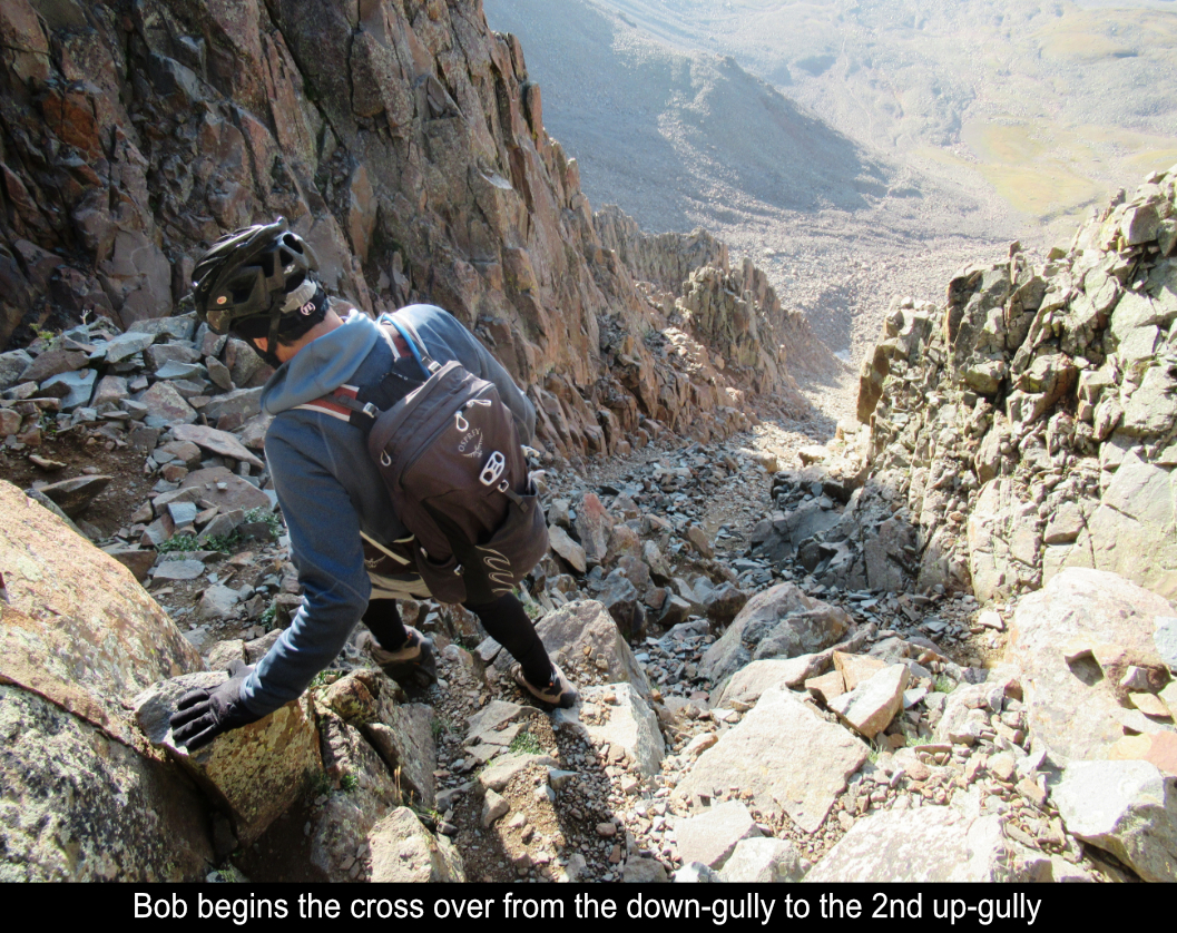
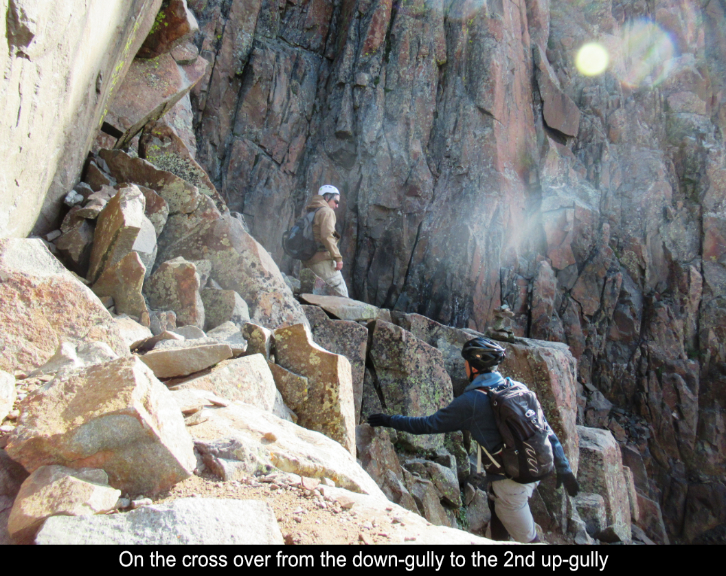
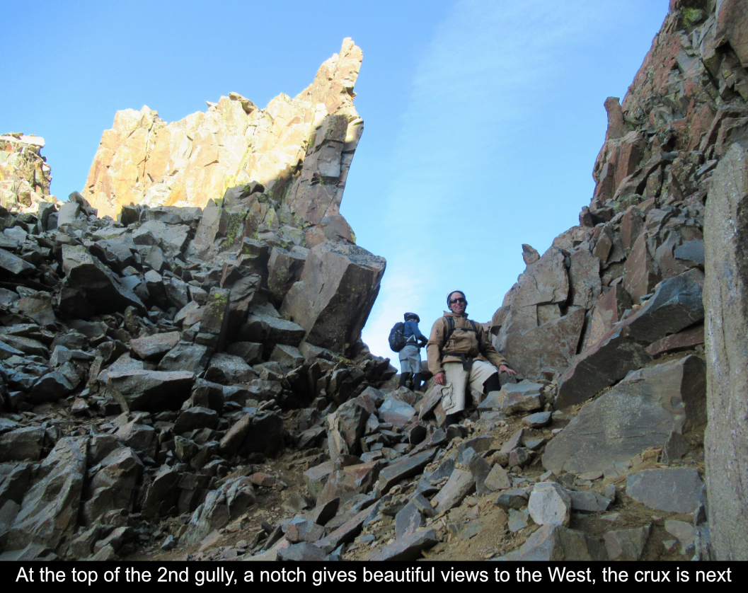
At the top of the first gully, there is a notch which leads you through and to the right (East) into
a gully that goes down. The route follows this down-gully where you then cross over to a 3rd gully which
is the 2nd up-gully. The down-gully itself is not a problem. The crossover area is an area I couldn't
find much info on ahead of time. I was worried it might be difficult. And sure enough it's not a piece
of cake. The thing is that you don't want to go WAY down that second gully because it gets REALLY steep.
So, you need to cross over on some blocky rocks. In the end, it's just a quick climbing move or two and
really builds confidence to go ahead and pull it off. It's very make-able!!
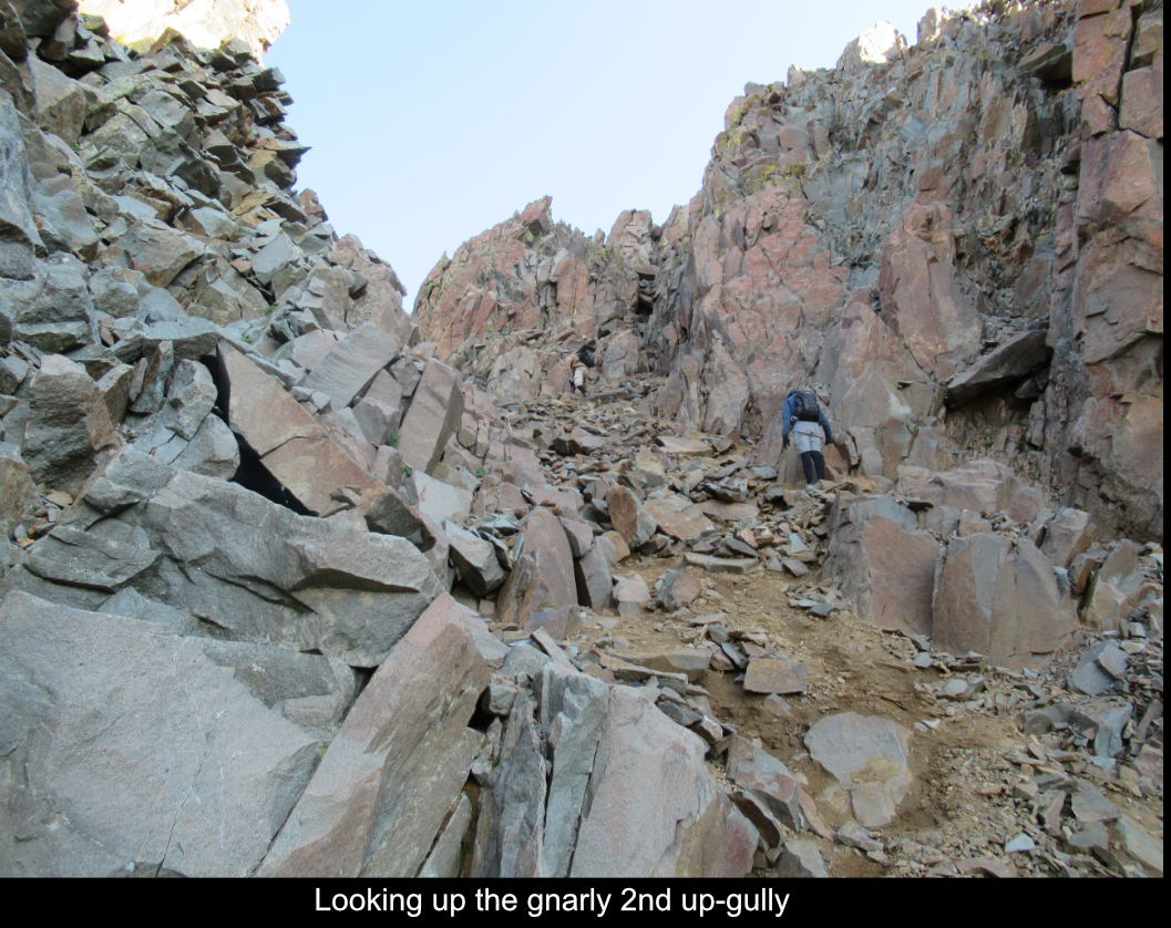
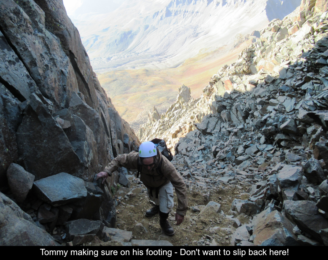
The up-gully after the down gully is no problem. Keep in mind we did the hike in late August in a
low-snow year... most reports show snow in this gully which would completely change the prospect. If
you don't have snow equipment, sticking by the left side seems workable but for sure would make it more sketchy.
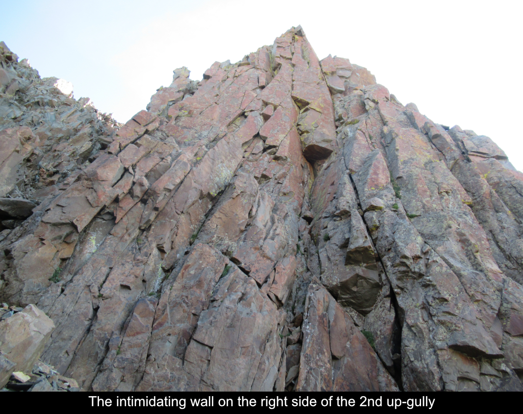
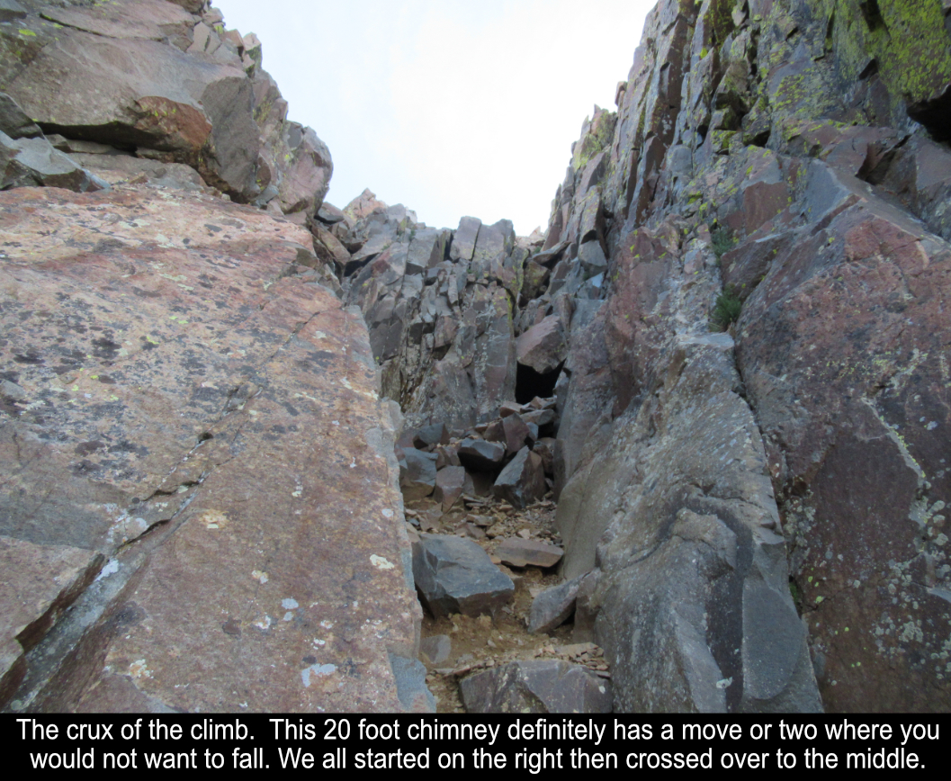
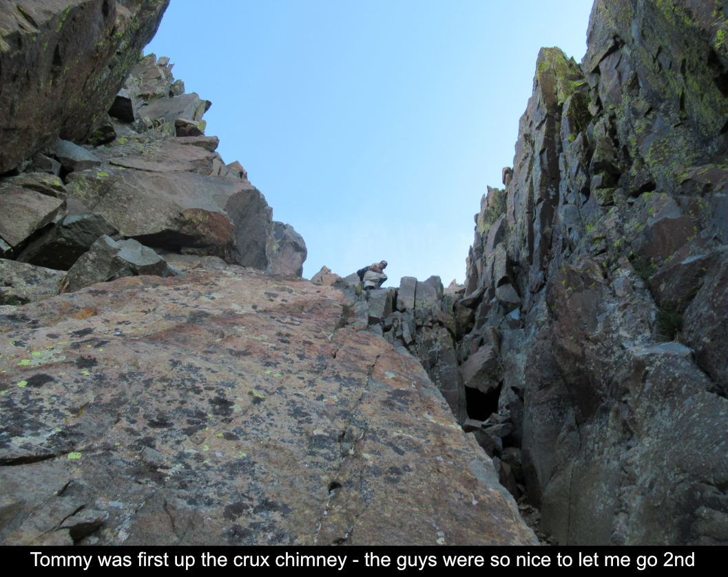
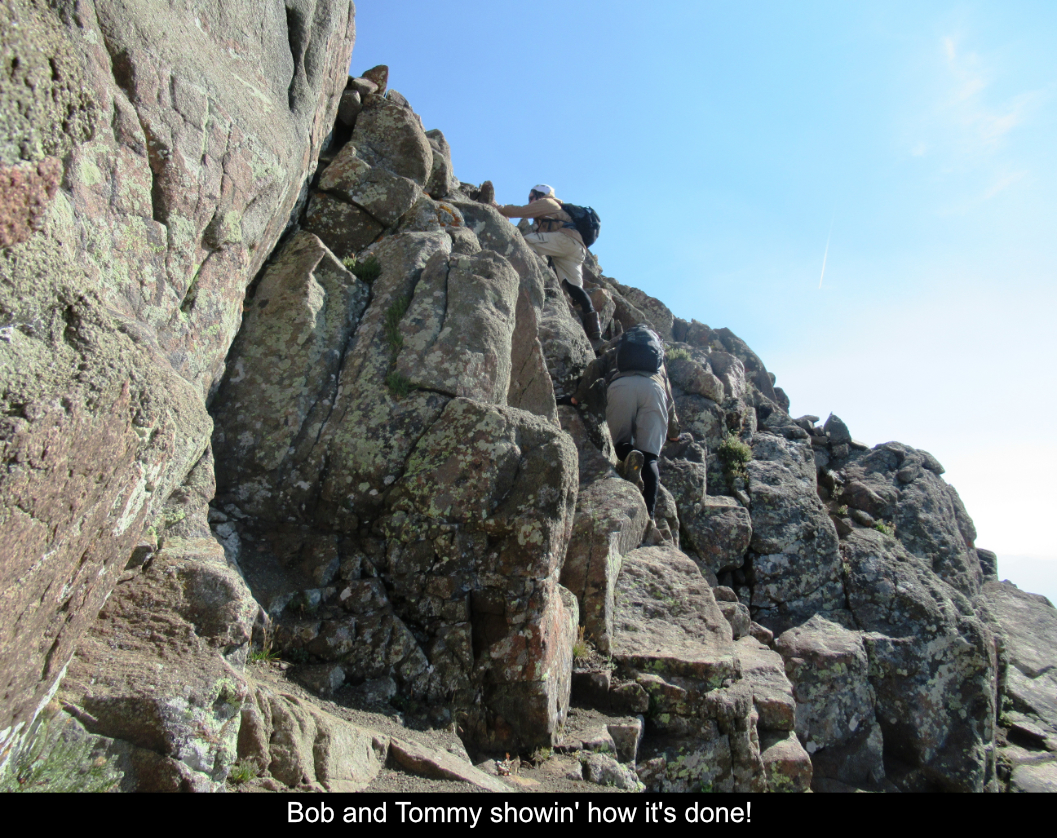
After a turn at the top of the up-gully (after the down-gully) there is a steep section I referred to
as a chimney. I felt it touched on Class 4, maybe tough class 3, but for sure it is a tough little section that is the crux of
the climb. Work with your team, plot the best line and head on up! My sense is that you would want to have
some rock scrambling or gym experience to be comfortable on this section. You do have to make a climbing move.
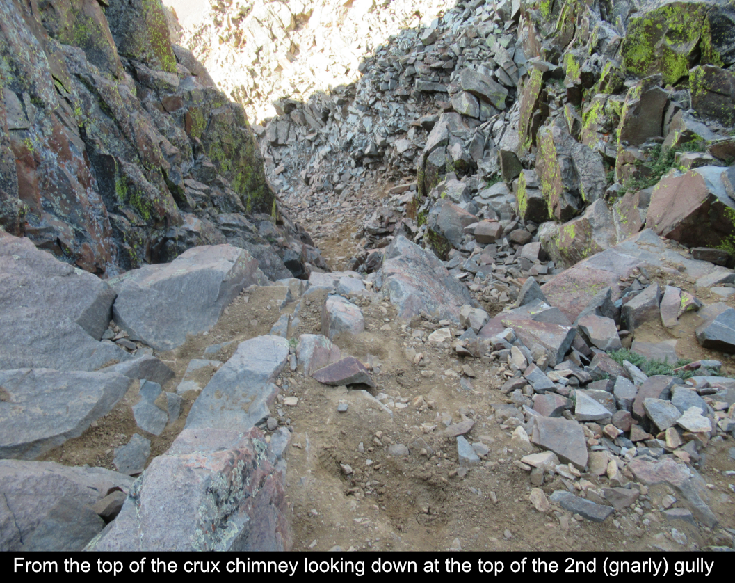
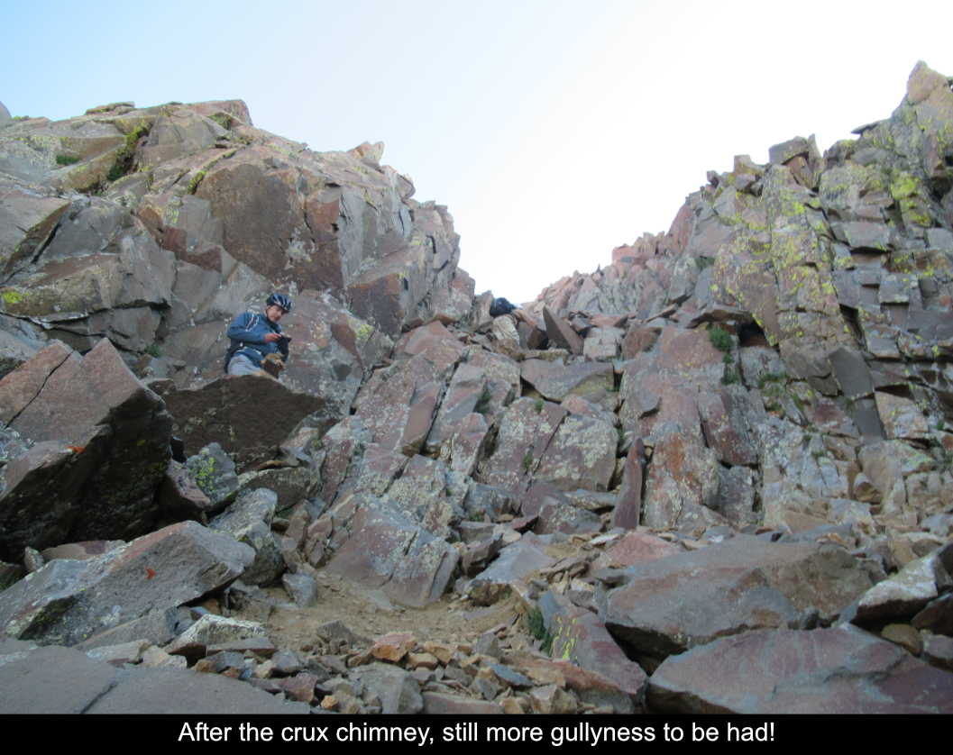
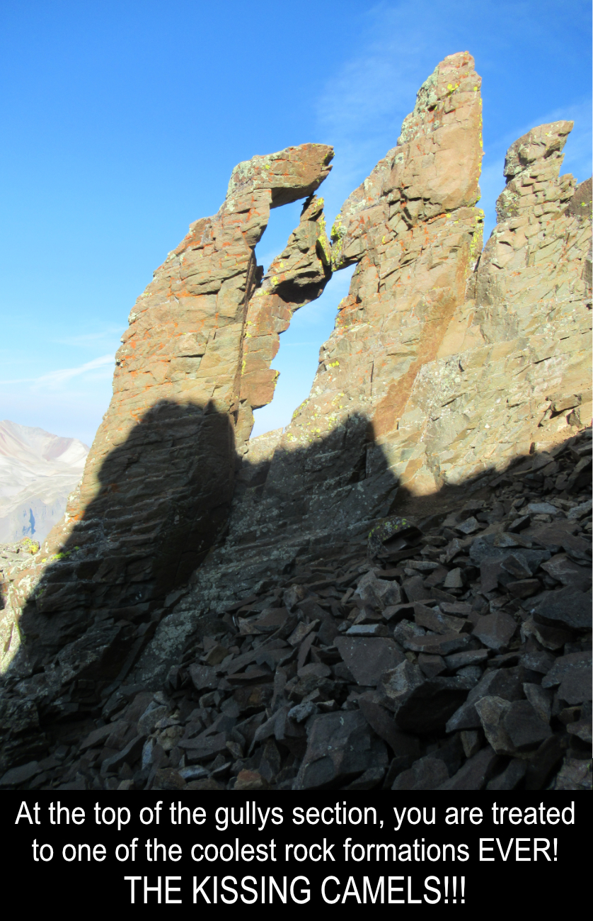
There are a couple of more easy gullies after the crux, one with the awesome Kissing Camels rock
formation on the left! Make SURE you stop and find the Kissing Camels. I wouldn't be surprised if
there is some sort of mythical luck thing involved with these amazing rocks, so don't pass them lightly!! :)
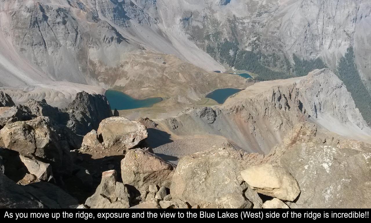
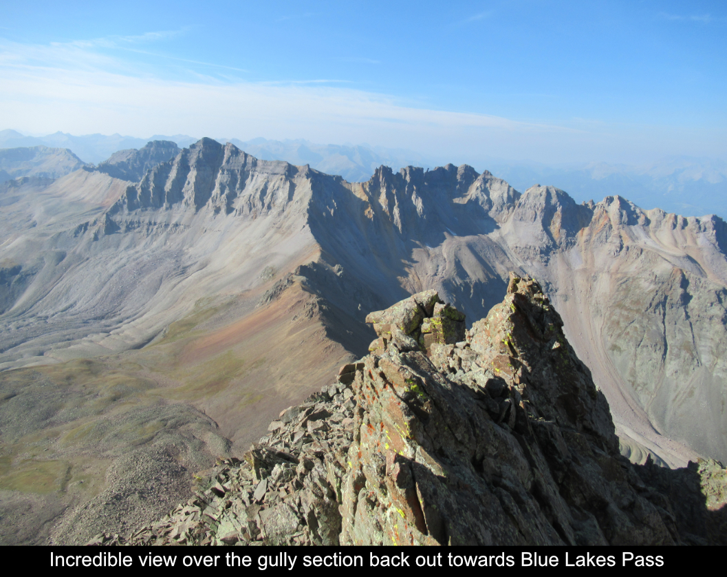
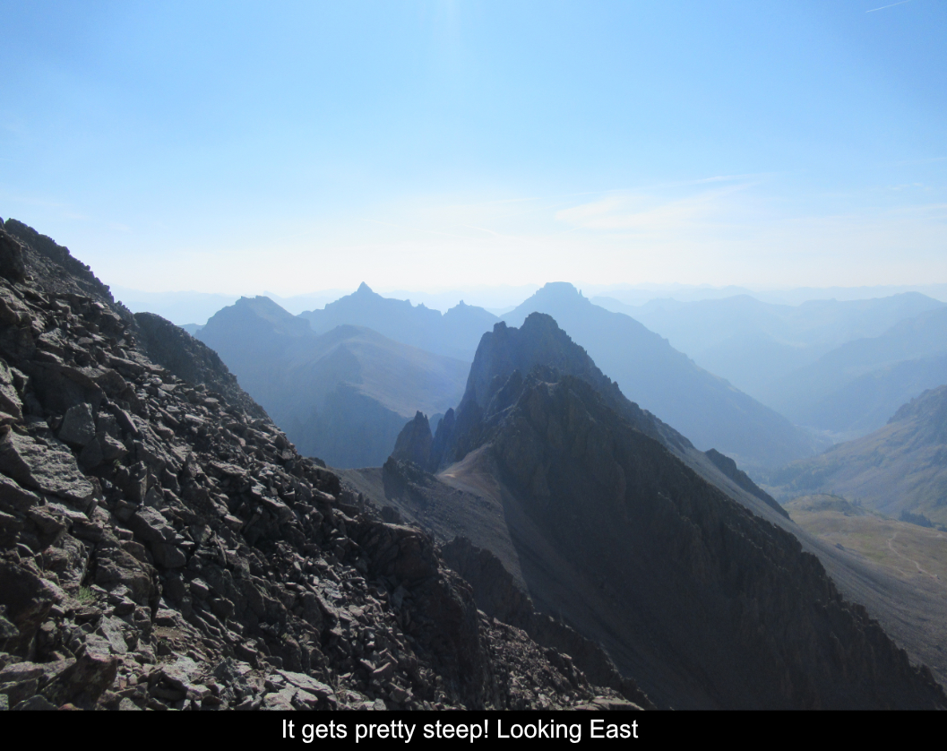
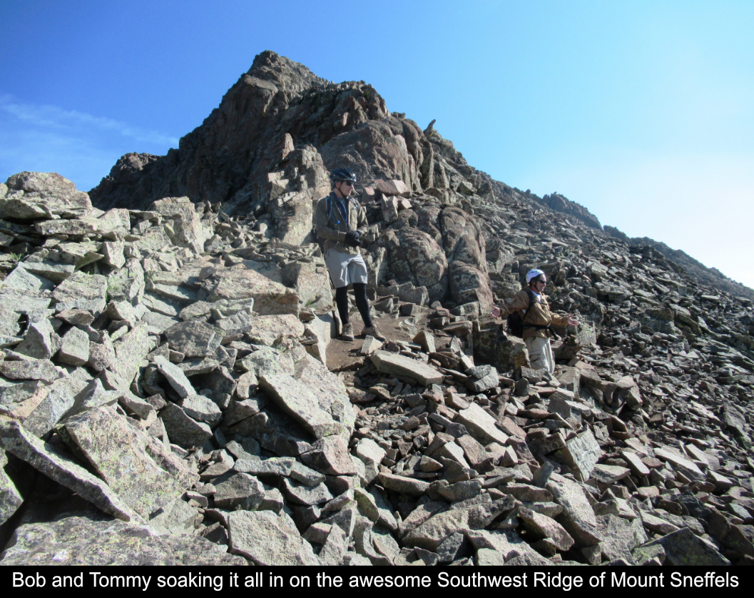
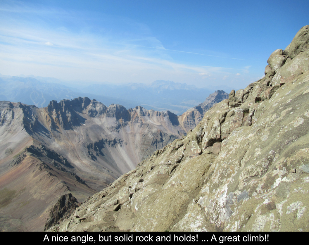
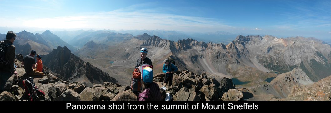
Around the Kissing Camels you emerge out onto the ridge section of the climb. About the ridge, there
aren't as many details to separate specific spots from others but there is one important one... that the
ridge itself to the top is long! I felt it was longer than the trip reports I had read indicated. For
the average to slow hiker, it will take an hour or more to get to the top from the beginning of the ridge
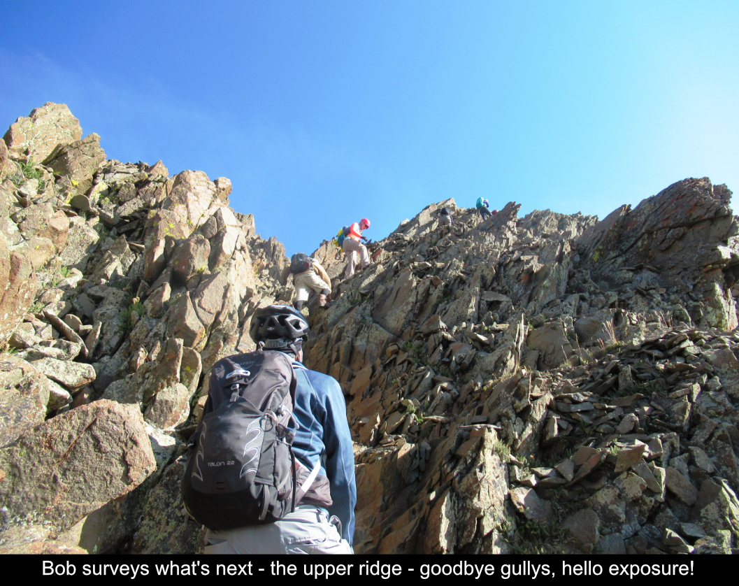
section. I thought from reading reports that you could avoid the exposure by sticking to the right... this
is not true. Yes it is true that there is much bigger exposure on the left (West - Blue Lakes) side, there
is no question that there are plenty of 3 points of contact - no fall zone - indeed exposed sections even on the
right side. Having said that, it is solid rock all the way to the top with great hand and foot holds. The next picture shows
how the ridge section is easily as long as the gully section.
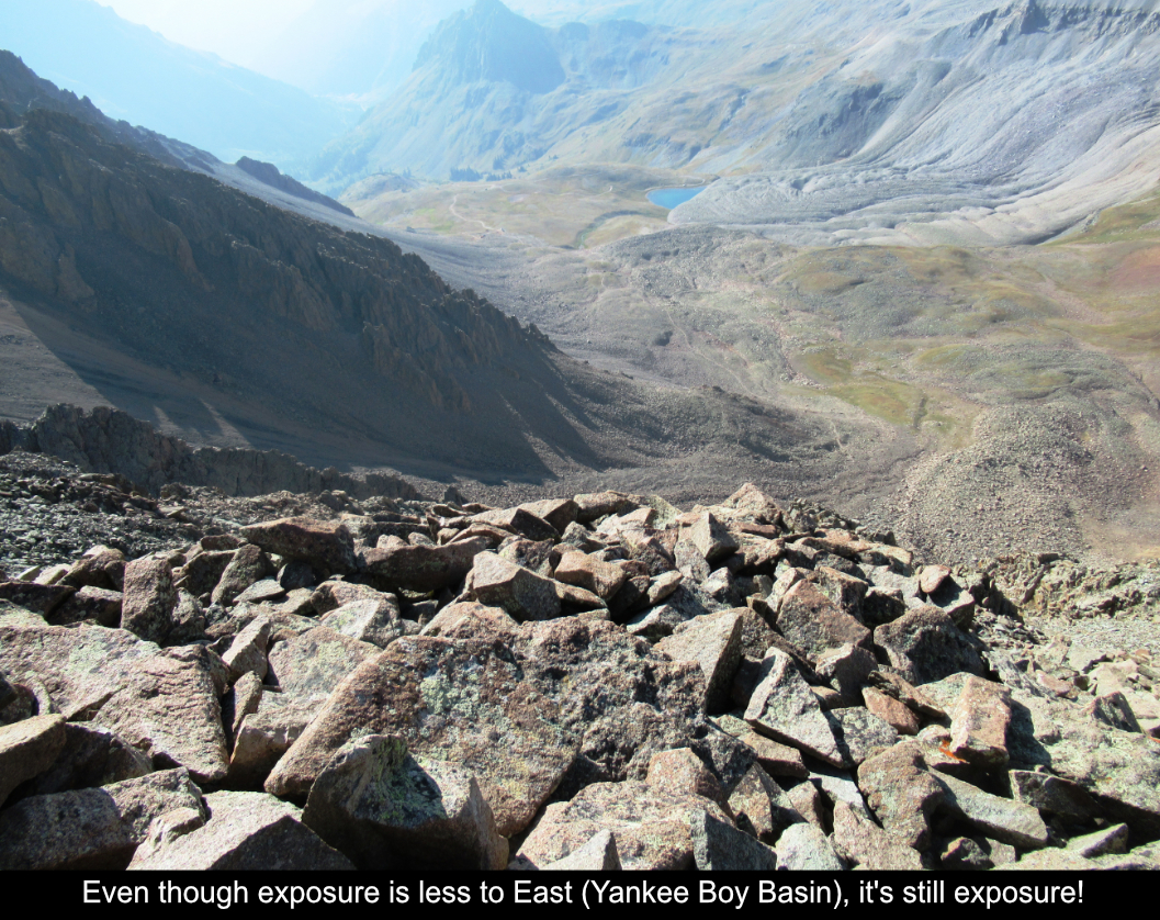
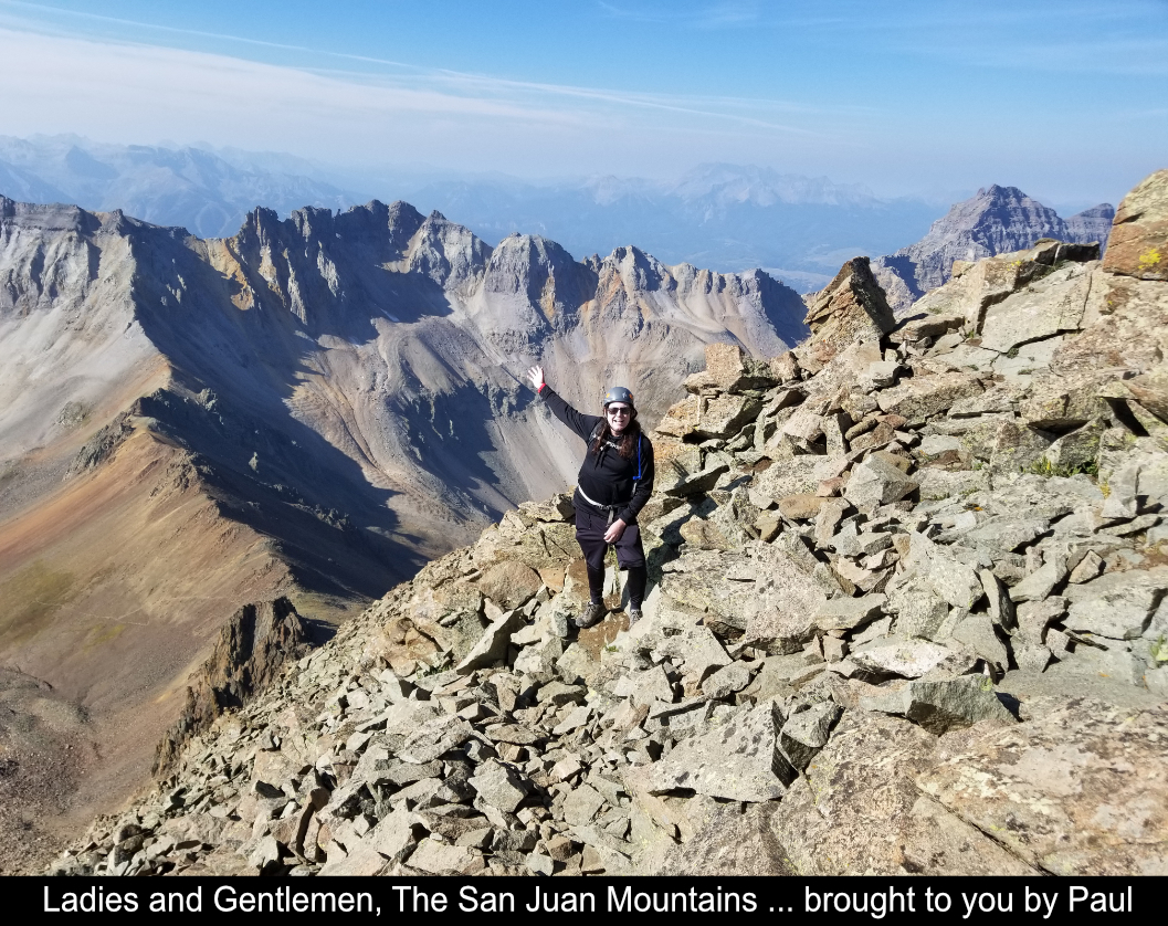
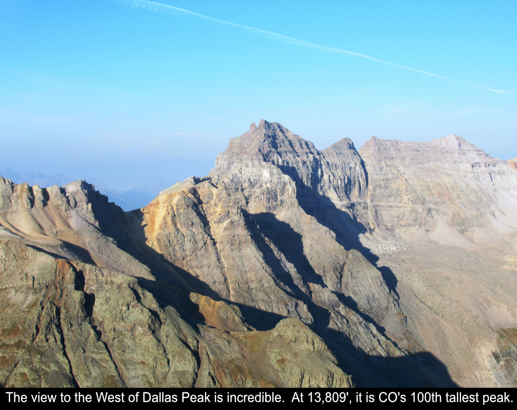
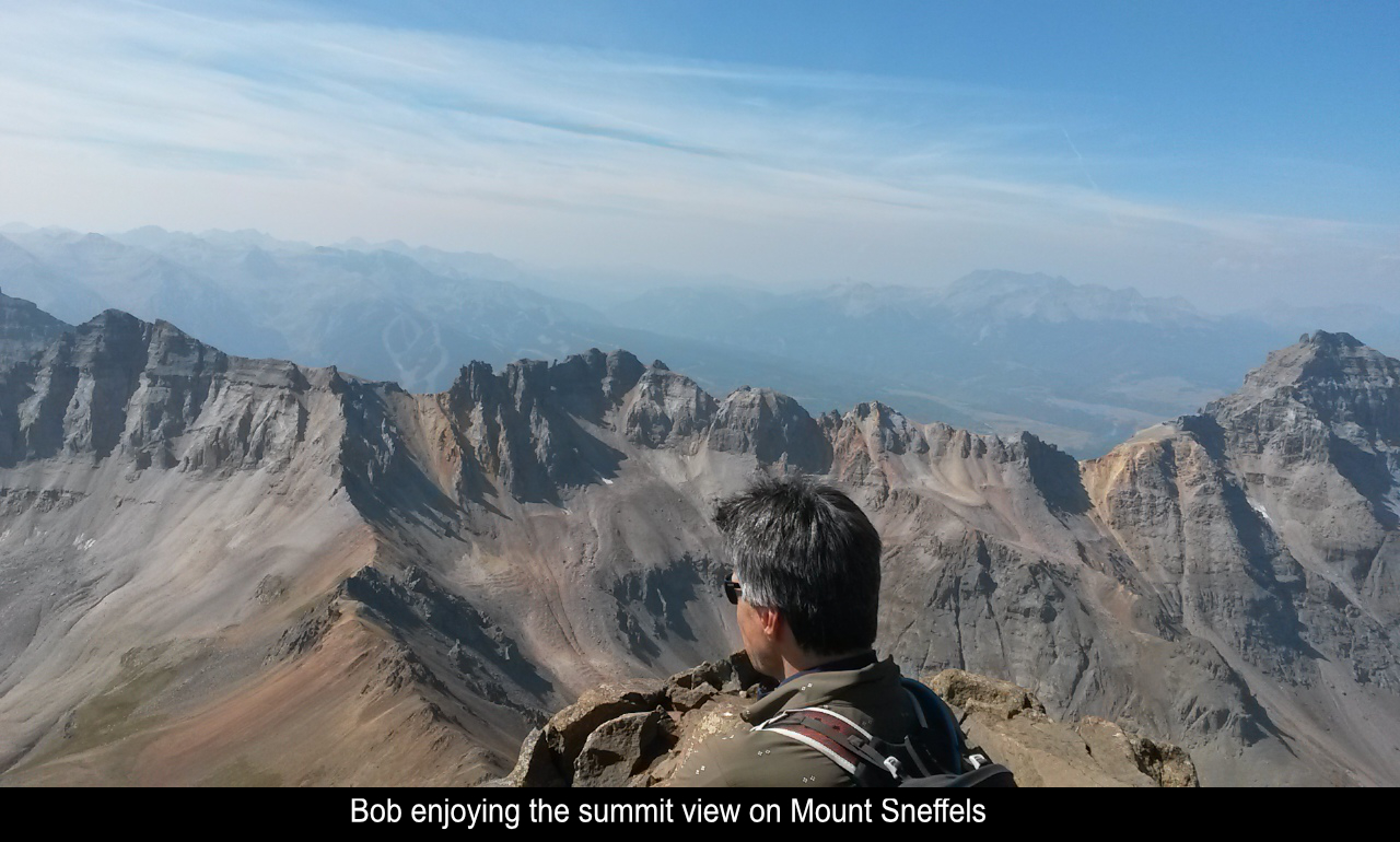
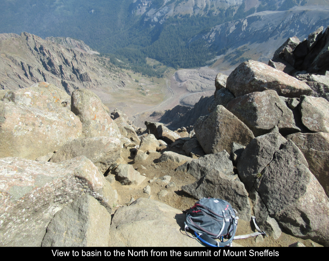
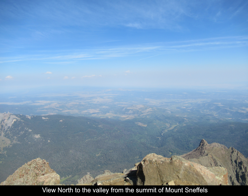
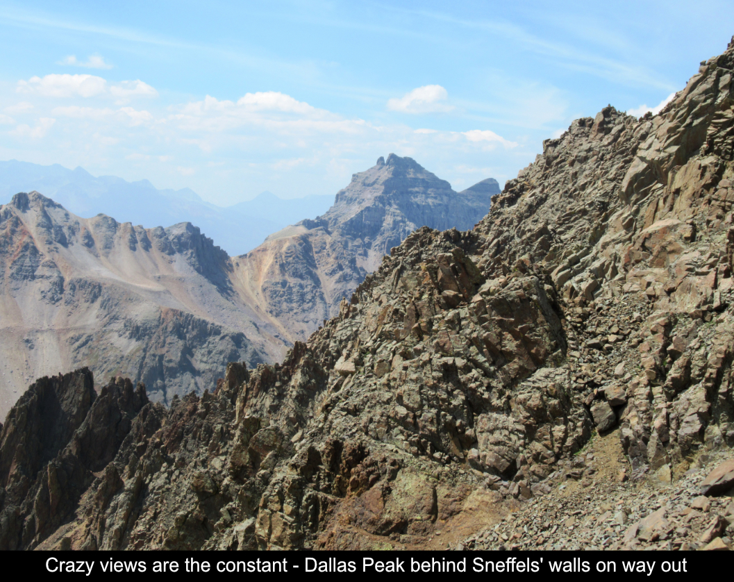
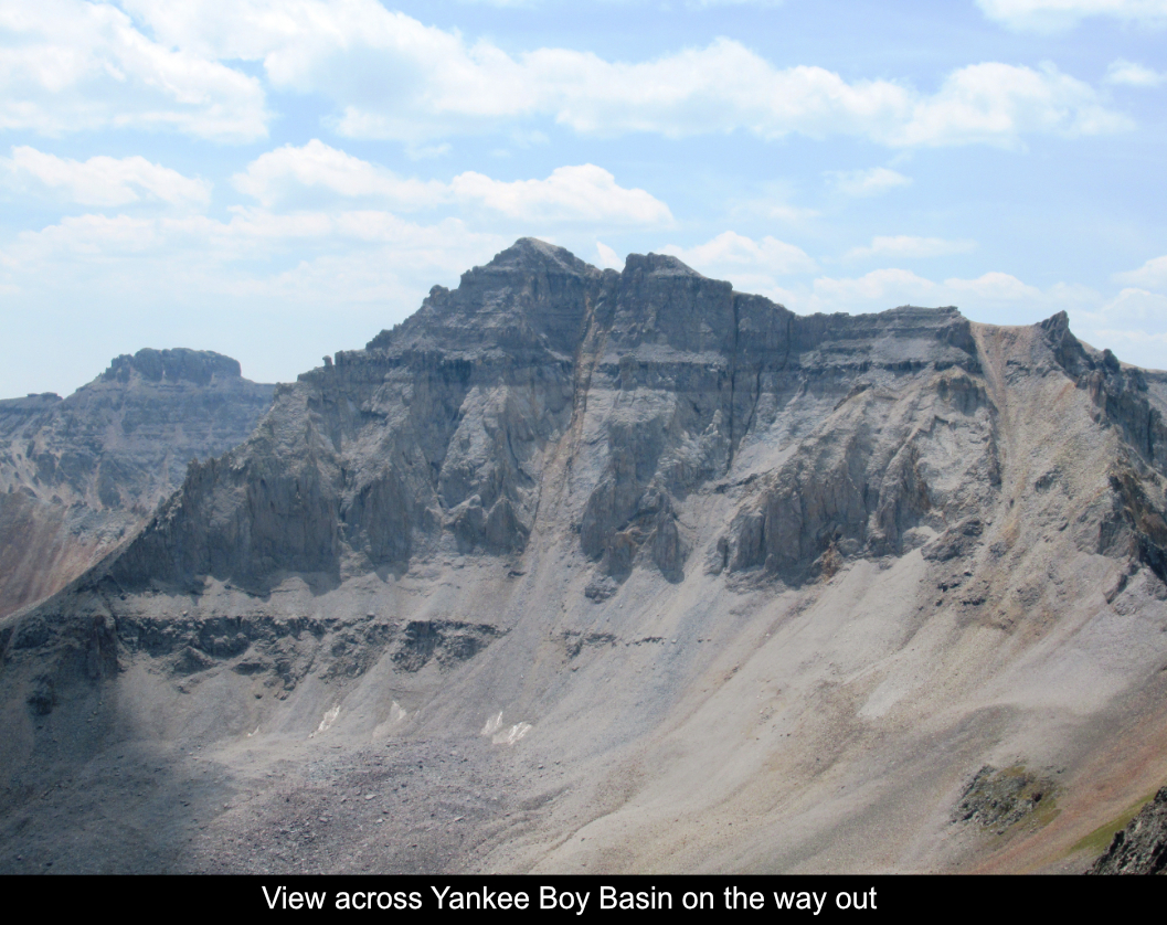
The summit was gorgeous as to be expected with views down into Yankee Boy Basin, over to Dallas Peak and
the Blue Lakes area, and out to the valley to the North.
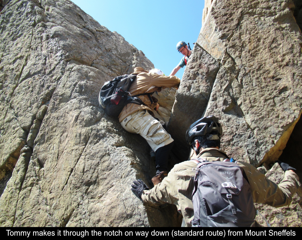
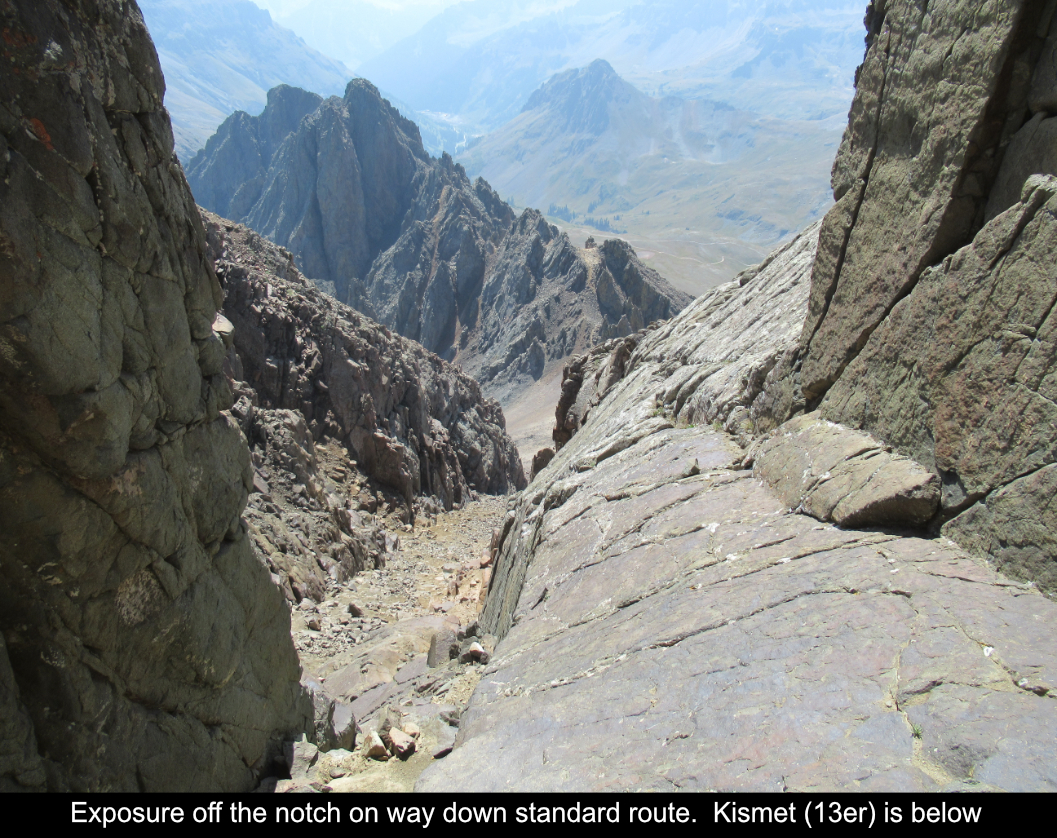
We took the standard route down and went through the infamous notch. This notch was definitely tricky, which,
with the miserableness of the talus gullies on that route, leads me to think 'why would anyone even take that
standard route?', especially with little or no snow and good weather. The ridge route is just so much more
interesting. Harder? Yes, a bit. But WAY more of an adventure.
For those wondering if this is a route you can handle (as I was), I would definitely say it would be helpful
to have done a lot of rock scrambling and / or gym climbing. There is LOTS of rock scrambling with a few small
climbing moves. If you're borderline, make sure you go with experienced folks as that will get you through! Stick
together and have fun!!
Here's a fun video I made of the day:
Hope this has been enjoyable and / or helpful to anyone reading it!!
Comments
Add Comment:
Name:
Comment:
Comments ReCaptcha (to verify you are actually a person)
Please click the ReCaptcha button below. Sorry to do this but we had robots posting spam messages on this blog and this prevents that.