La Plata Peak! Colorado - 14,336'
Southwest Ridge Route
11.3 Miles Round Trip
4100 feet of elevation gain
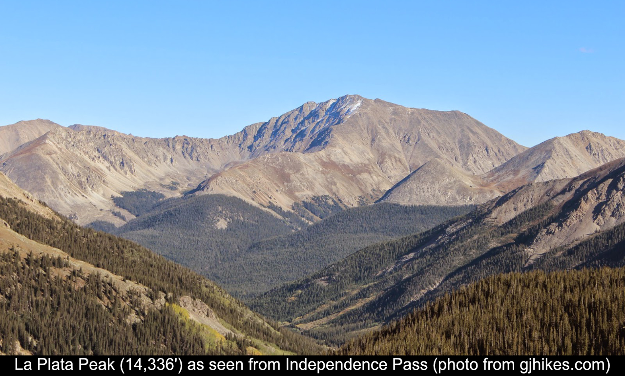
La Plata Peak! At 14,336 feet it is Colorado's fifth highest peak! Staying in Buena Vista, it seemed closer to
me to reach Winfield to attempt the Southwest Ridge route than to head towards Independence Pass to attempt the
standard route. Both are class 2, and the Southwest Ridge route is even shorter, so I figured why not take the
route less traveled.
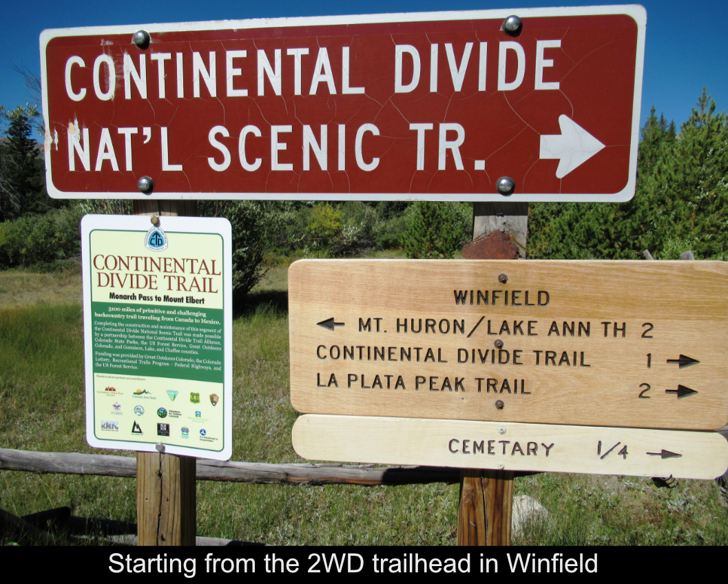
The 2WD road to Winfield is easy and there is plenty of parking there as lots of people camp around there. It
is also the 2WD trail head launching point for a bid of 14er Huron Peak. As opposed to many other 14ers, the trek to the
4WD trailhead was easy. While it is 4WD, the 2-mile trip is basically flat, while most roads to 4WD trailheads are UP!
One you arrive at the 4WD road / trailhead, then the actual trail begins to head through alpine areas.
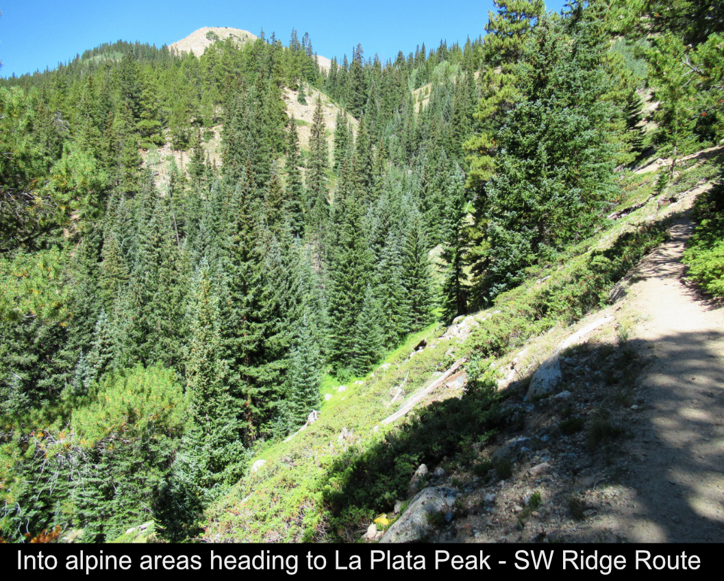
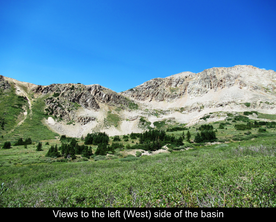
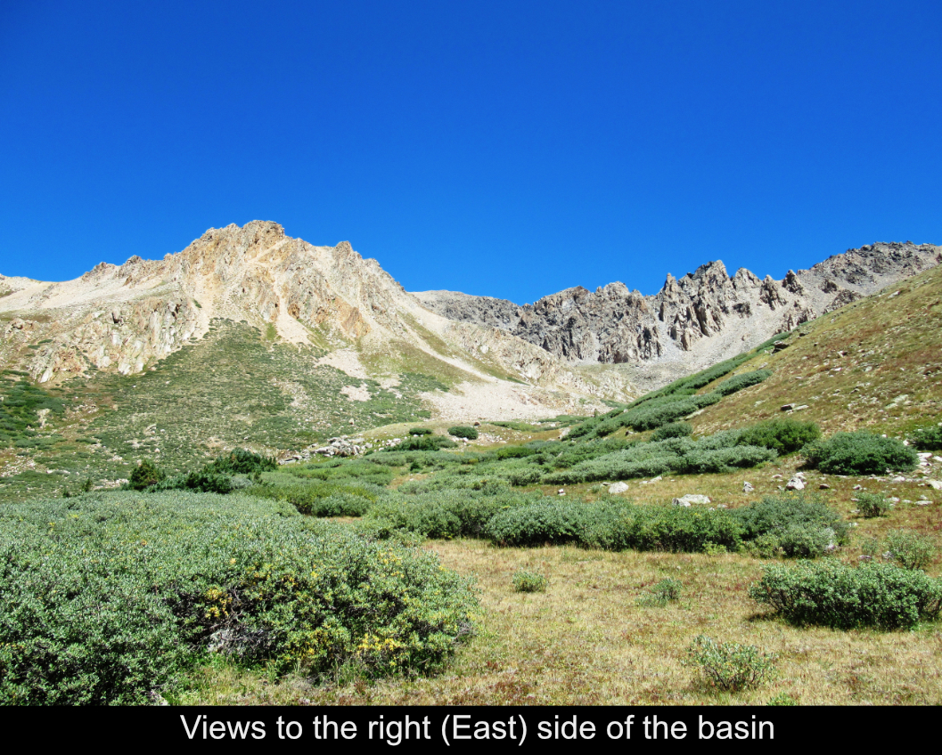
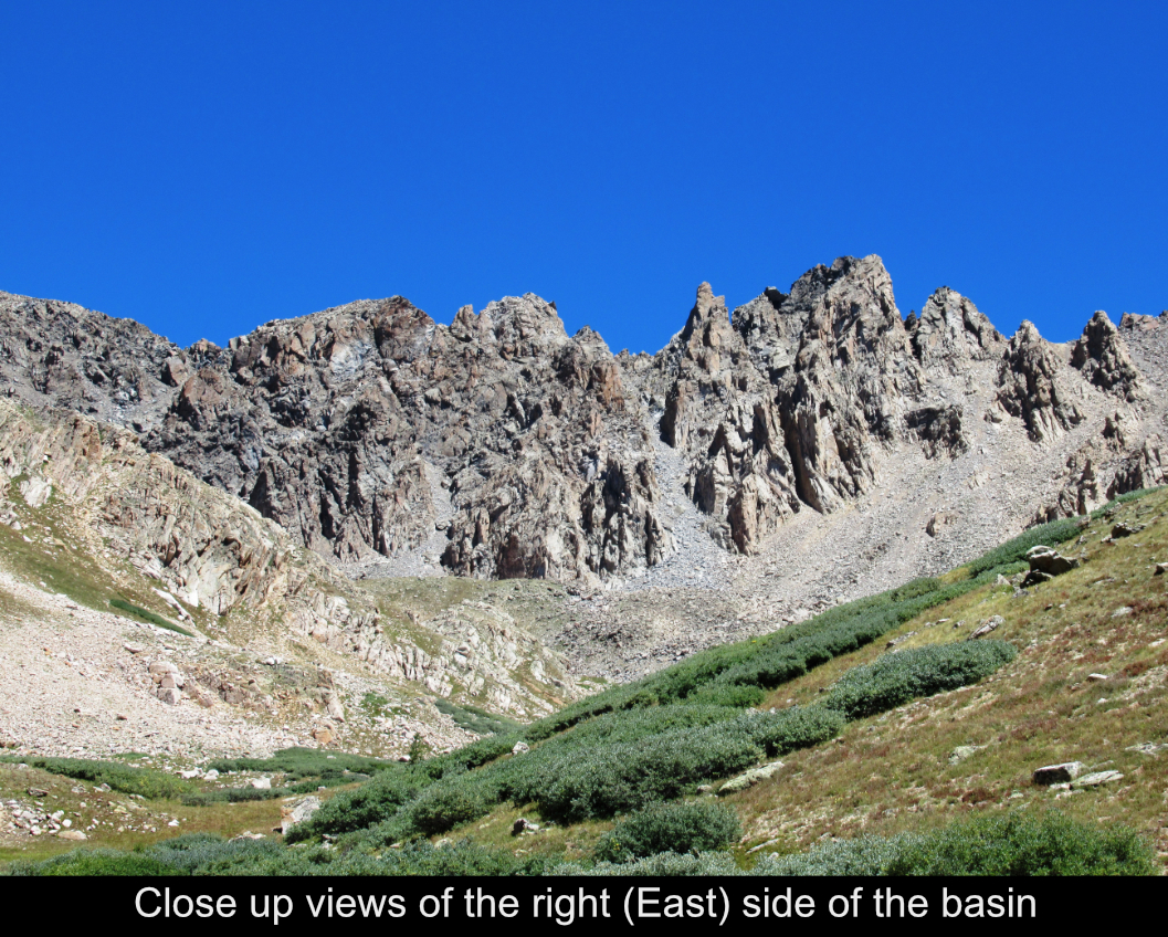
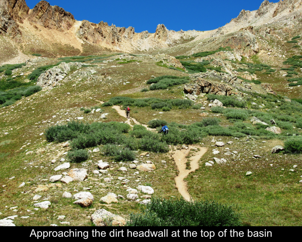
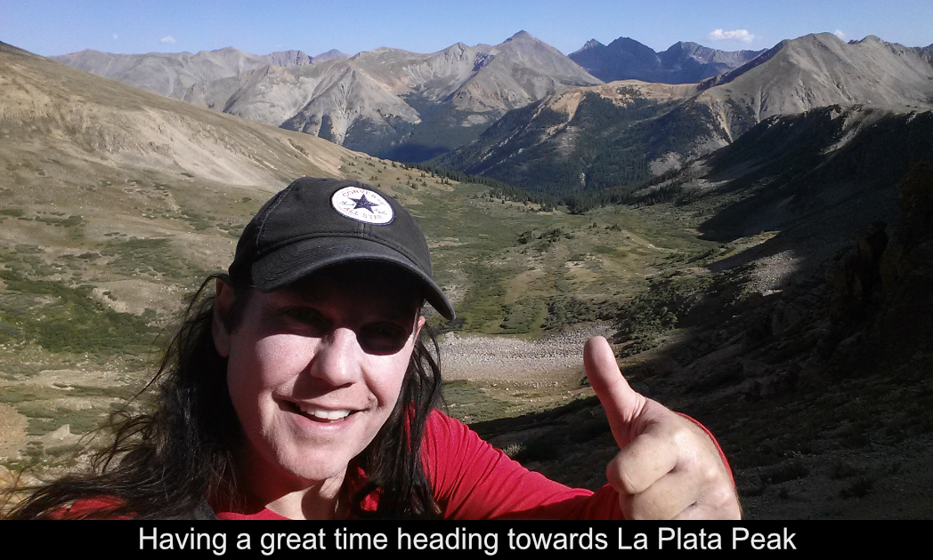
After a short way, you begin to enter the lower basin headed towards the saddle between La Plata Peak's Southwest
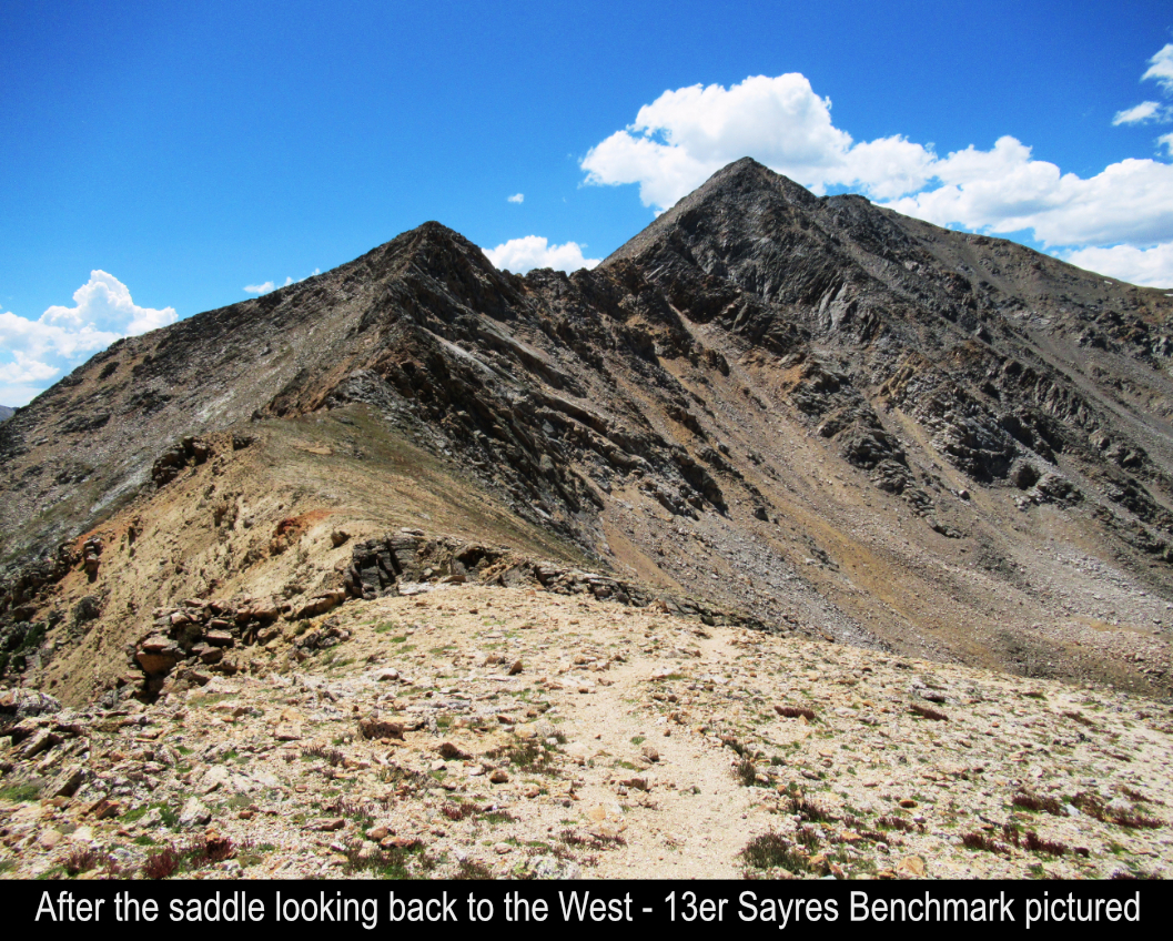
Ridge and the ridge to 13er Sayres Benchmark. This basin is gorgeous and I only saw 2 people in the basin all
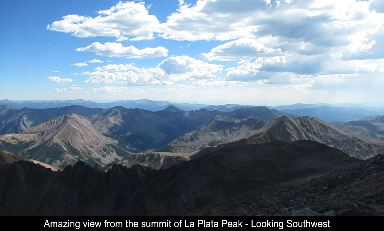
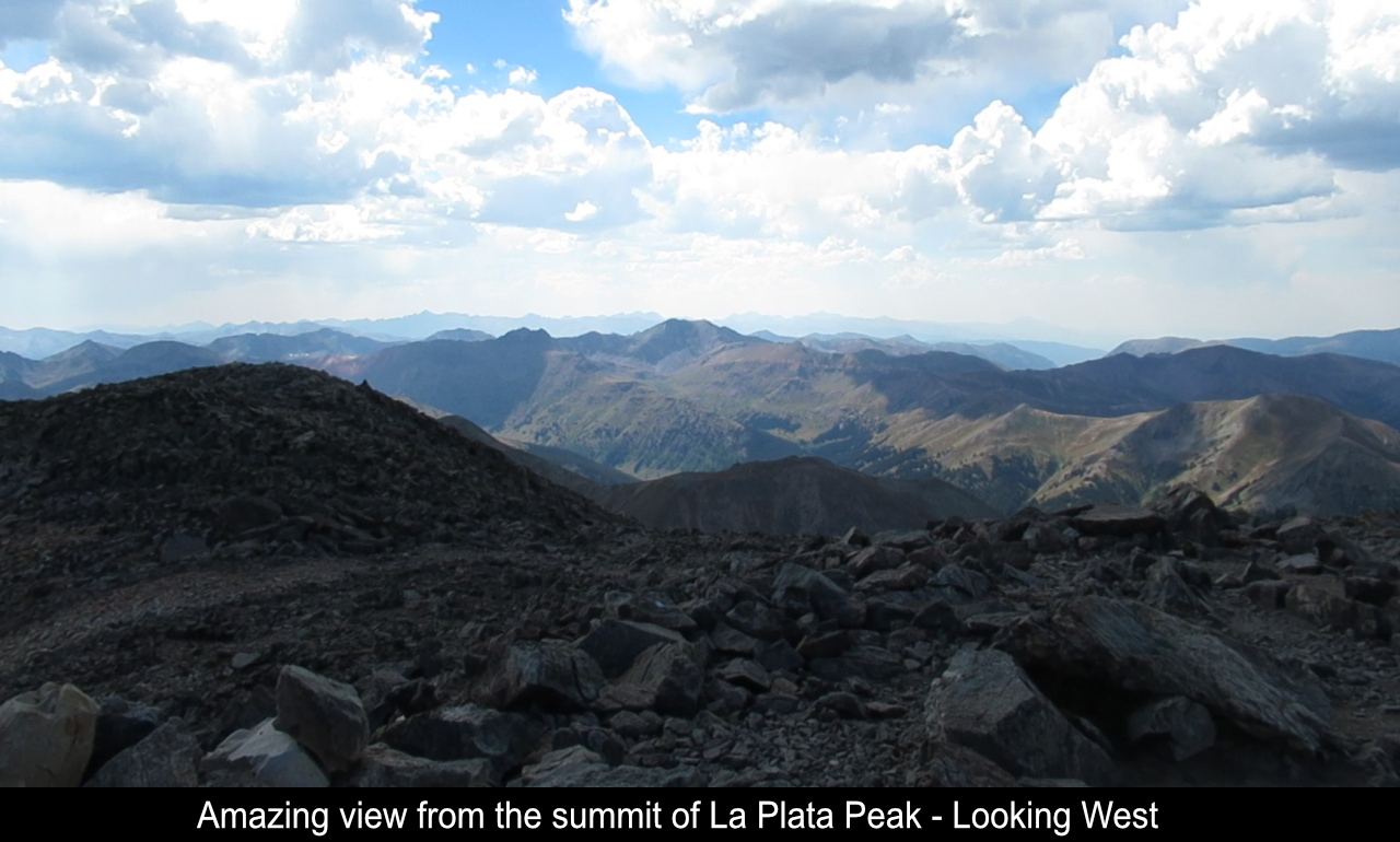
the way to the saddle. The views to the left and right are really cool with the right-side (East) views becomming
really craggy!
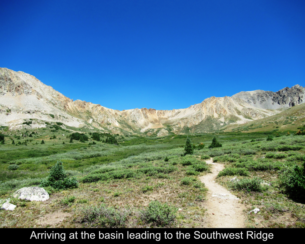
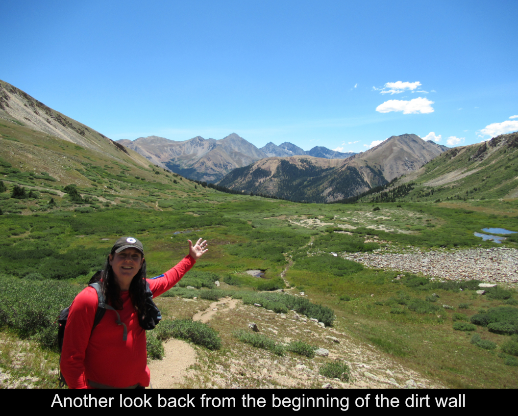
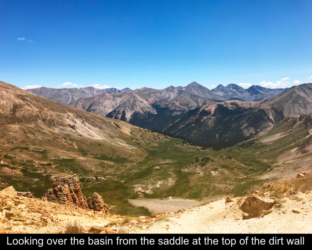
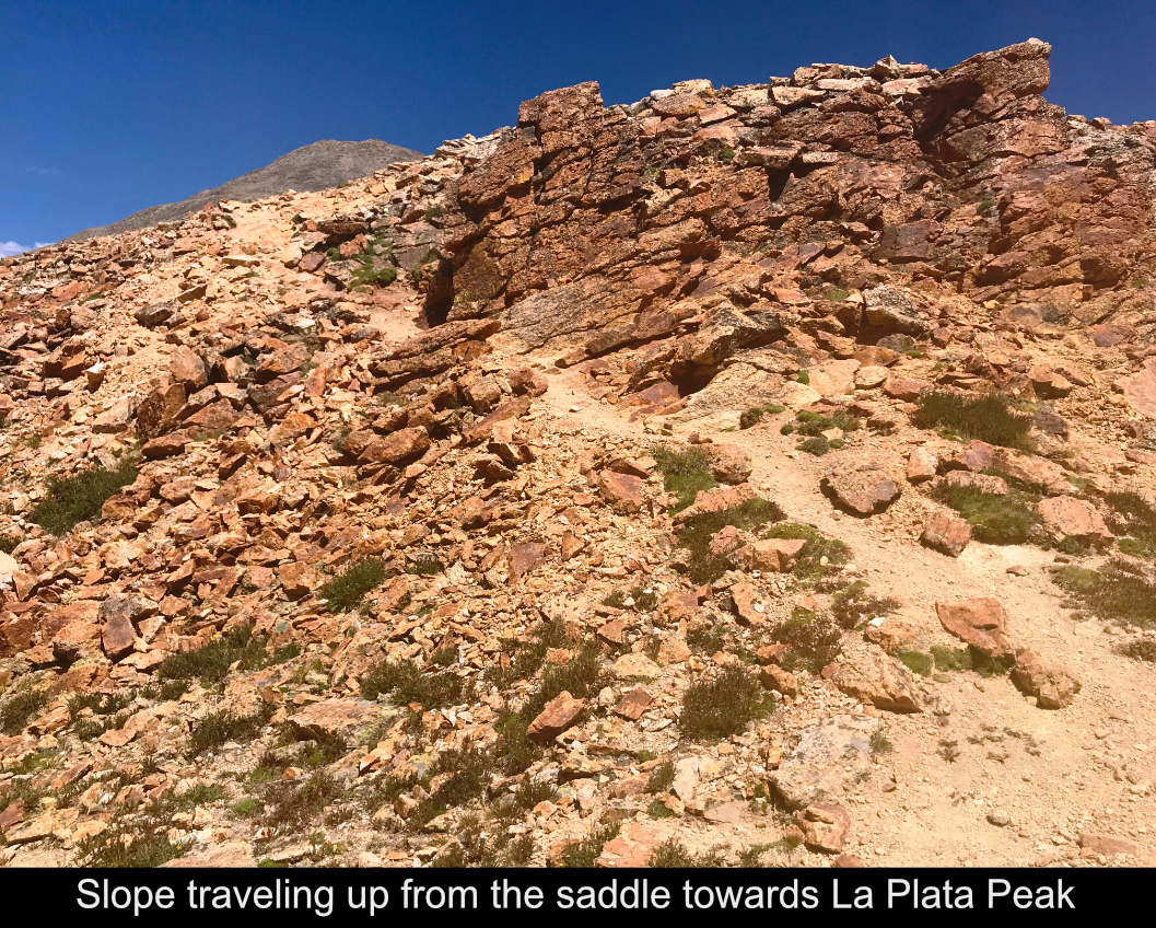
Next is the nemesis, and what might be the crux of the entire route, the sketchy, loose dirt wall that ascends
from the top of the basin to the saddle. I'm a former skiier and skiing dirt and grass hills is old hat to me. But
man this hill was raunchy and slippery!! Sometimes you know it's just gonna be a slip fest and you basically
have to run / jump to the next rock up the hill just so you don't slip back. But it's all a part of the fun
getting the the saddle where the views become even more gorgeous!!
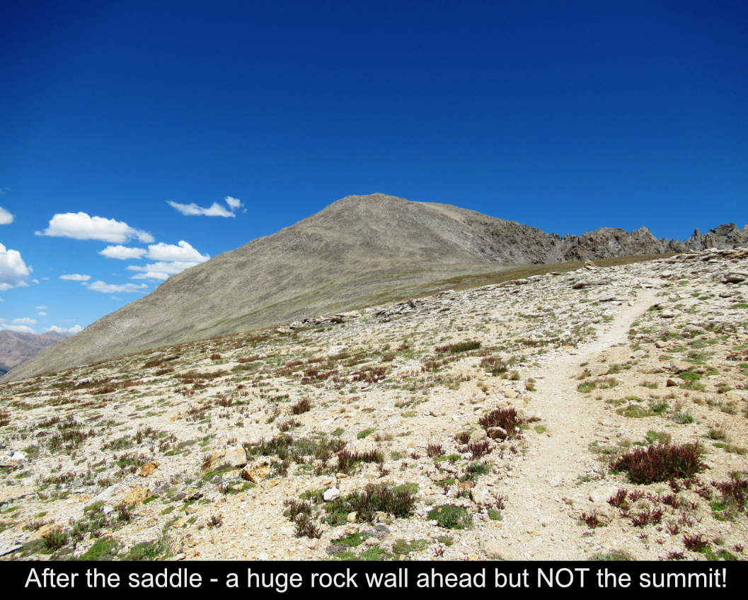
I ran into some hikers above the saddle and asked them the obligatory 'how much further?' question. The answer
to my surprise, was not good. It was getting late (maybe 11AM) and while the sky was clear, it is a well
known fact that storms can hit anytime in the Summer in the afternoon in the mountains in Colorado and you
never want to summit much past Noon. The hikers told me I had 2-3 MORE HOURS to get to the summit!! The
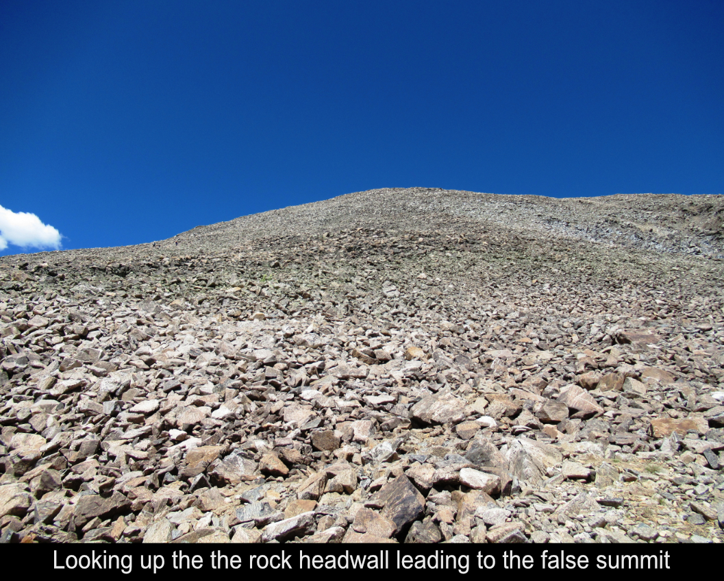
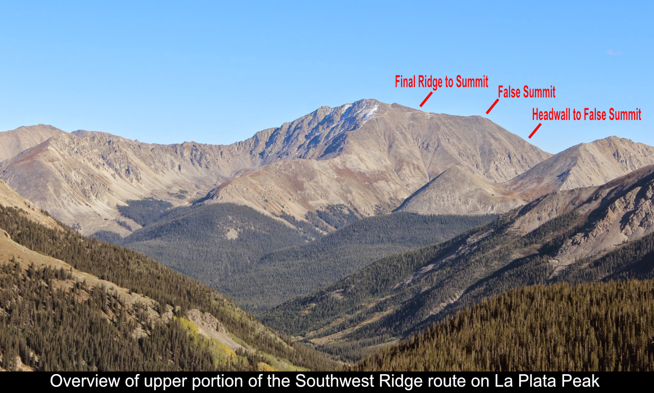
reason is there is this huge rock wall you see above the saddle... it LOOKS like it could be La Plata Peak but
no such luck! It takes a good while, maybe 30 minutes to reach the lower wall, then a good 45 minutes to an hour to climb it,
and then probably another hour to tackle the upper ridge above the false summit to reach the actual summit!
At this point, I needed to decide to keep going or not. I made the irrational decision that because I had some
hikers behind me still heading to the peak that I could continue on. And the sky didn't look bad and the forecast
had a very minimal rain possibility (but not zero!).
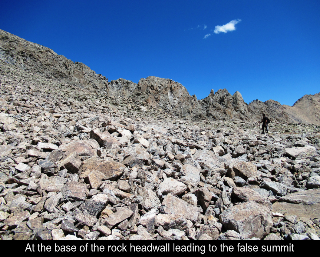
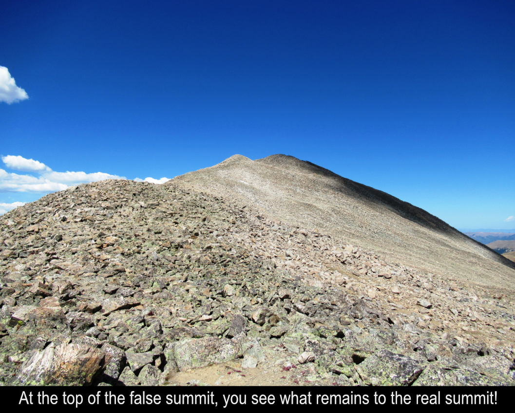
The top of the first rock wall admitedly took a while. It's just a long talus rock hop. But when you get to the
top you see that you still have a good ways to reach the peak!
The weather was holding about the same so I figured I'd go for it.
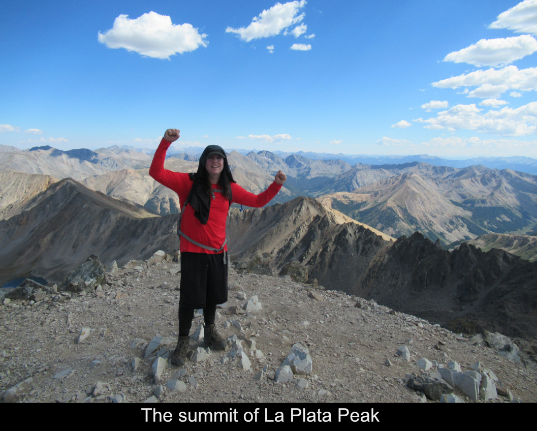
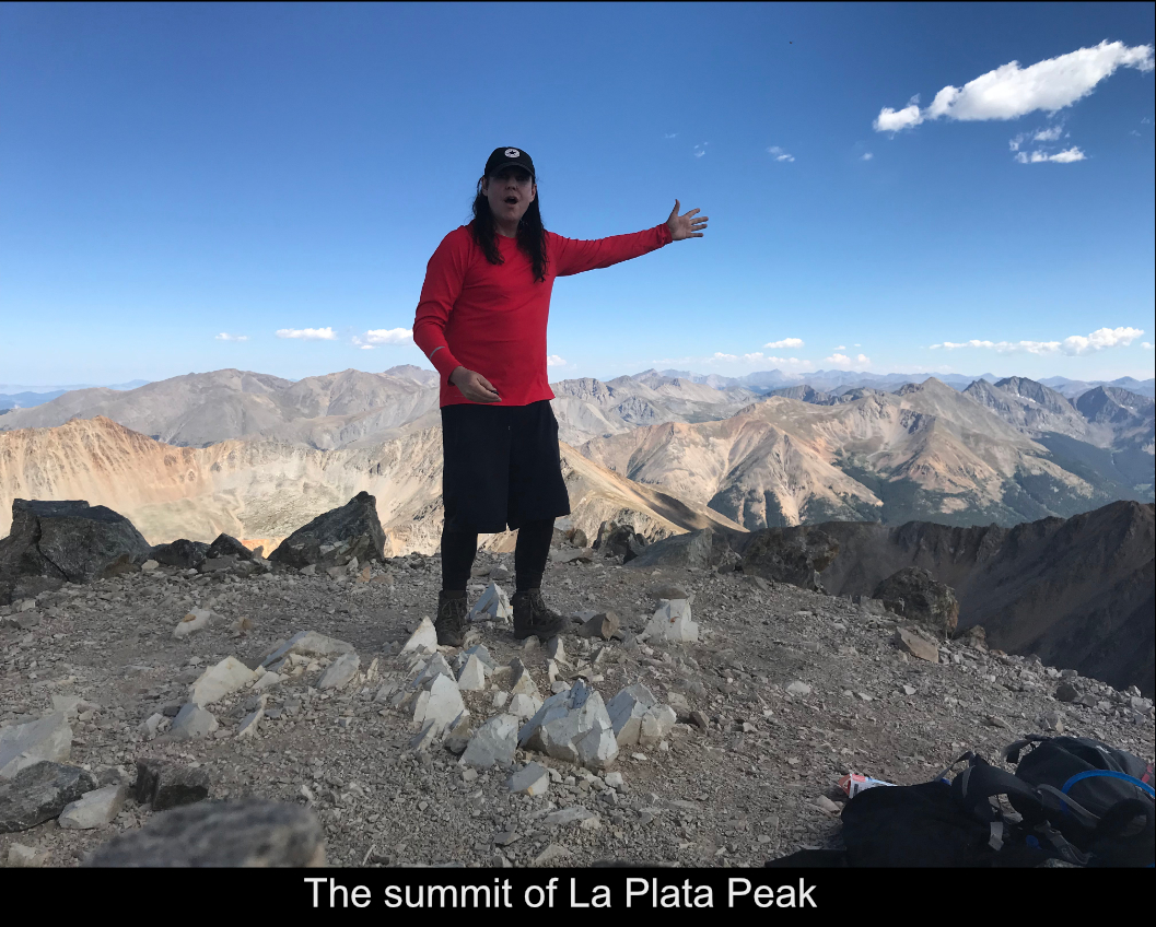
Upon arriving at the summit there were two guys who took my picture... then they left. It hadn't rained and
there were a couple of clouds but nothing looked too frightening. So, I was hamming it up taking some selfies
enjoying the views, and BAM!! A quick lightning strike flashed over the summit... granted it seemed to be a
very non-powerful flash that was real quick with no thunder... but still, this literally FREEKED me out!! I
was like 'what am I gonna do as I'm on this summit with 45 minutes to even the false summit (which is still
obviously exposed to any lightning and way above tree line)?' ... suddenly I was REALLY scared. What to do?
TAKE OFF and get down as quickly as possible.
This panic induced strategy is not a good one, and anyone reading this can try to take away from it. Of course
it was the right idea to get down. But to let my heart start racing and to move too quickly across the talus
back to the false summit was just plain risky. I made it fine, but practically running over talus is a recipe
for disaster ... had I tripped and snapped an ankle I would have had HELL and LOTS OF MONEY to pay!! Lesson
learned : panic is the worst thing you can ever do on a mountain! Even if you are at some increased risk, it is
only going to benefit you to keep your wits about you and still work through whatever you have to do methodically as you can.
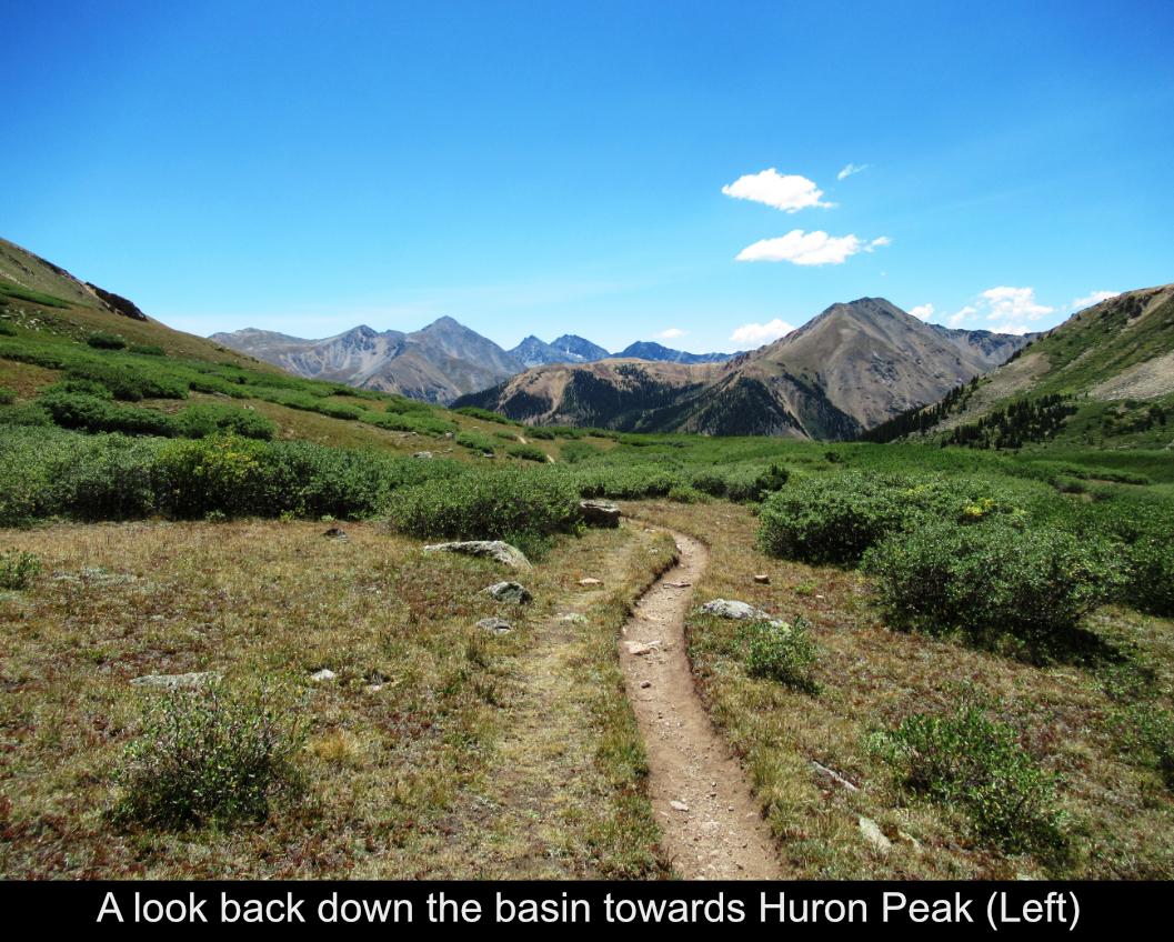
After getting to the false summit, the clouds cleared and there was no more danger. The hike back down the
saddle was fine. Now, the dirt section again!! I basically ski'd part way down it but made it no problem.
Here is a video of me skiing on the dirt!!
Arriving in the basin, I ran into a real nice guy Fred from Atlanta who was actually coming off of his 3rd
summit of an attempt at the Nolans 60 hike. That's where crazy people try to do like 12 14ers in 60
hours. Anyway, Fred and I walked for an hour together back to the car and traded emails and had a great
chat. I always seem to make friends in the mountains. Must be cause everybody there is really cool and
out to have a good time.
Nonetheless, this is a great route!! A bit long at about 11.3 miles and 4100 feet of gain... with the rock
hopping involved, and average to slow hiker might complete it in 7-8 hours or so. It took me 9 hours but that
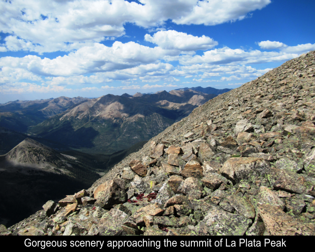
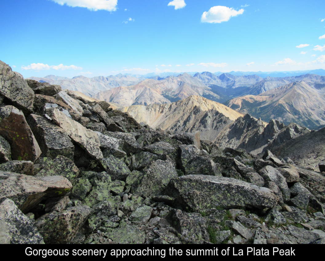
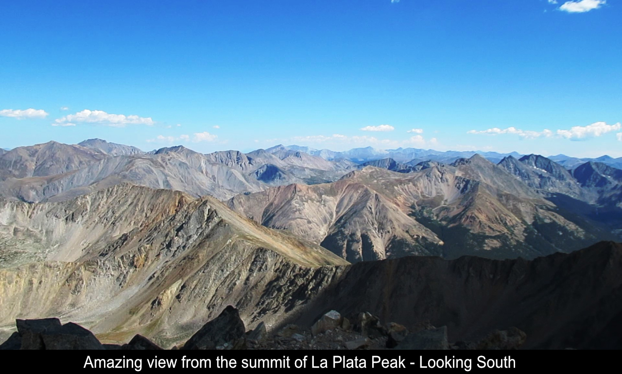
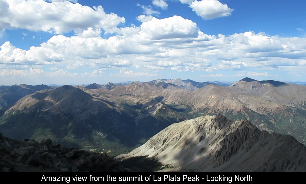
was pretty leisurely as I stopped and chatted quite a bit. But the scenery is fantastic!!
Hope this has been enjoyable and / or helpful to anyone reading it!!
Comments
Add Comment:
Name:
Comment:
Comments ReCaptcha (to verify you are actually a person)
Please click the ReCaptcha button below. Sorry to do this but we had robots posting spam messages on this blog and this prevents that.