Mount Princeton! Colorado - 14,197'
East Slopes Route
7.1 Miles Round Trip
3200 feet of elevation gain
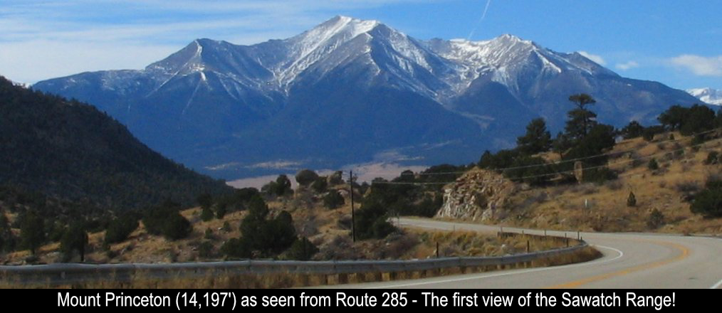
The first time you make your way around Colorado in a car, the mountain views just blow you
away. Different views no matter where you go. One of my favorite first experiences was when you travel from the Denver
area to the Collegiate Peaks / Sawatch Range via Buena Vista. As you come down the plateau from the Fairplay area on
Route 285, you see this enormous peak literally right in your face! It's mind boggling! This is Mount Princeton!! Ever
since I saw that peak I told myself I had to go stand on top of that!!
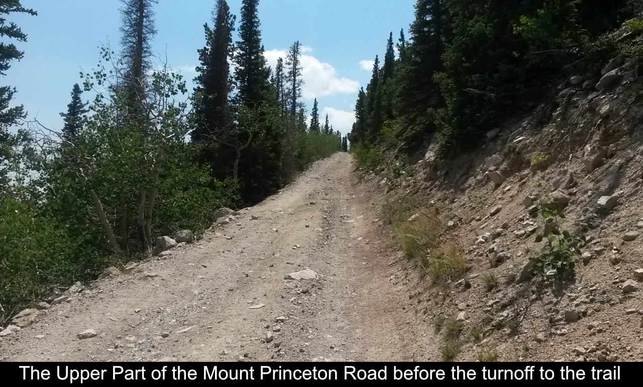
The standard route up Mount Princeton comes off of the 4WD Mount Princeton Rd. This road
goes a LONG way (4+ miles) up from the base of the mountain. So, if you don't have a vehicle to get up to the parking
areas somewhat up the road, it is going to be a very long hike with a lot of elevation gain. Plus you'll basically
have to walk up a long, not as much fun as a trail, road!
Luckily for me my friend Tim from Aurora was down for a few days as I camped in Buena
Vista and he has an Xterra! Hurray! A ride up the Mount Princeton Road!
A popular up-road parking area is by the radio towers at about 10,800 feet. This is
where Tim dropped me off. This is already 4 miles up the road but I still had to walk about another mile on the
road to get to the steps that begin the actual trail.
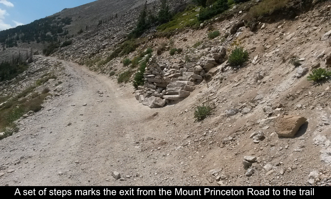
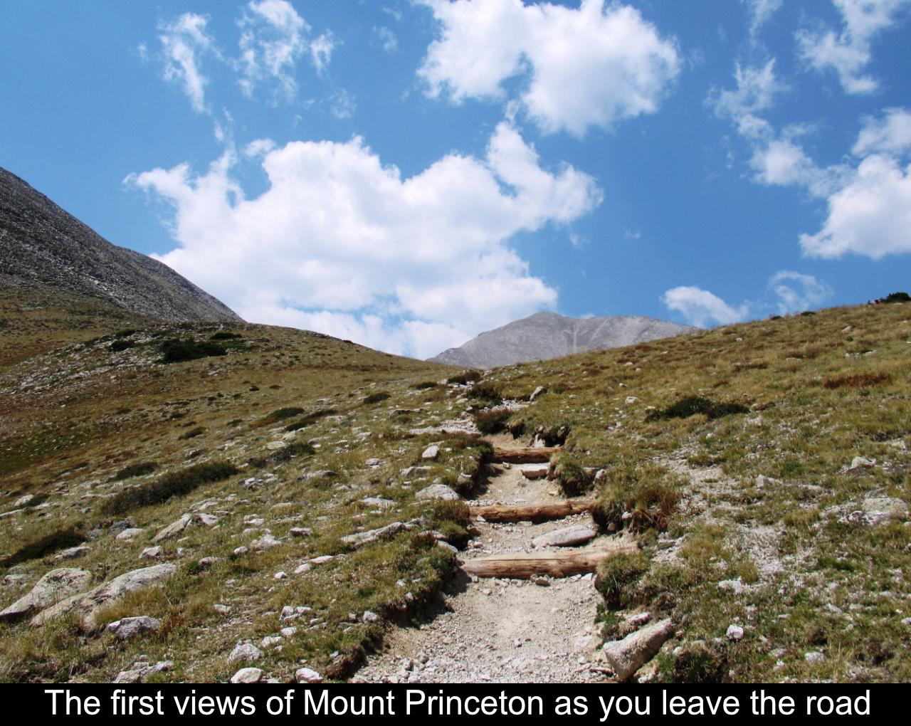
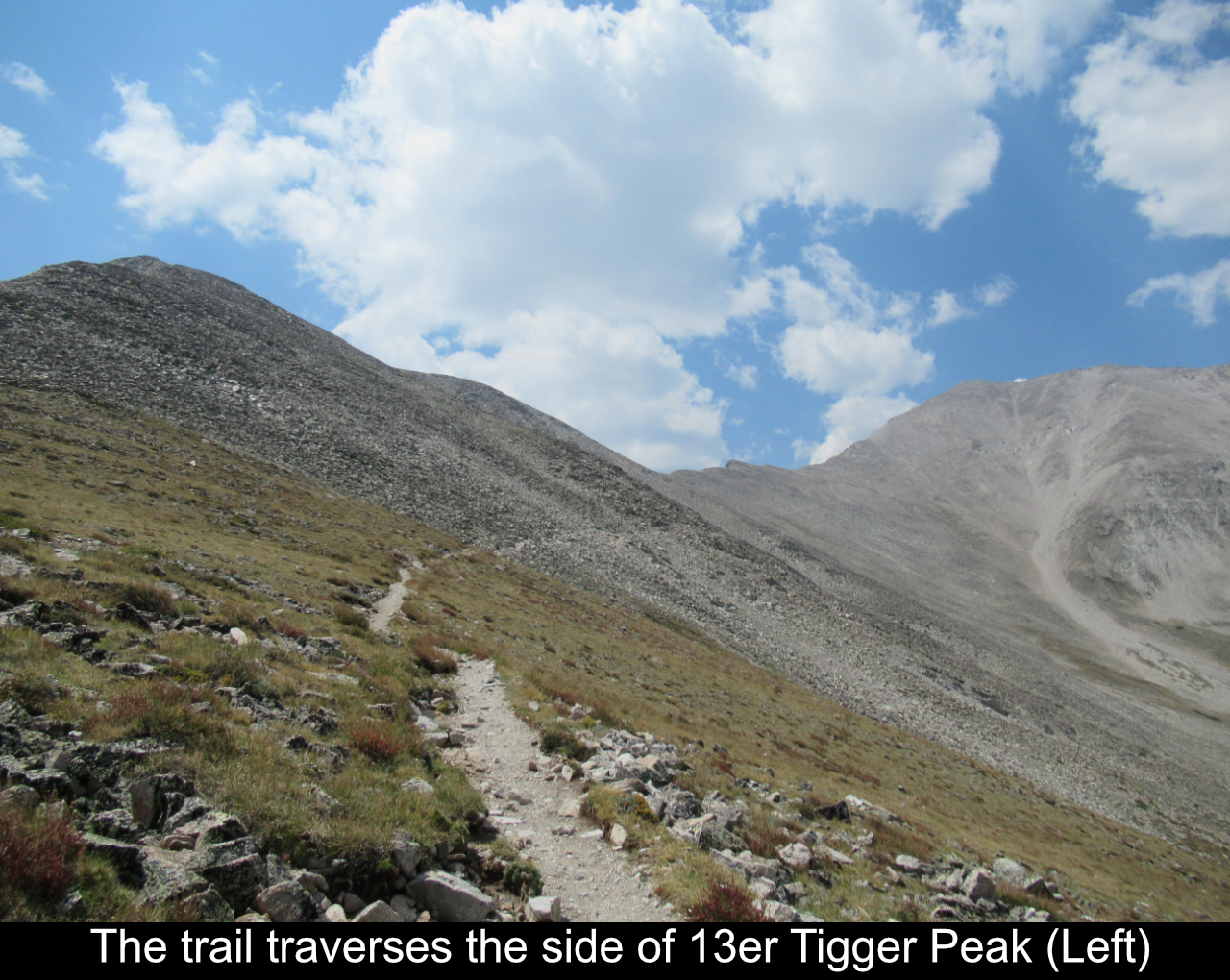
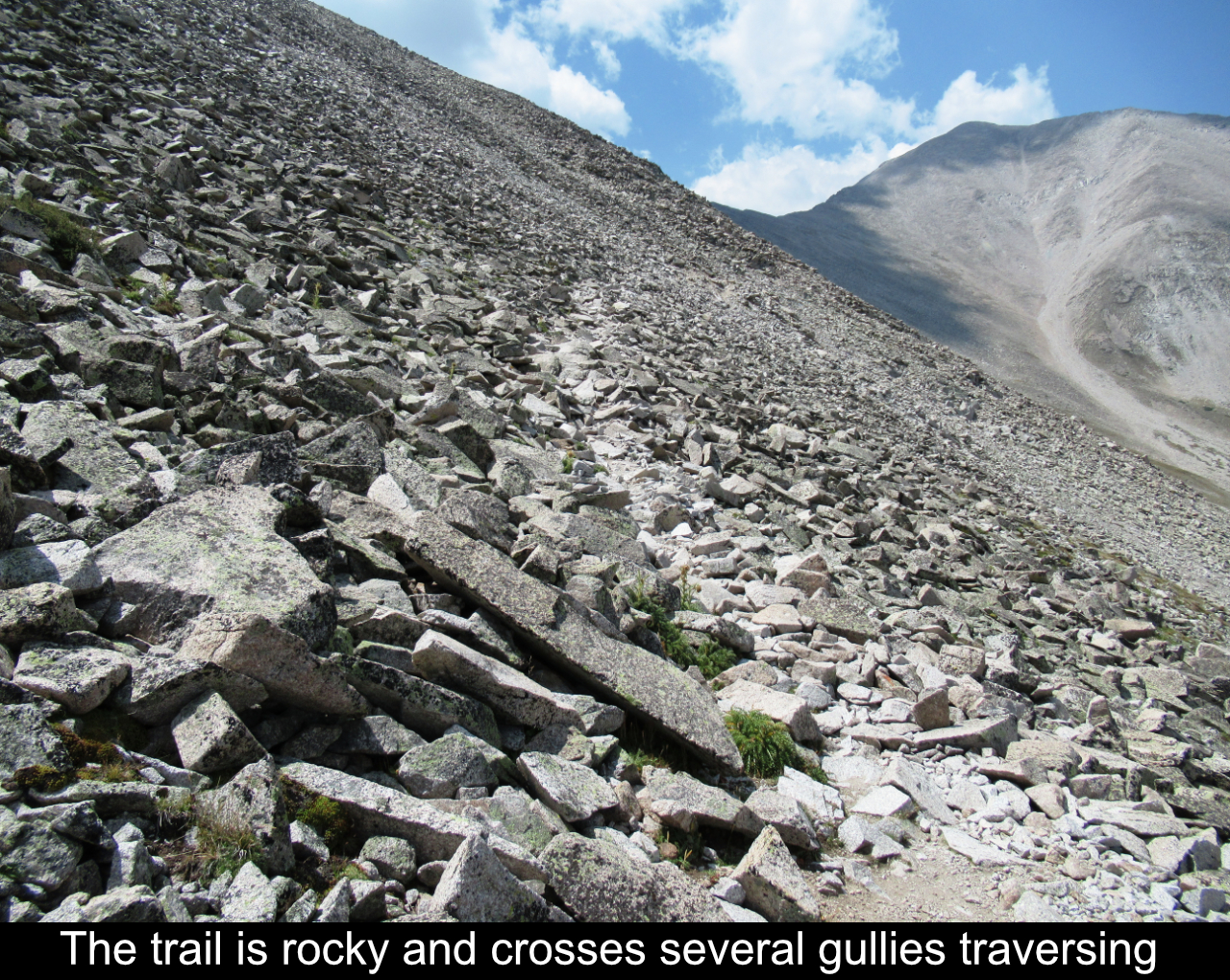
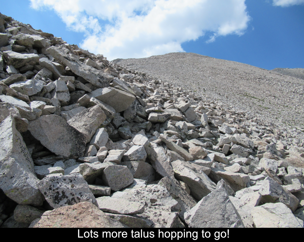
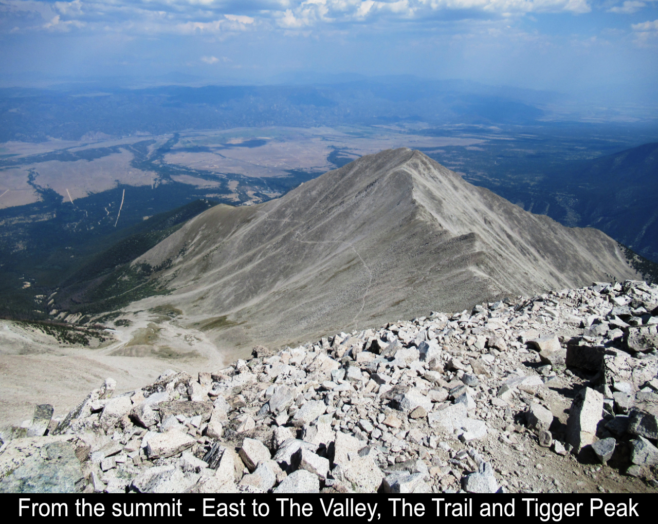
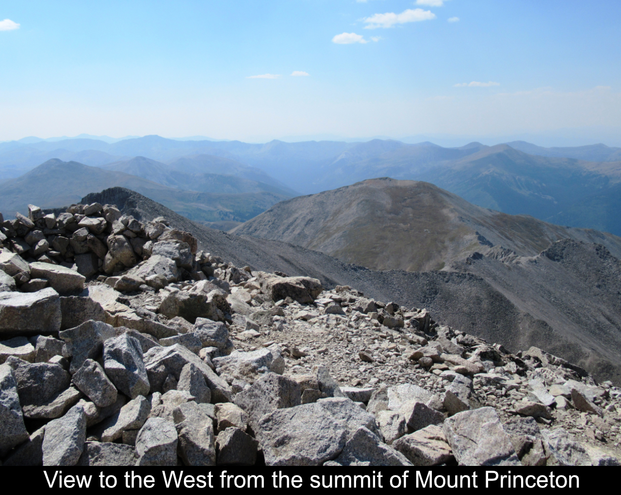
Once you're on the trail, you're already above tree line. And the Mount Princeton massive
is just HUGE! Basically you are on this endless talus field. First the rocky trail crosses a bunch of gullies on
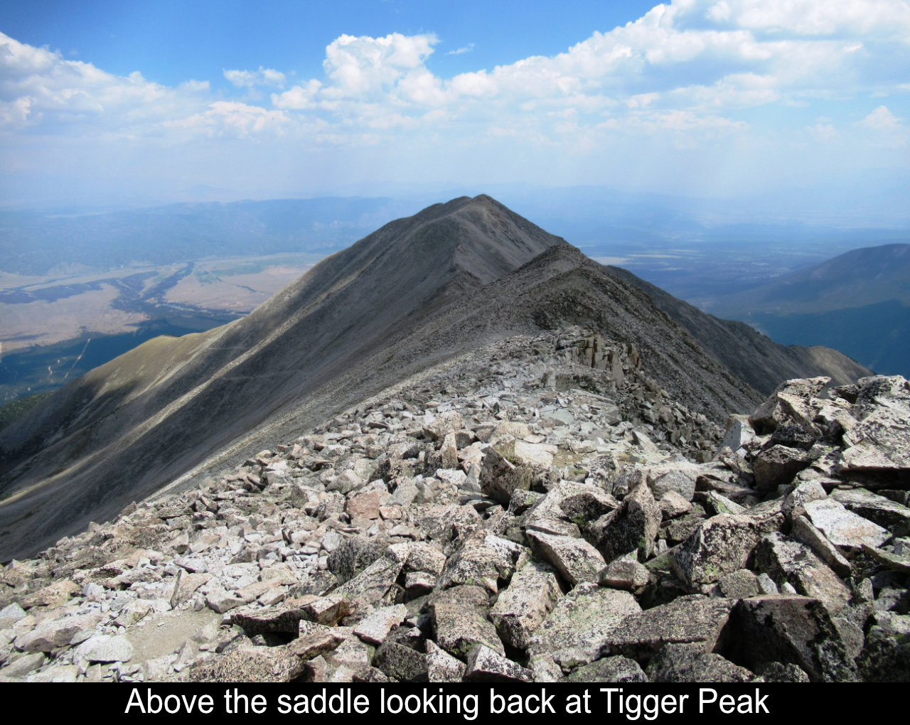
the side of 13er Tigger Peak (which is basically a sub-summit from the ridge on Mount Princeton). You traverse the
side of the slope.
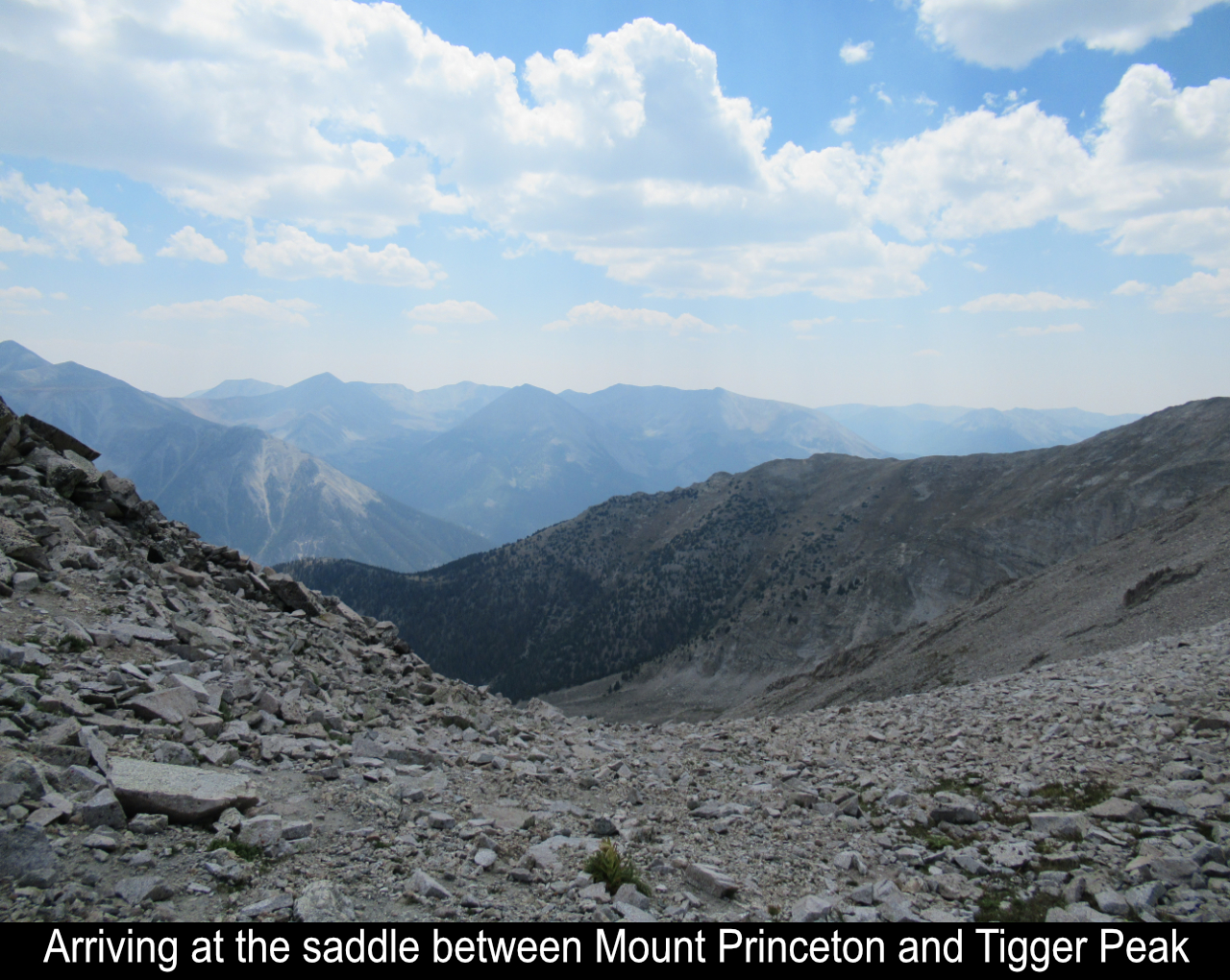
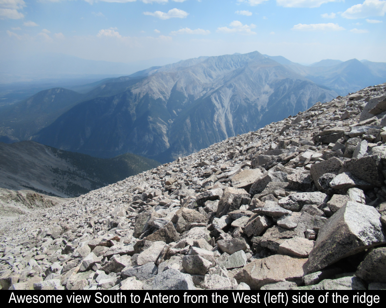
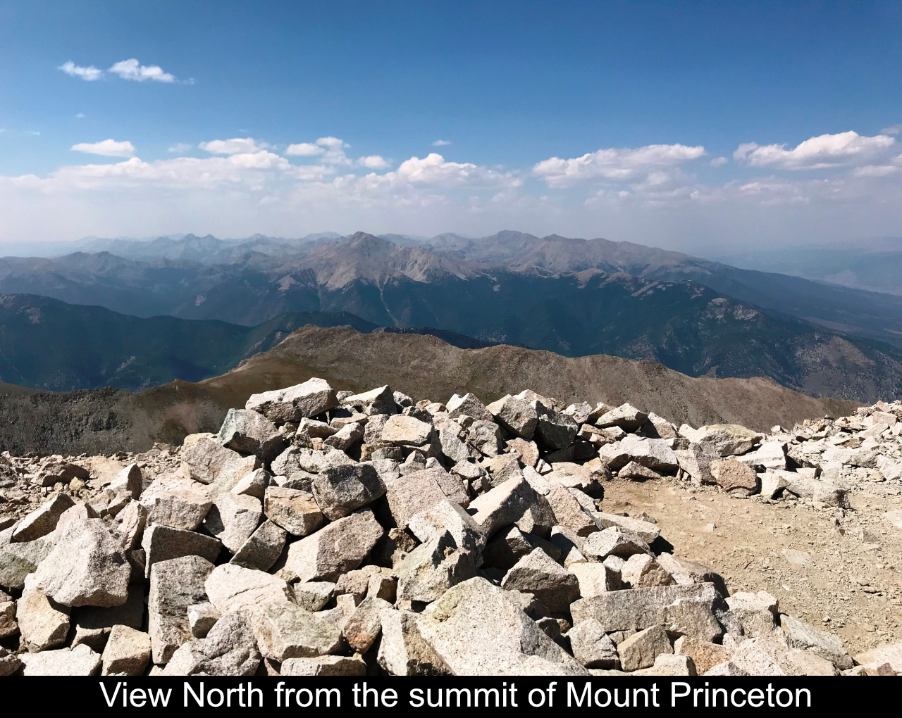
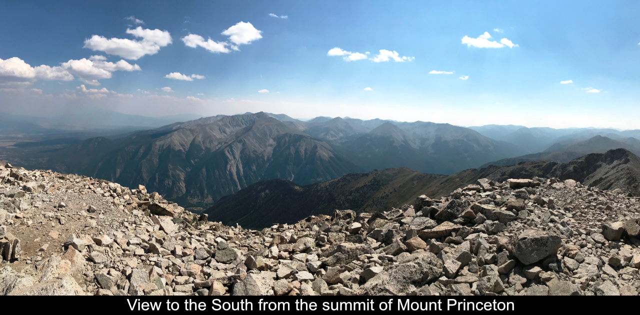
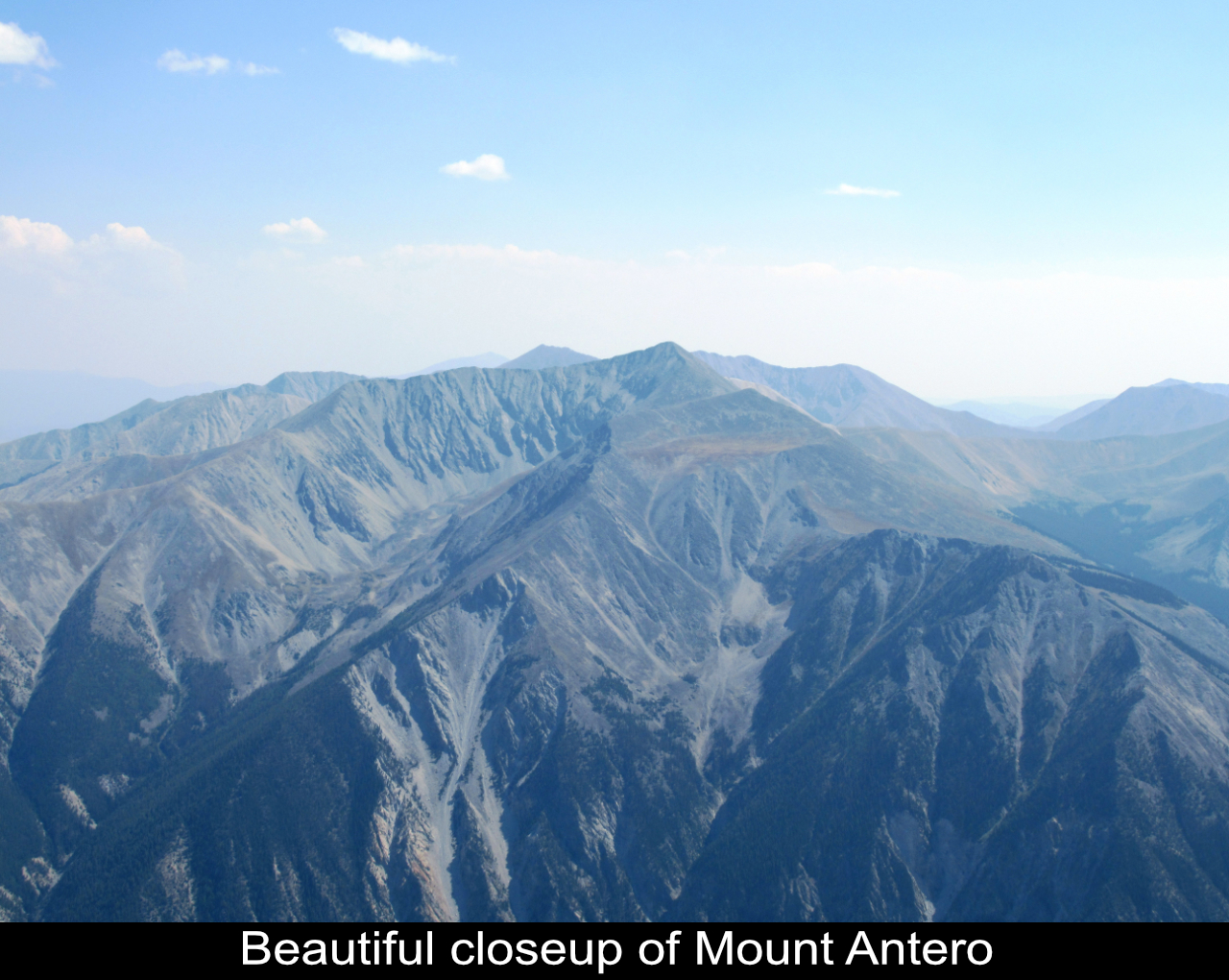
Eventually you hit the saddle between Tigger Peak and Mount Princeton. Here you can
finally peep over the ridge to the South and see beautiful views of Mount Antero! Down in the Canyon is the road
that divides the two peaks and goes up past Chalk Canyon. And there is a lesser known route up Mount Princeton
from in that canyon called the Grouse Canyon route that begins from the canyon between Princeton and Antero.
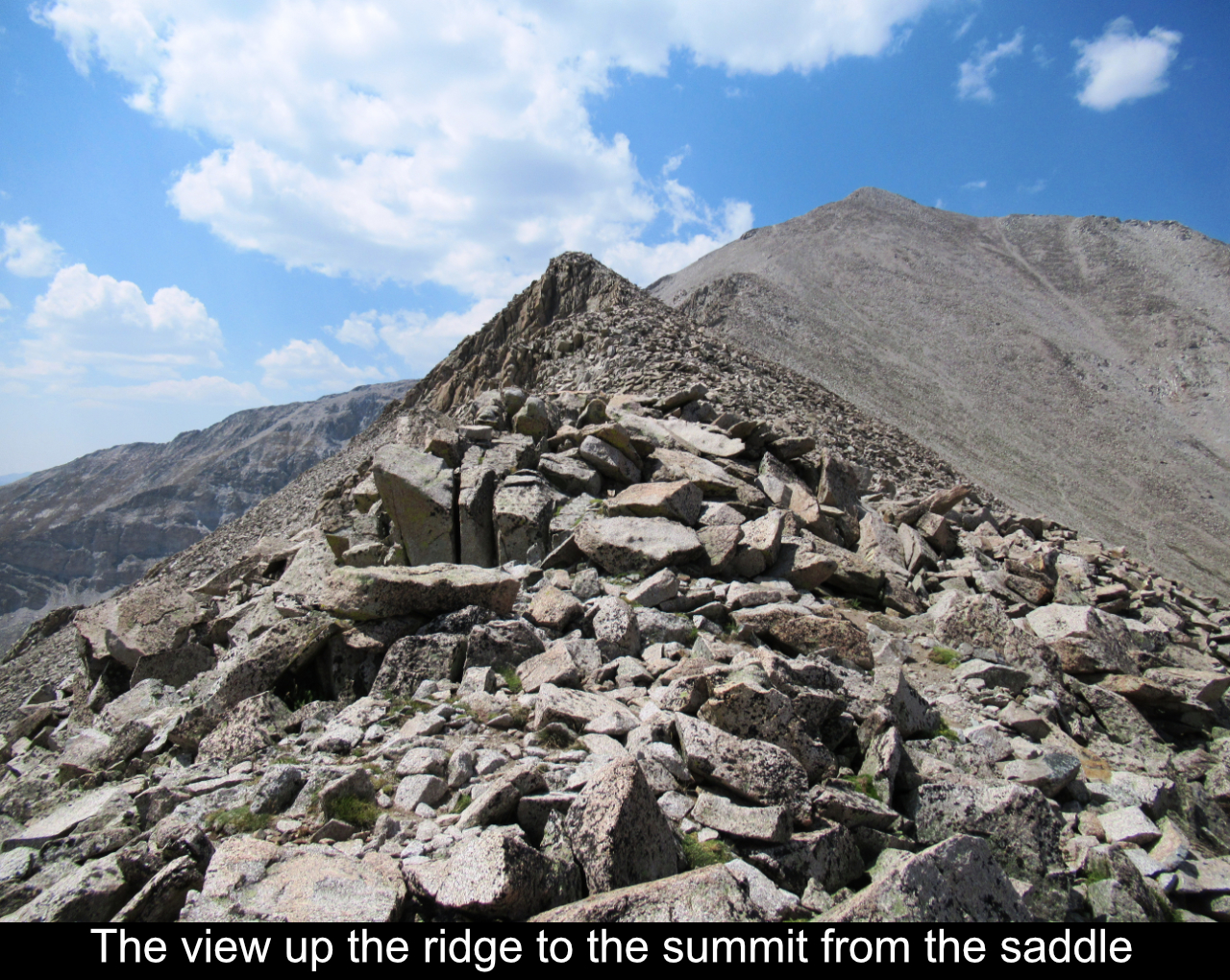
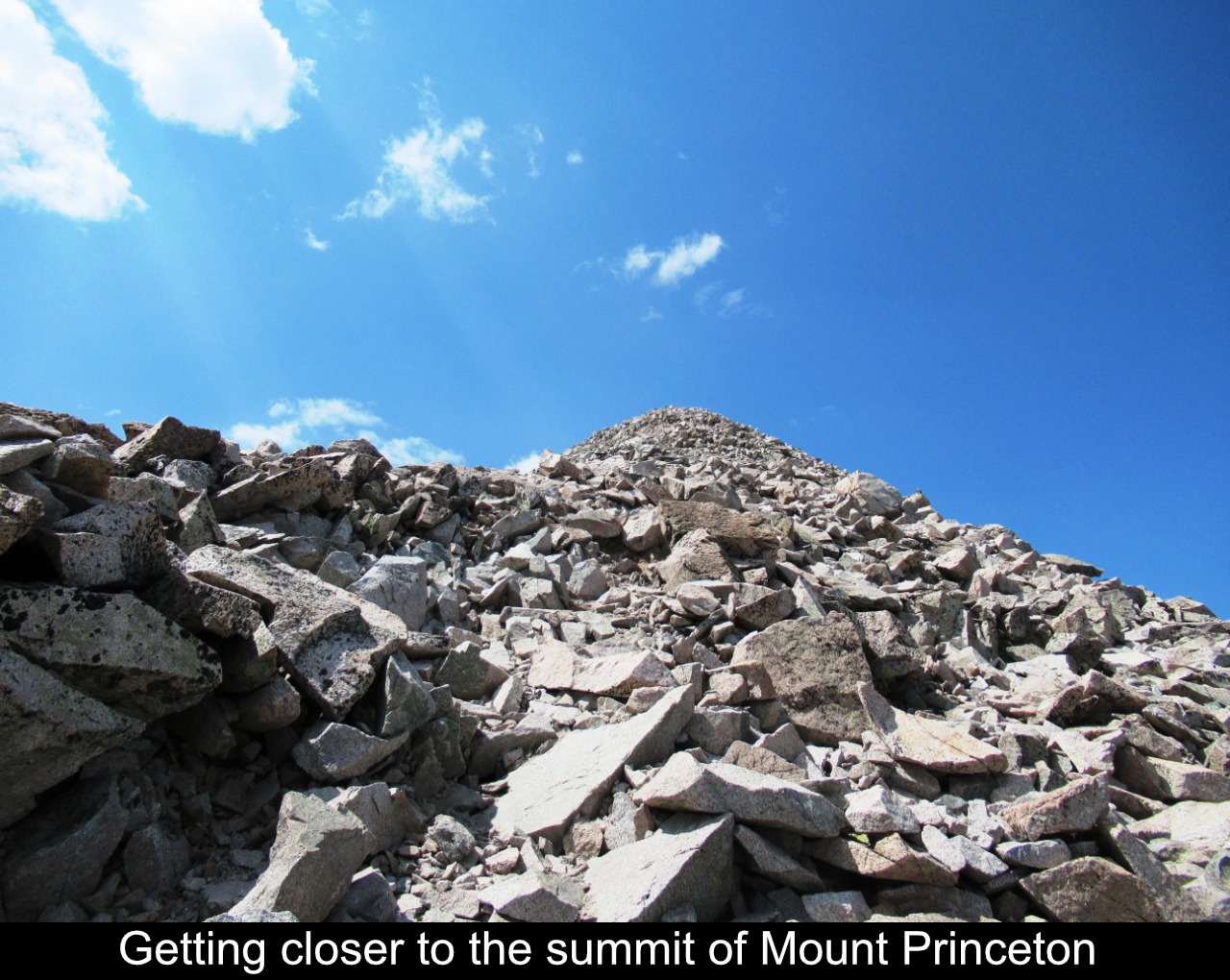
After the saddle, it's another slog up the ridge to the summit! It probably takes an
average to slow hiker an hour to make it, and there is definitely at least one false summit that is a little
deflating, so be ready for that!
On August 7th 2018, the weather forecast had been clear for the day but you just never
know. Admittedly I had started WAY late in the day and didn't even begin hiking until after 10AM. So, if I had
to turn around it wouldn't be a disappointment as I was extremely late. I was basically just taking a flyer and
if the weather held I'd go for it. LUCKY ME!!! As I passed the saddle and went up the ridge, there was a baby
cloud here and there but the blue sky was prominent!! The best part of this is that you rarely get to summit
late in the day, and because of this, there was NO ONE anywhere near the summit or even on the mountain by the
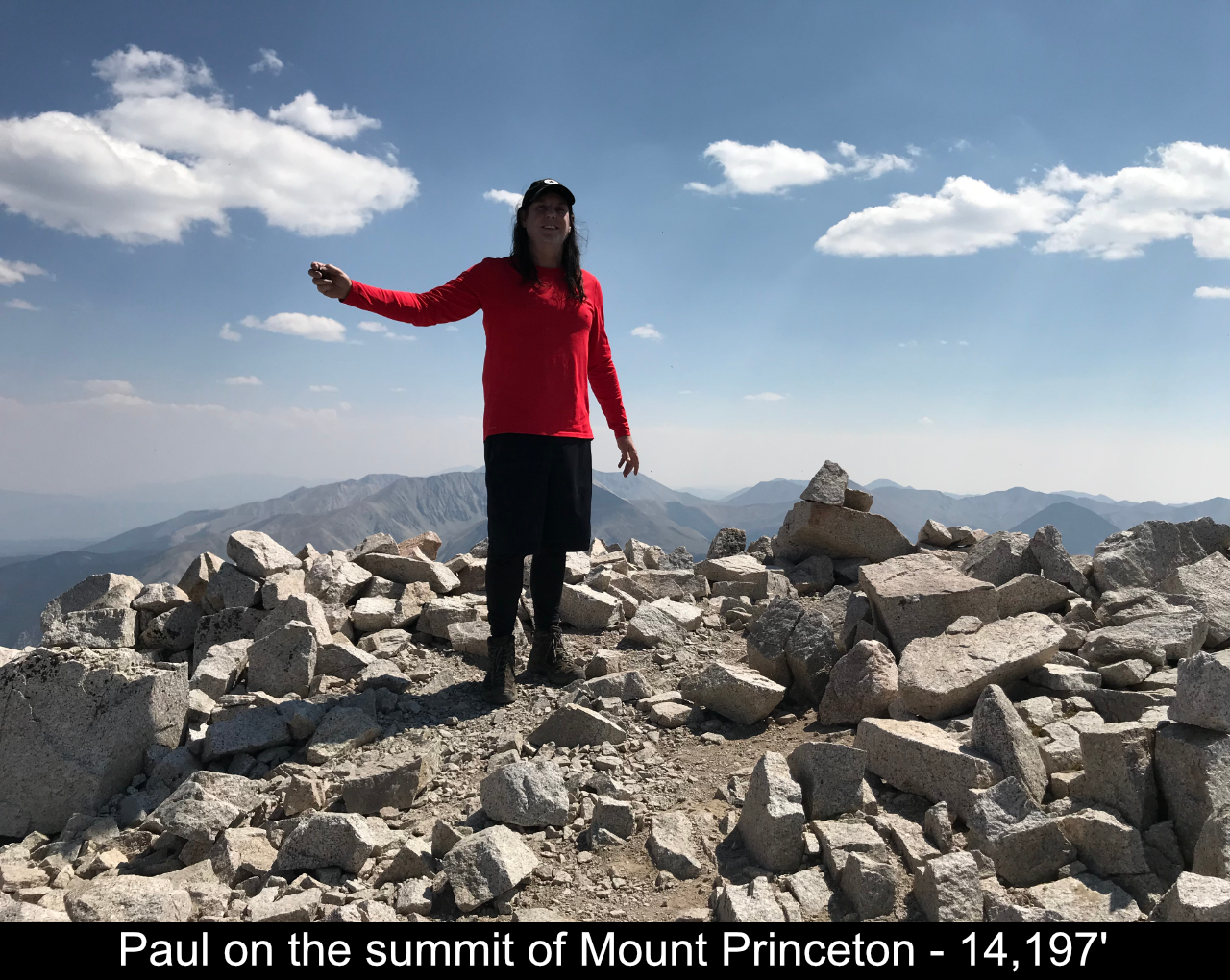
time I got to the top!! It was crazy! This was the first time I ever had a 14er summit to myself. I set up my
tripod and was taking pictures and dancing and just having a blast! Sat down and had a nice snack. It's hard
to describe, but for that half hour or so on top of Mount Princeton, I basically felt like I owned the world
and I was the King just sitting there enjoying my planet .... SO MUCH FUN!!! Would it have been nice to share
it with a friend? ... yes ... but absent of that, it is easy to still have a blast!!
OK, so back to reality. Luckily I could get cell phone reception from the top and
was able to coordinate for Tim to come back up the Mount Princeton road and pick me back up at the radio
towers. So, just had to get back down. The descent was uneventful but I did have a great time hanging out
talking with Mrs. Grouse!! Here's a fun video:
And here is a great video of what the Mount Princeton Road is like:
I loved hiking Mount Princeton and would return again with anyone who ever wants to go do it!
Hope this has been enjoyable and / or helpful to anyone reading it!!
Comments
| Posted By: Prodigal - 4/11/2024 |
| Comment: Thanks for this trail report, and particularly for the photo from 285. I had the same reaction seeing Princeton from 285 before I'd ever done a single 14er and your photo is better than any I ever took. I summitted it a few years later on Independence Day. Not my favorite due to all the rock hopping and the fact that I run as much of the trail as I can (I'd probably enjoy it more if I took it slower). It's a majestic peak and I'm glad I had the opportunity to have a successful adventure to its summit and back. |
| Posted By: Barry Walz Tucson - 9/21/2019 |
| Comment: Thanks for taking the time. Looks very doable ! With no ropes or scaling needed . I'm ready. 👍 |
Add Comment:
Name:
Comment:
Comments ReCaptcha (to verify you are actually a person)
Please click the ReCaptcha button below. Sorry to do this but we had robots posting spam messages on this blog and this prevents that.