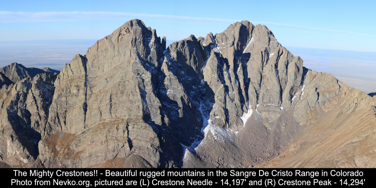
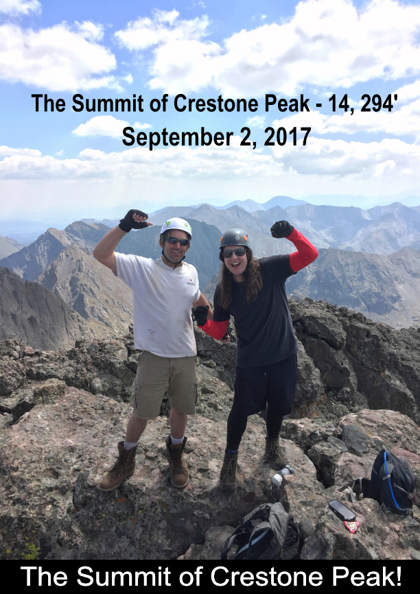
Crestone Peak! 14,294'
Cottonwood Creek Approach
13 Miles Round Trip
5800' Elevation Gain
My brother from another mother Tommy Neville and I took the Cottonwood Creek approach
to Crestone Peak! It was a day we'll remember forever, a truly amazing journey! We had an
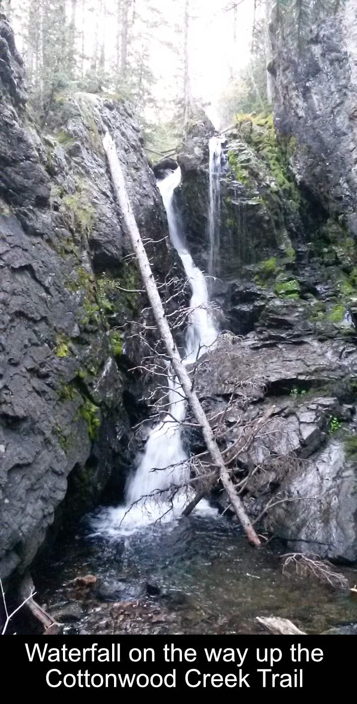
awesome time. The creek trail is amazing with several waterfall sections. Arriving at
the Cottonwood Lake area and the base of Crestone Peak was incredible. And climbing the
Red Gully and the summit block, the whole day was just an unbelievable adventure.
We left the trailhead at 4:30AM to get a head start. The first 3 miles head up nice
trail following Cottonwood Creek. Of course it was dark so we couldn't see much, but it
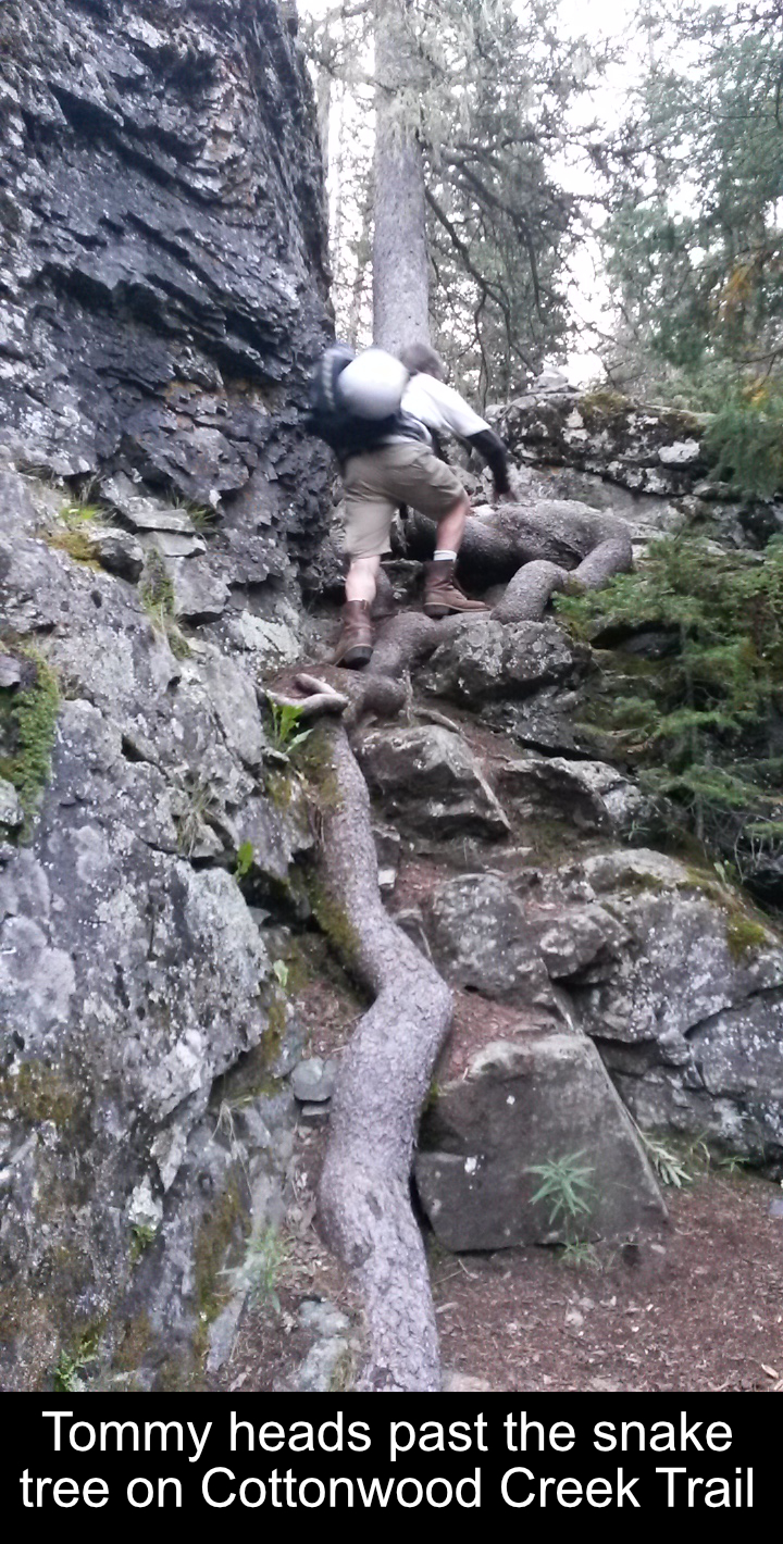
seemed to make the miles go a bit easier. You see things change when you hit the first
waterfall along Cottonwood Creek and this crazy tree with it's roots flowing down
like a snake. It was a great place to take a break and few pictures.
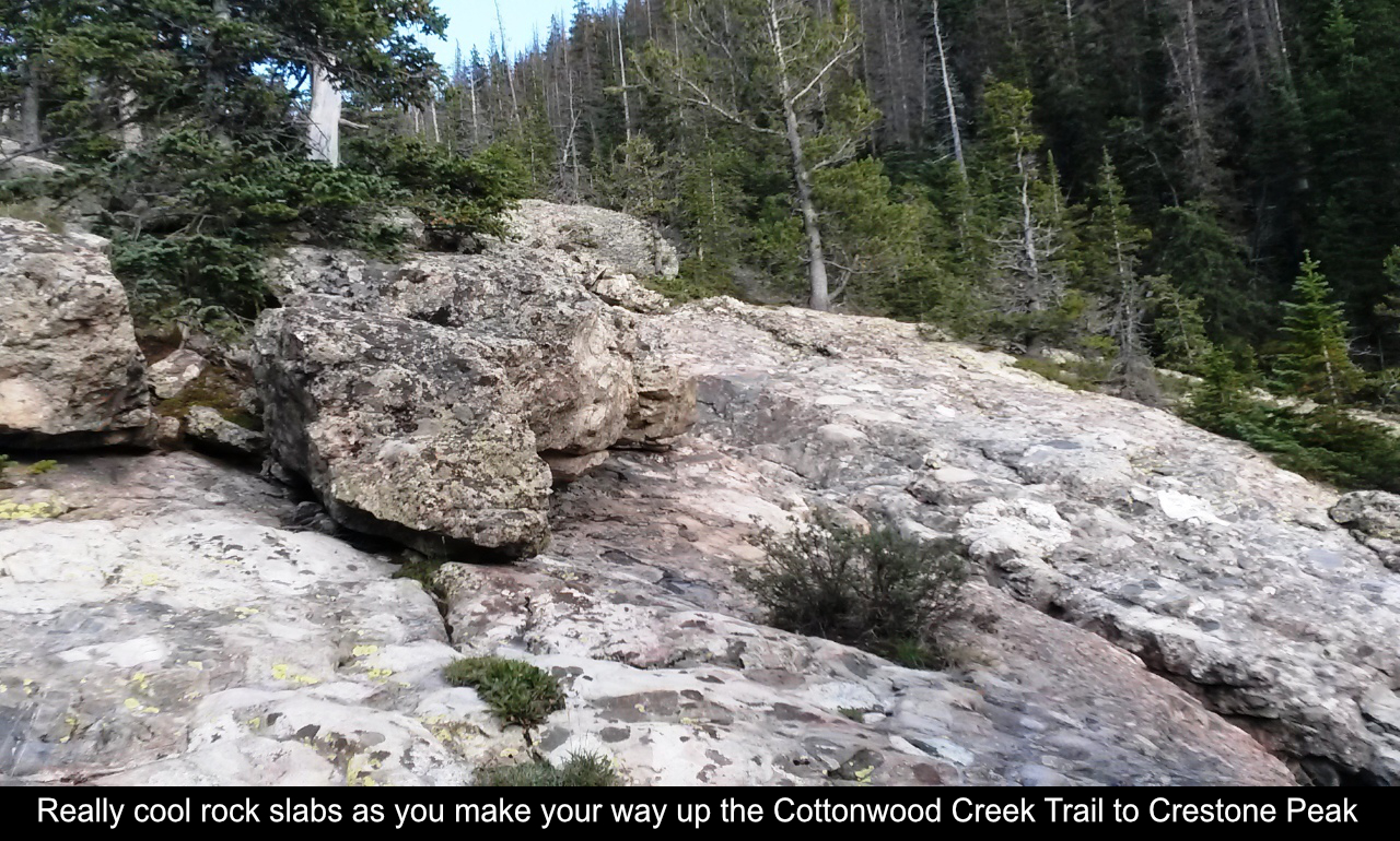
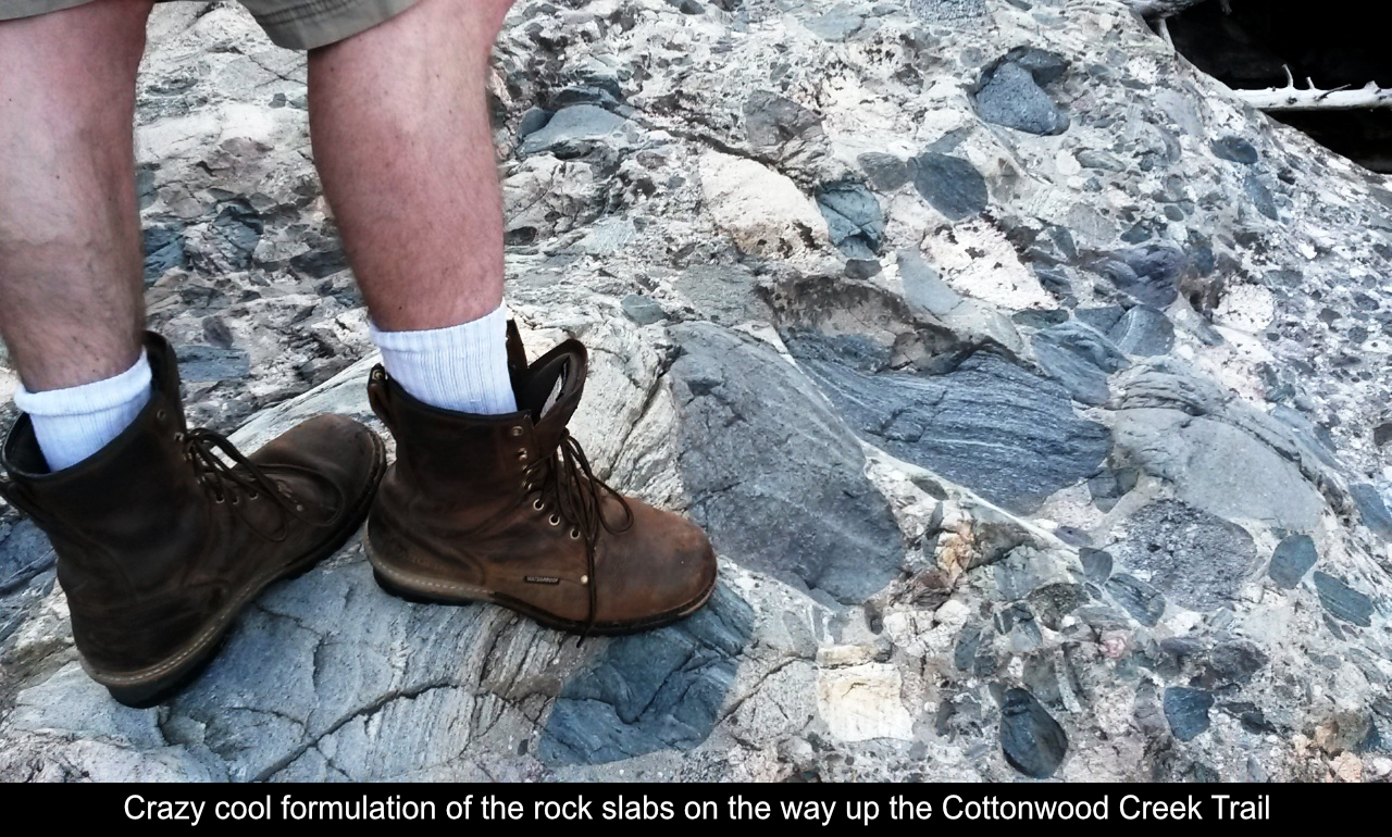
Once you pass the first waterfall, you begin to hit the 'boilerplate slabs' (as they're
referred to by Gerry Roach, Colorado Mountaineer Extraordinairre). They are these really
cool slabs with crazy rock formulations that go up along side of the creek. There are plenty
of twists and turns through the boilerplate section but the trail is cairned. When in
doubt, keep going up the canyon that follows the creek!
There are some trip reports on 14ers.dom that talk about a lot of deadfall on the
Cottonwood Creek trail. This must have been cleared as of our hike as there were only a
couple of spots where we had to log hop.
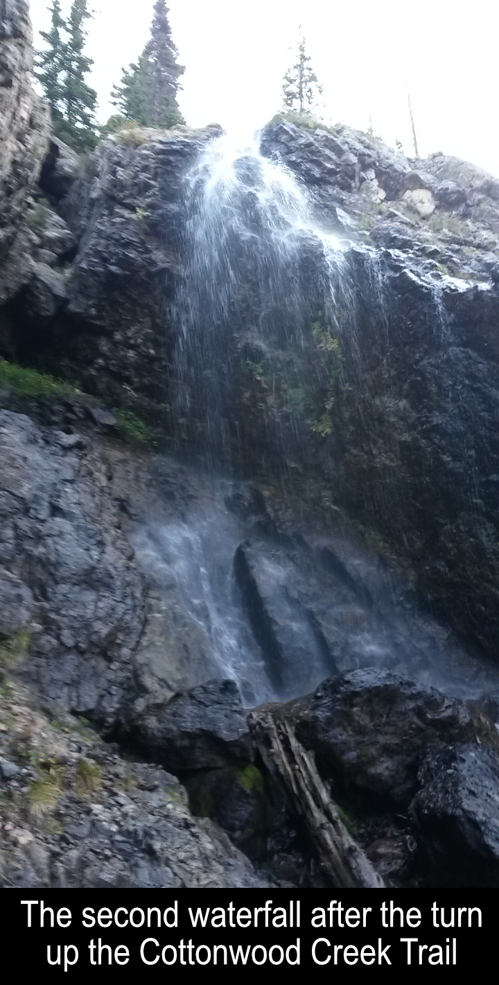
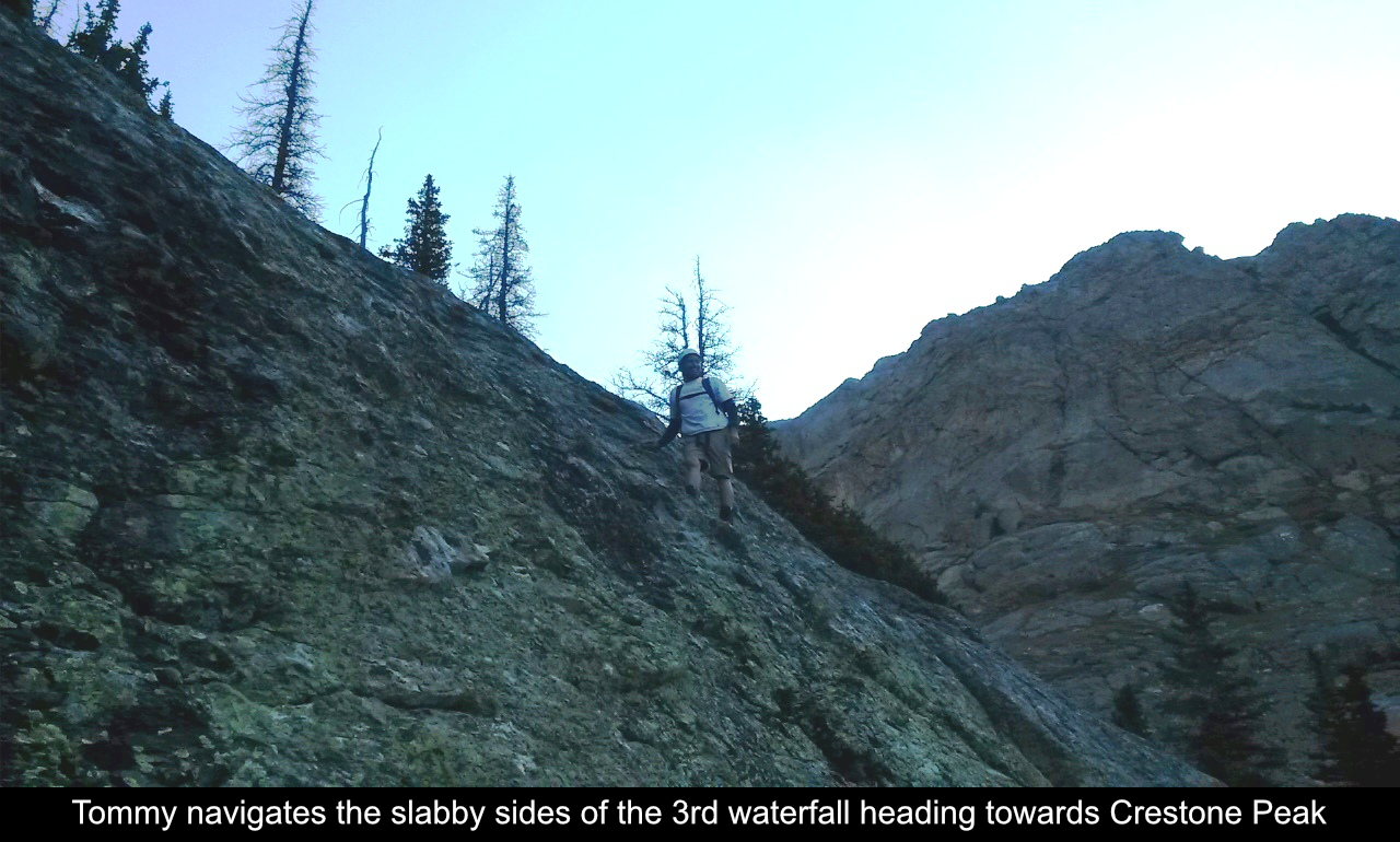
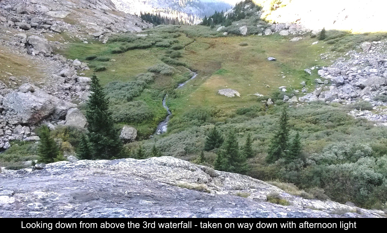
We met some really cool campers at about the 4 mile mark as we finished passing the 'boilerplate slabs'
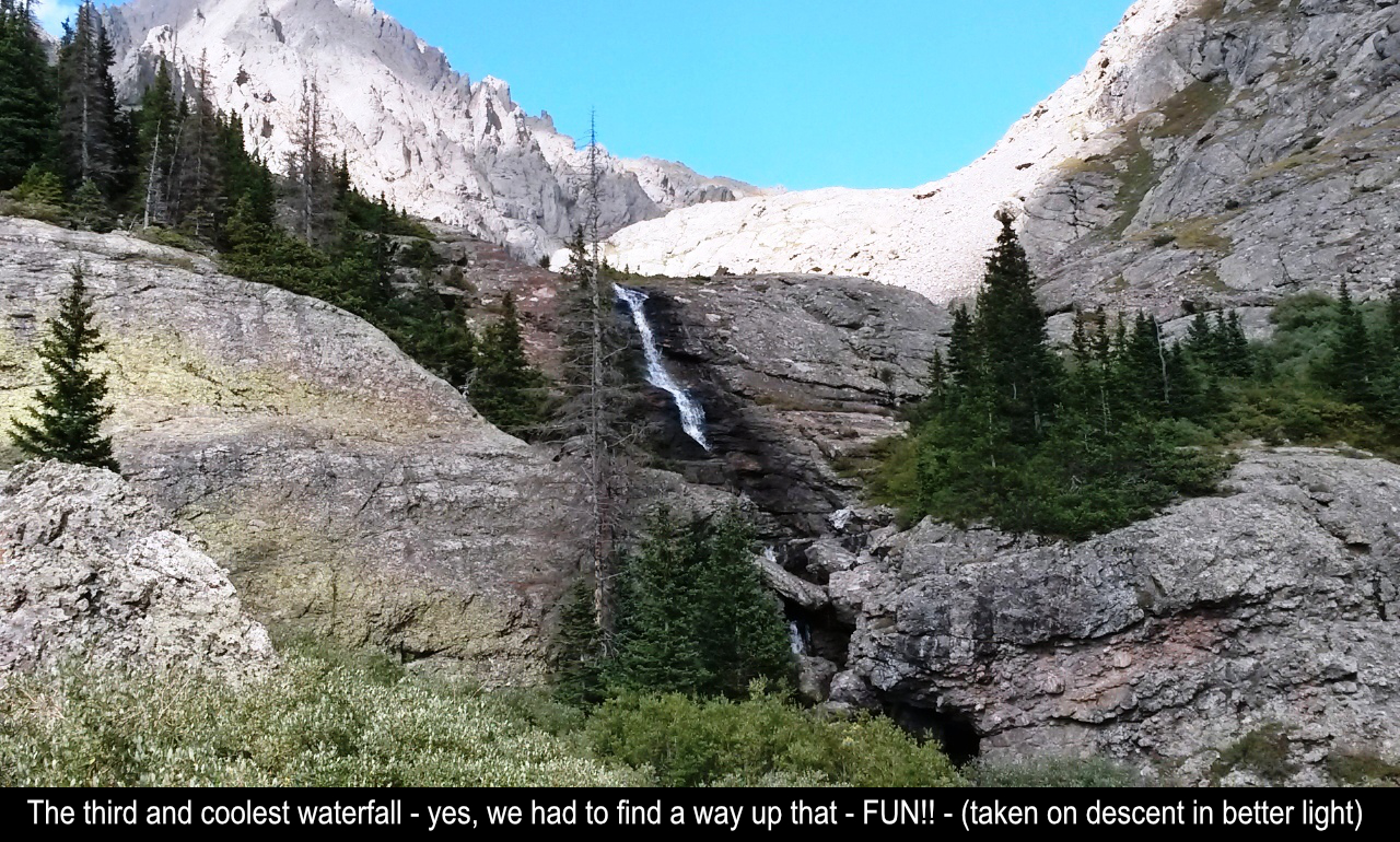
section. They mentioned that once we turn into the drainage, that there are 2 more waterfalls (which are
bigger than the first one lower down Cottonwood Creek). Of course waterfalls are basically cliffs, so yes
this section is steep and this section of the trail is the least established. But there are several ways
to move up. We found that sticking to the left on the ascent, right on the descent, was best for us. The
second waterfall we went through steep trees where the last waterfall we navigated the slabs along the side
of it... really fun rock scrambling.
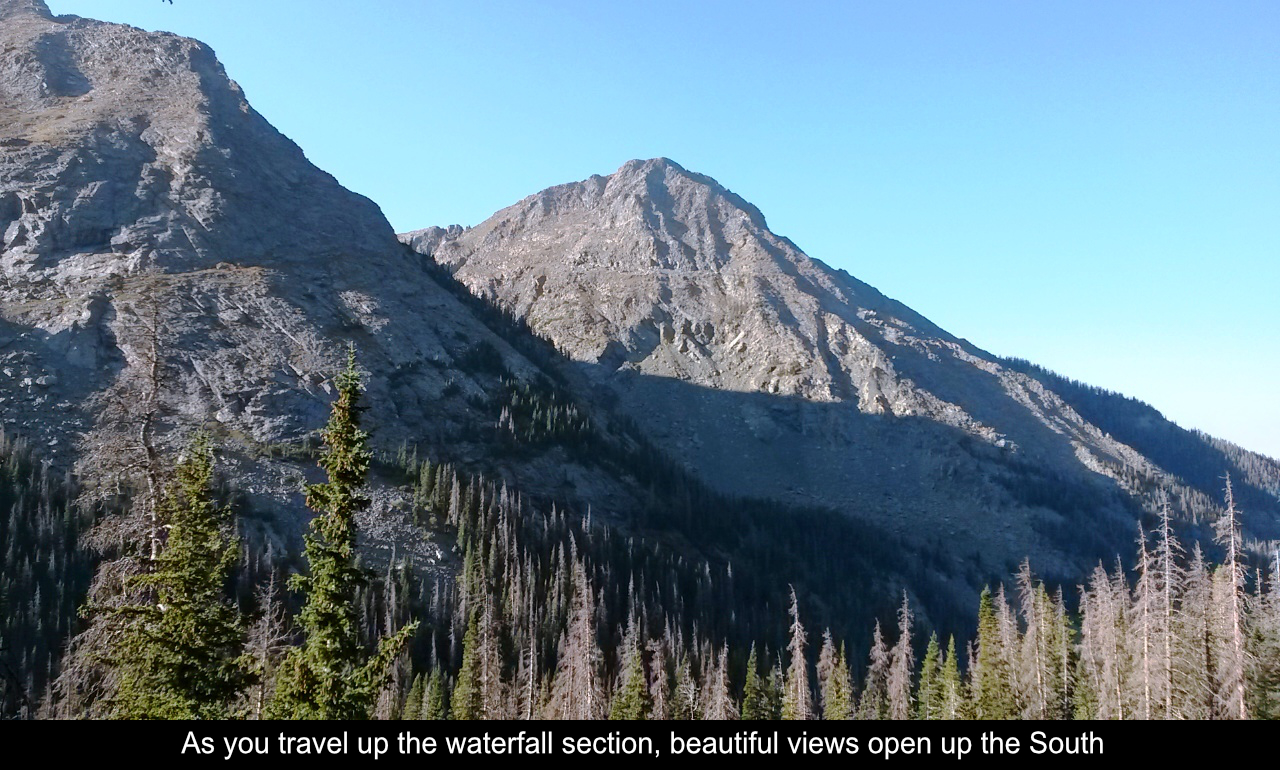
Other reports / threads discuss whether to go way high on the talus fields to the left to
avoid the willows before and after the 3rd waterfall. We felt that would have cost us a lot
more energy with the trek up the Red Gully still in front of us. So, we stuck as close to
the left of the creek as possible... there was a litte bit of willow-bush-red-sea-parting
goin' on, but wasn't really bad.... there's kind of a small trail underneath a lot of those willows.
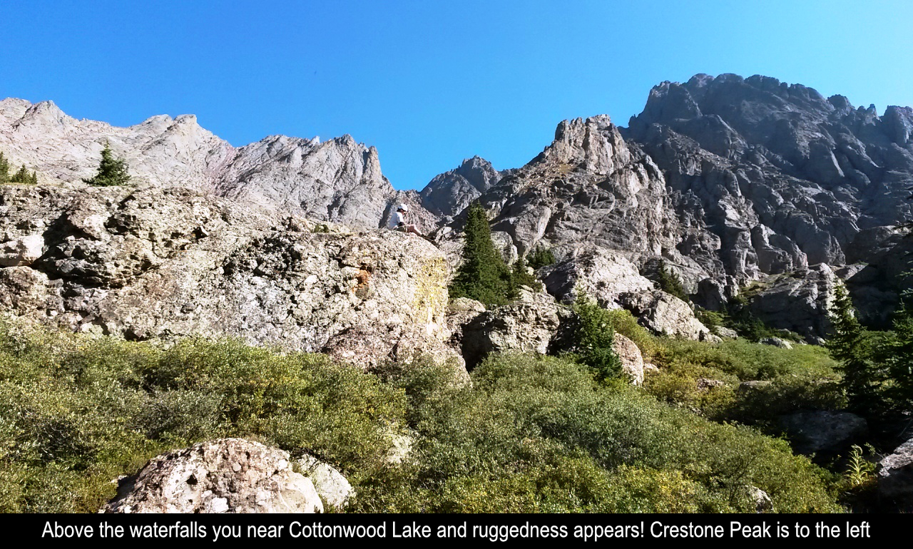
After about 5 miles you connect with standard trail to Crestone Peak. It is flat out
stunning to see the Peak and the Needle for the first time. Tidbit - if you are are taking
this route and only doing the Peak, you will actually never see Cottonwood Lake. It is just
one quick detour if you want to run over and see it... but this is the case. Once you reach
the standard trail, you still have a decent winding climb through the bottom of the basin to
reach the trail entrance to the Red Gully.
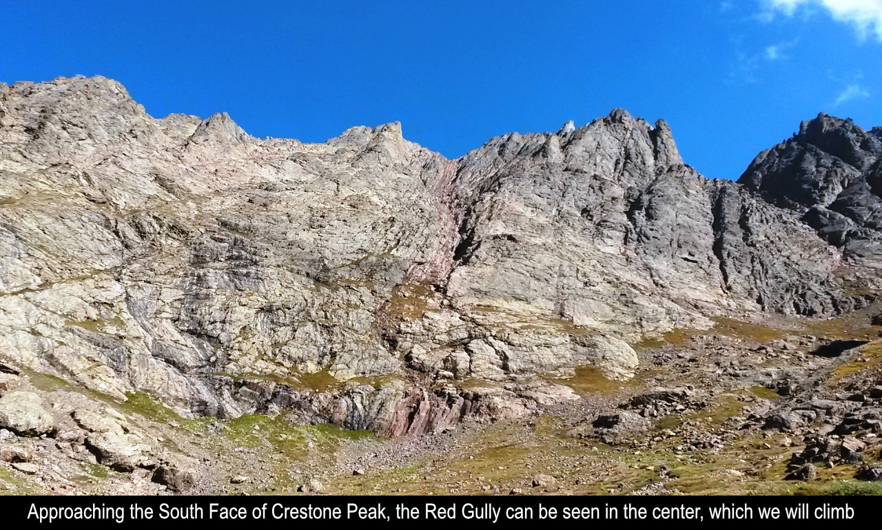
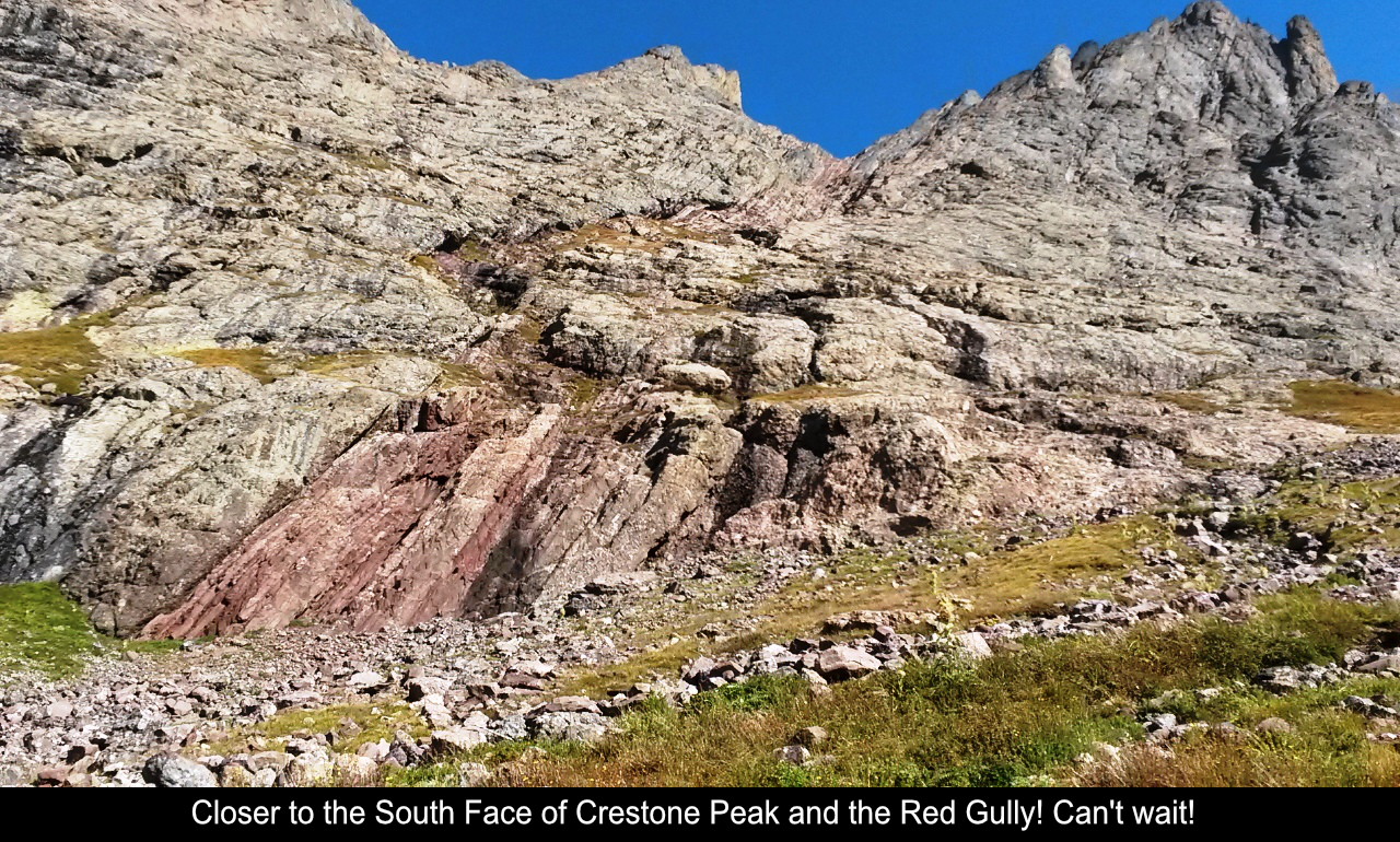
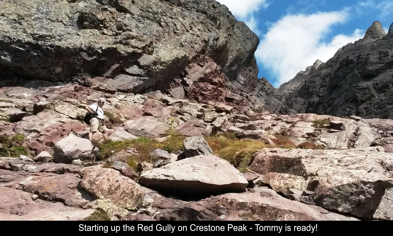
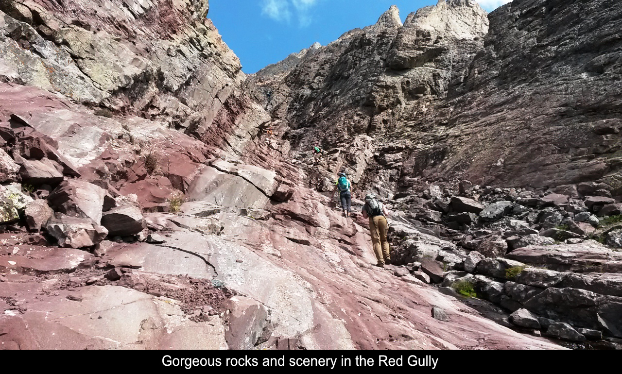
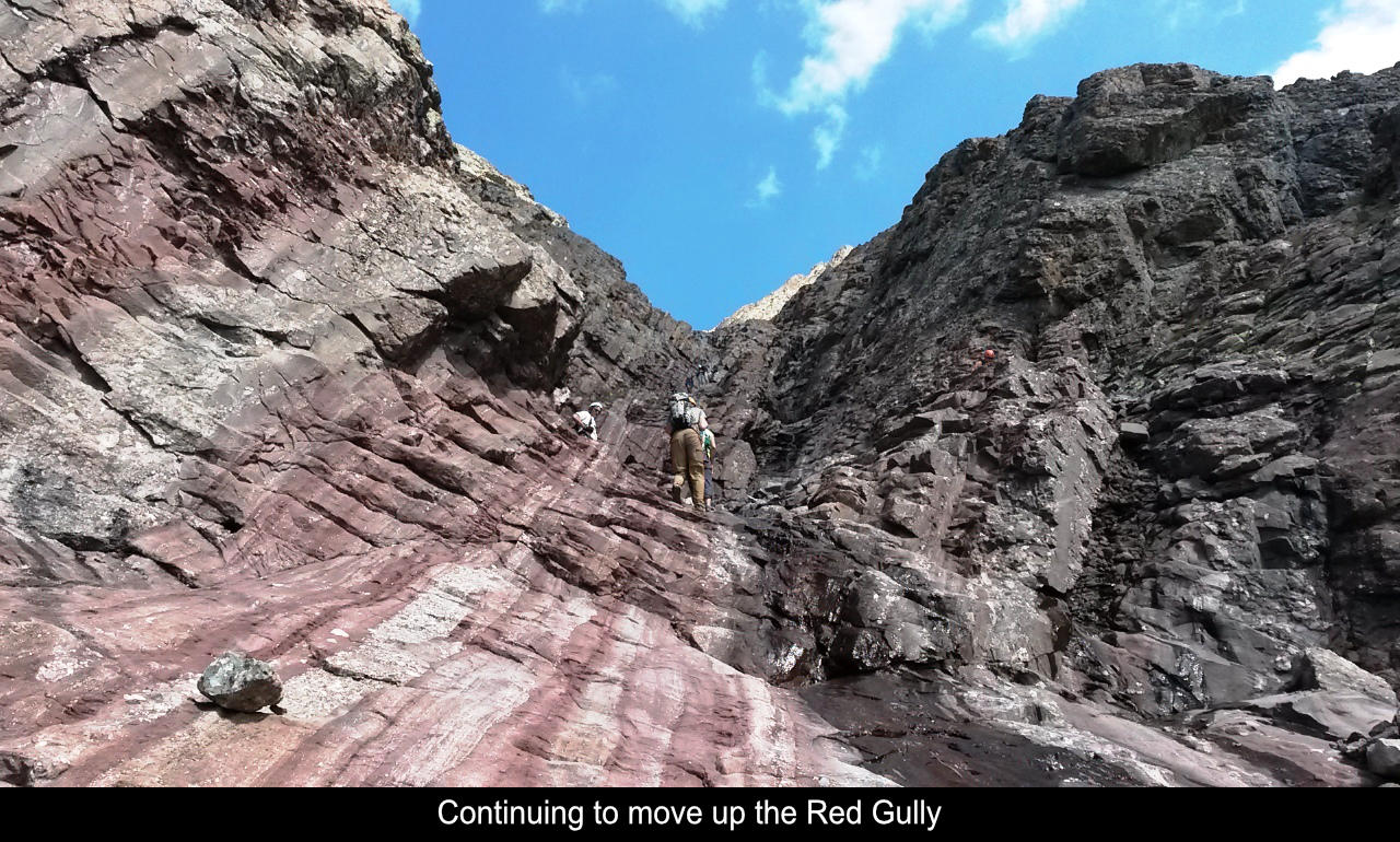
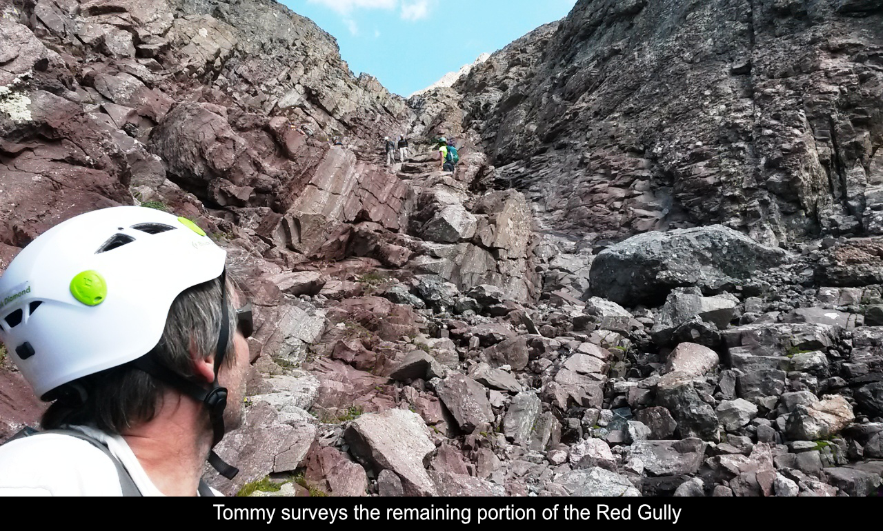
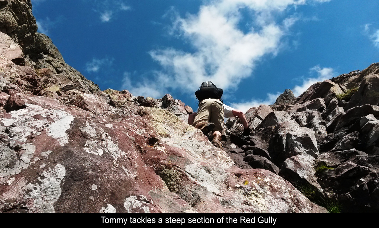
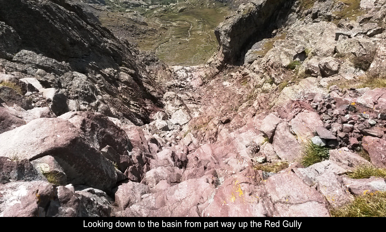
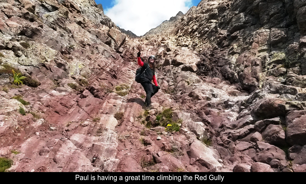
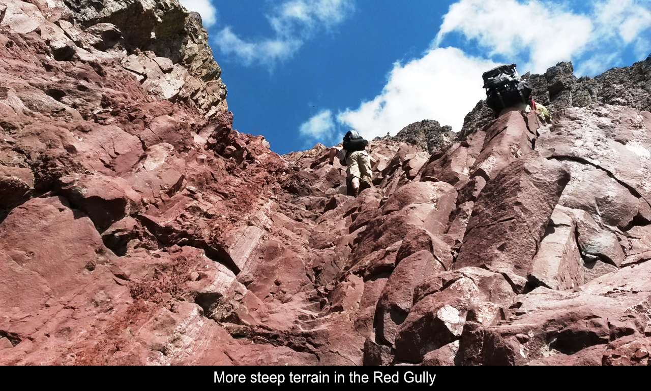
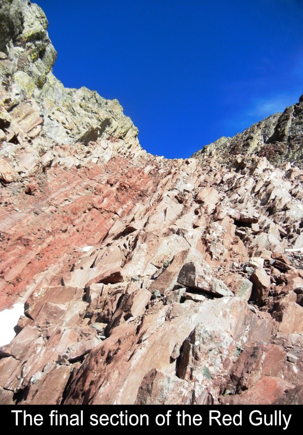
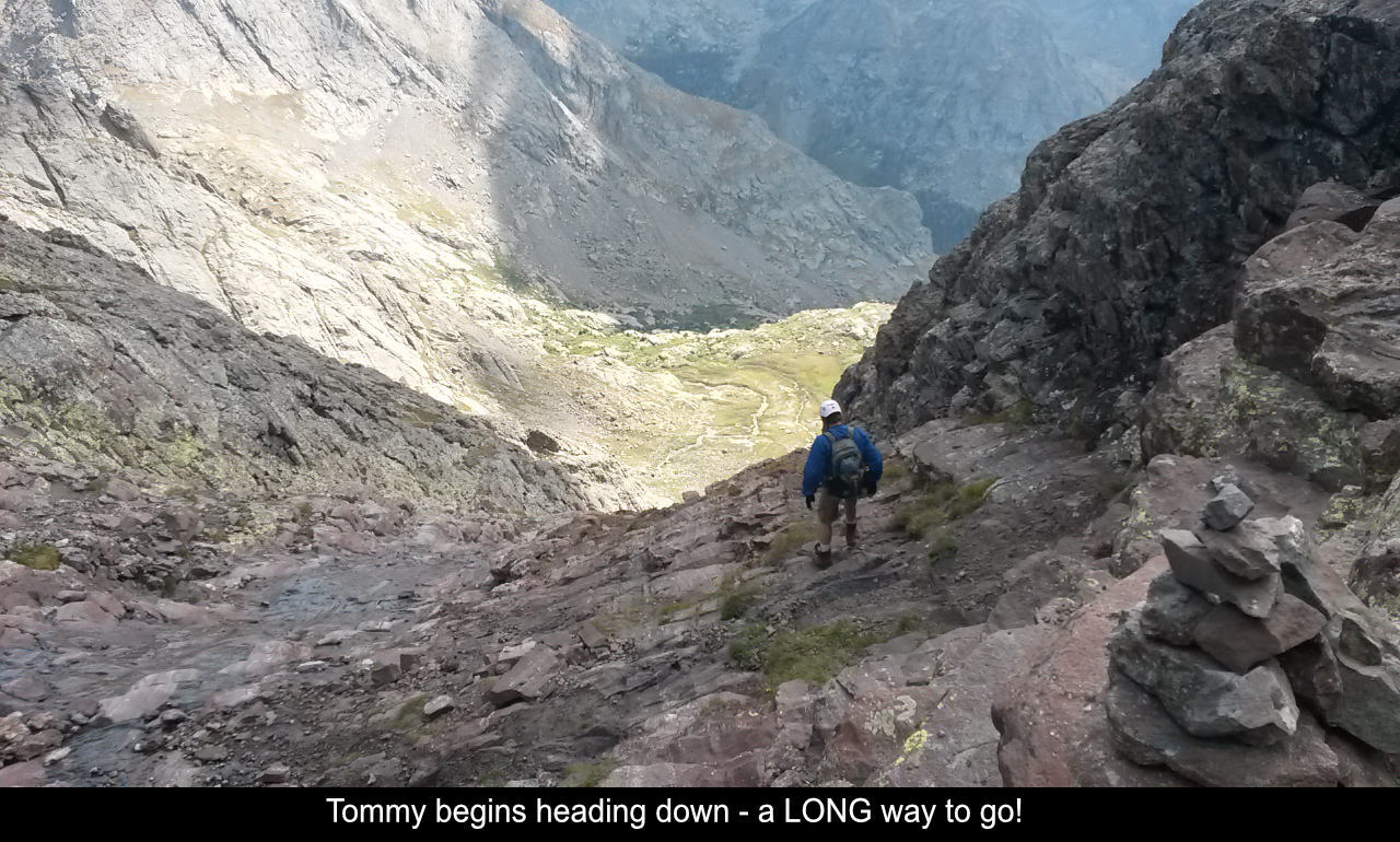
The Red Gully is just insane. I think it's close to 1500 vertical feet. The pictures are
great but it's just crazy to actually climb in that thing! You take your time and it goes up,
up, up, up!! (Oh crap, I forgot, we have to come down that thing!). Tommy and I loved the
gully as it felt like we were truly mountaineering.
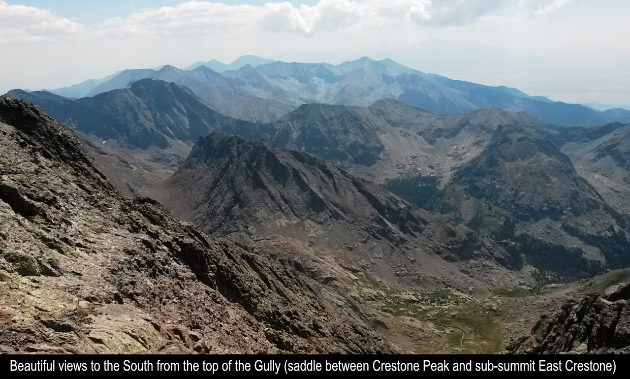
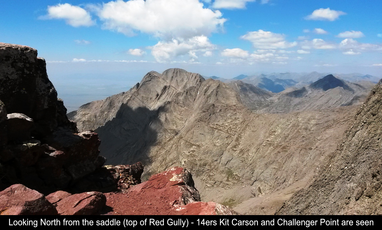
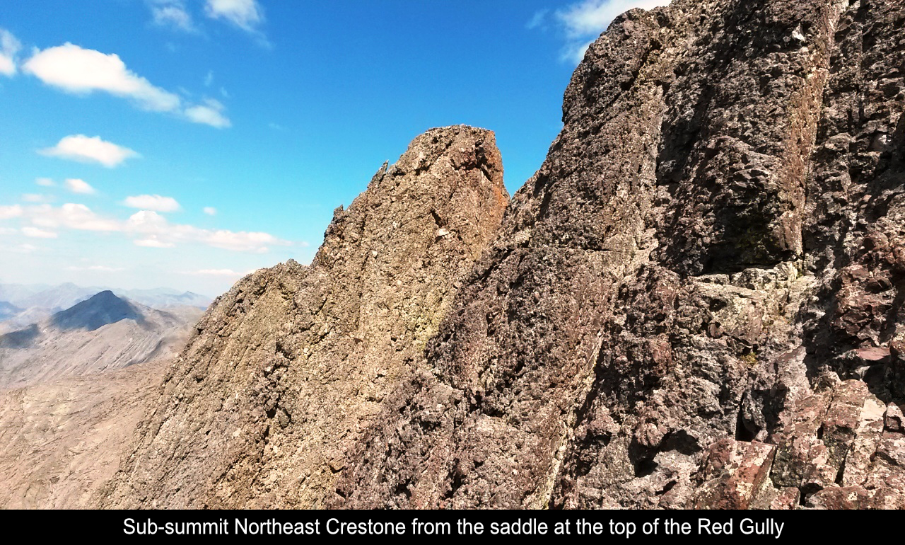
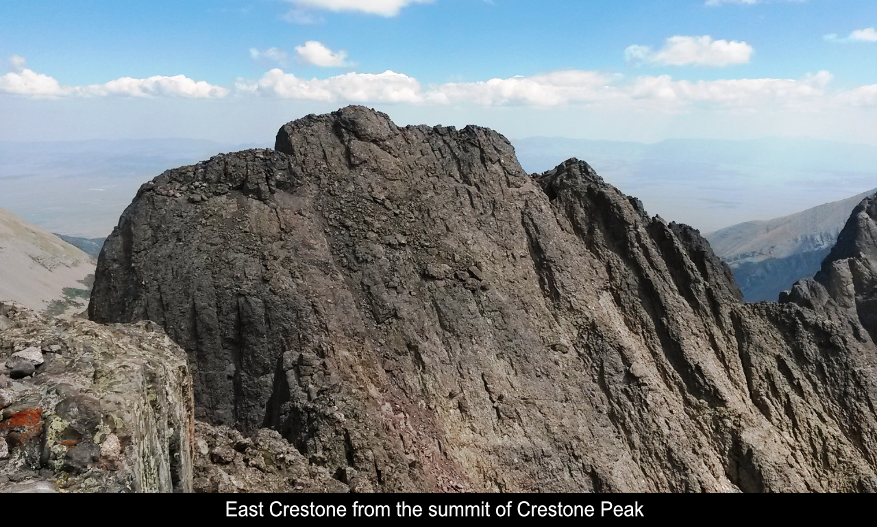
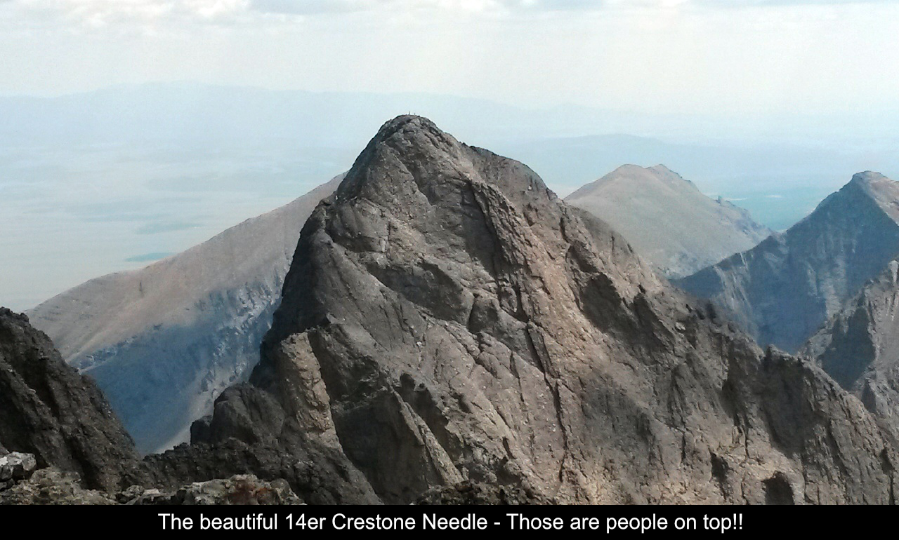
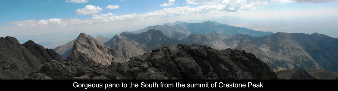
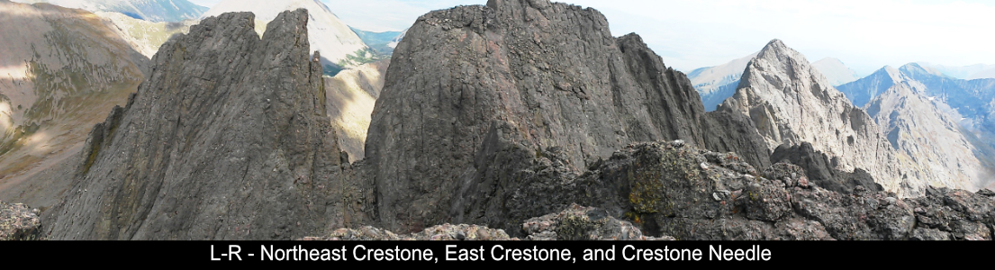
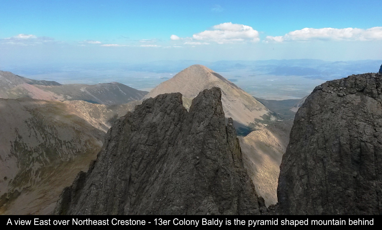
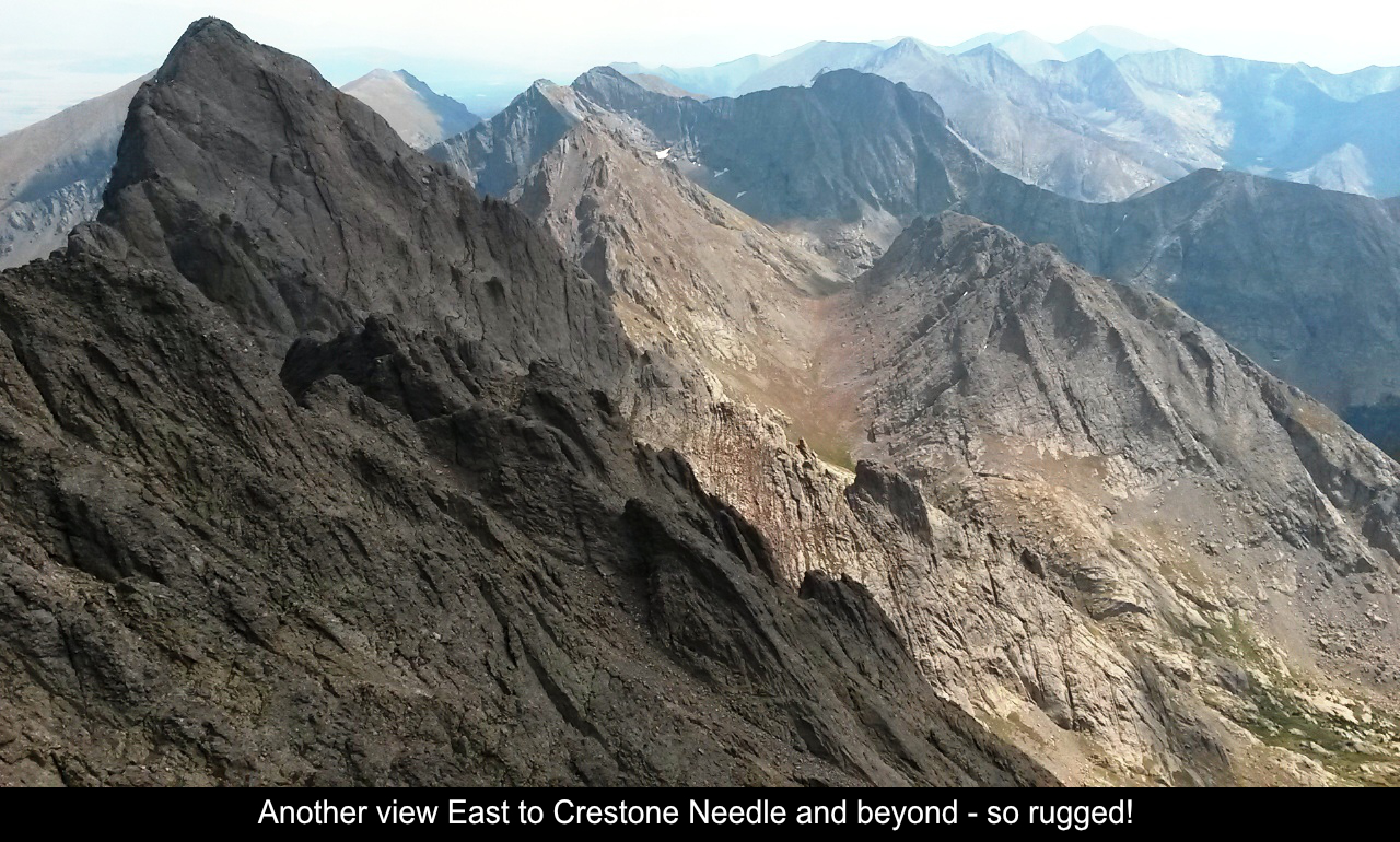
Once you arrive at the saddle between Crestone Peak proper and East Crestone (a sub-summit
of Crestone Peak), you are treated to amazing views to the North of Kit Carson, Challenger Point, and
other high peaks. The Sangre De Cristo's are SO AMAZING! Outside of the Tetons, I don't think
I've seen any more rugged mountains in the US.
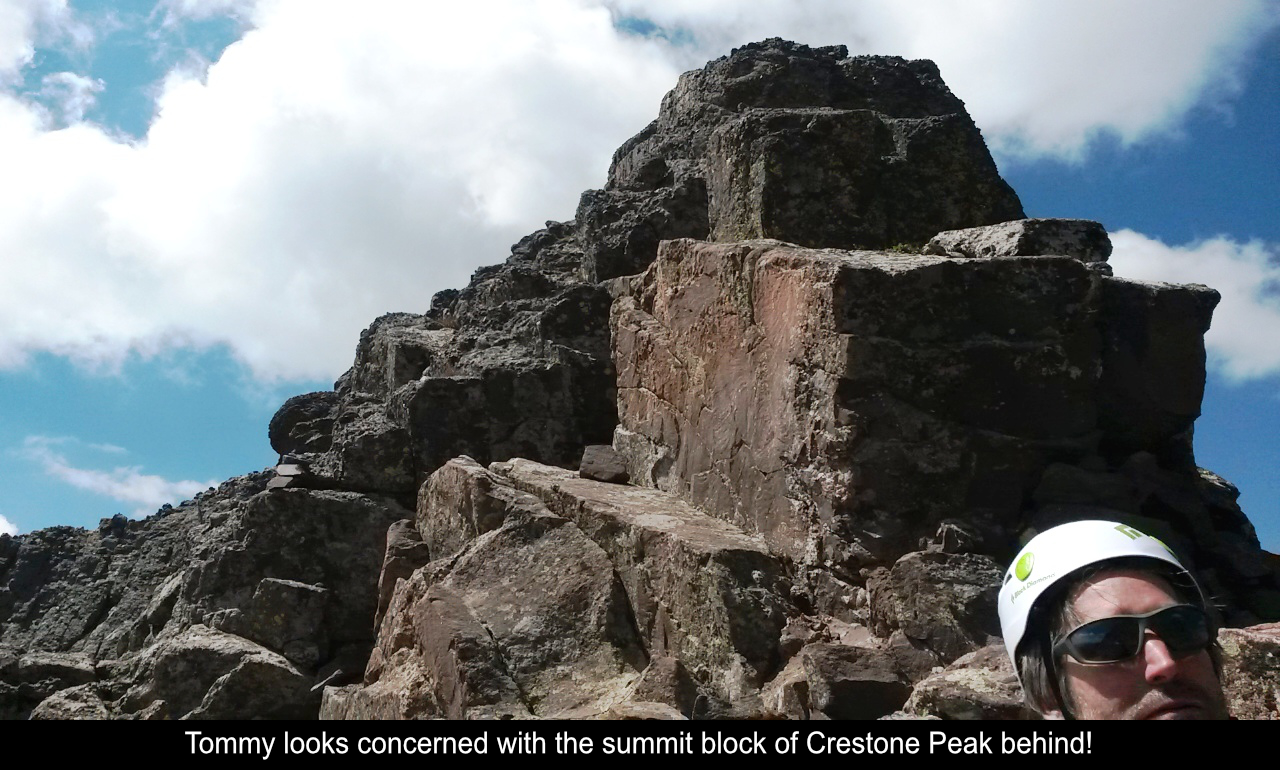
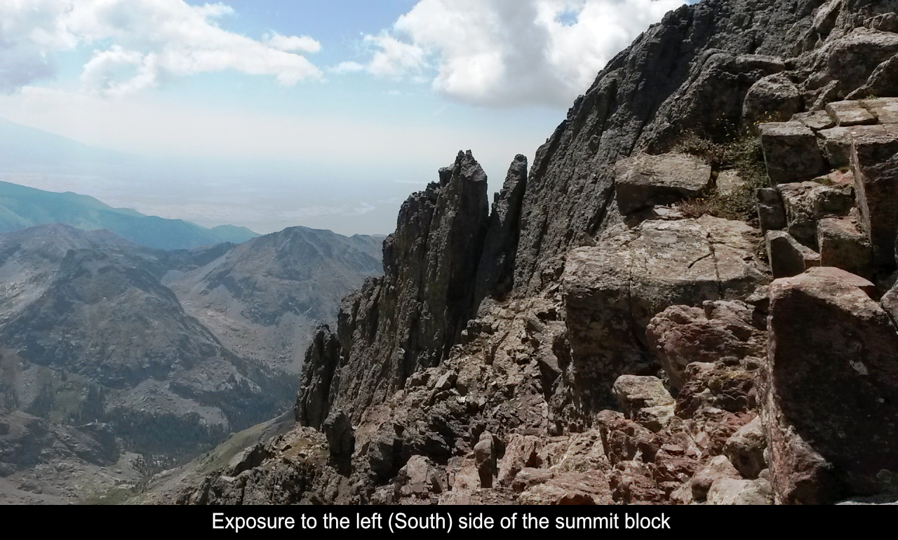
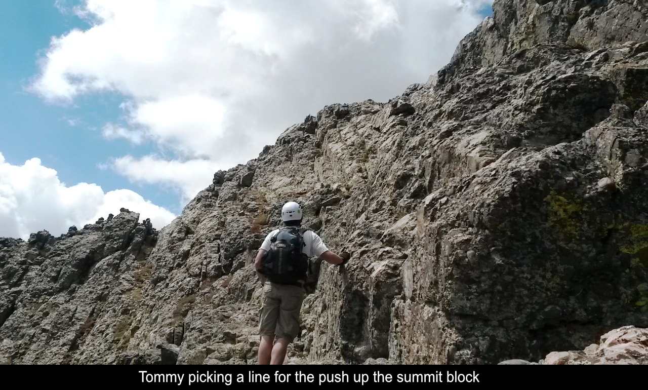
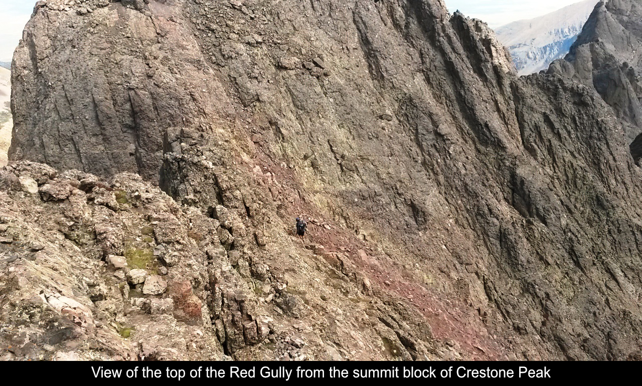
The Summit block is really cool too. It kind of has these blocks like ancient Egyptian
pyramids that you navigate. Oh wait, there's a 1000 foot drop off to the left! (woops - forgot
that minor detail) So you pick a line and move up. I was a little unnerved by the exposure, so
I picked a more inner (higher) line. It makes for a little harder climbing / scrambling move, but
it makes the exposure less. Tommy took the line that was lower, more exposed, but probably a bit easier.
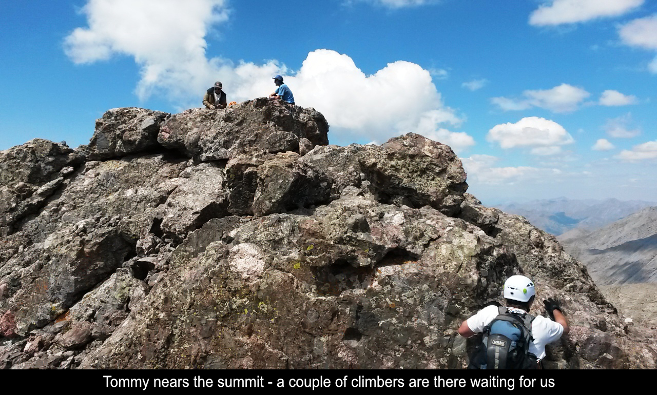
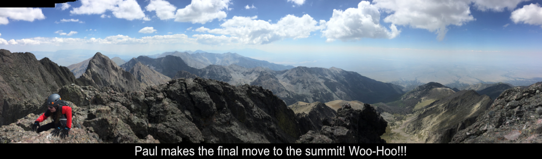
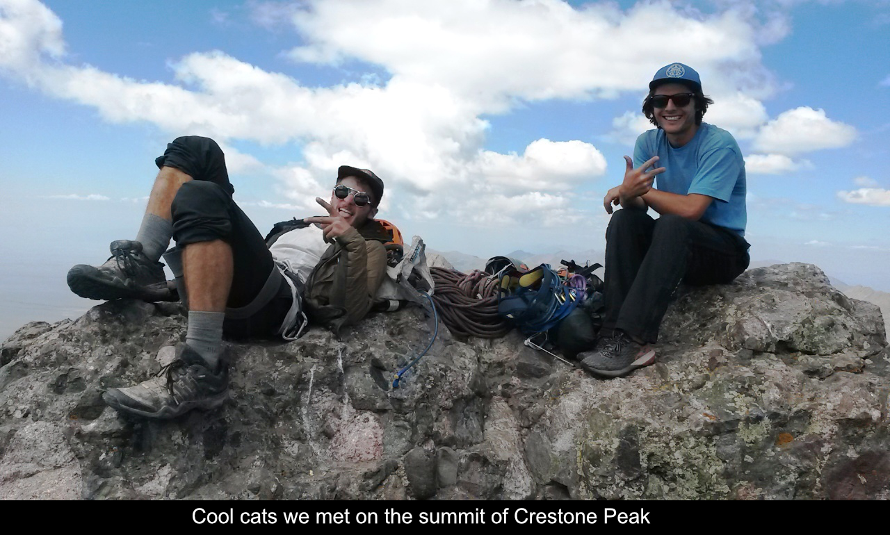
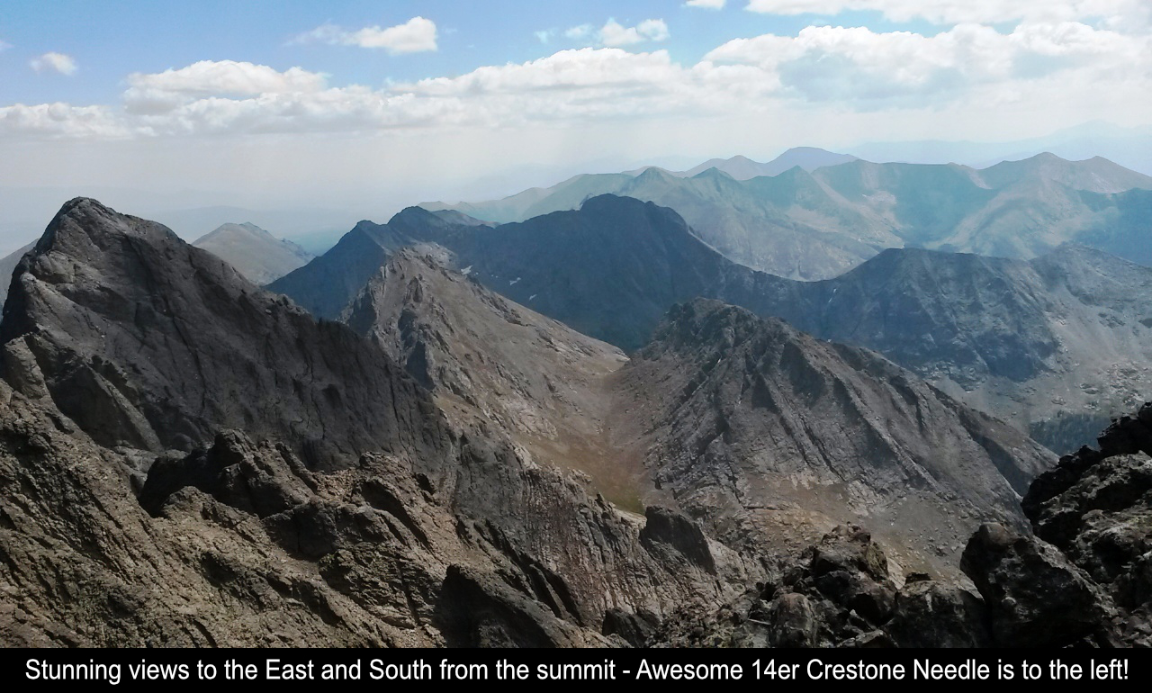
On the summit, we met these two young guys who were like mountain goats. The views to other
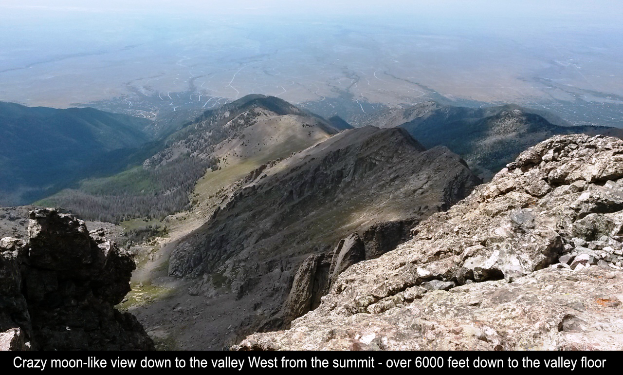
Sangre De Cristo mountains are just insane as well as those down to the valley. You just can't
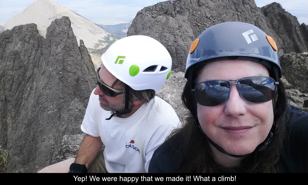
believe you are actually sitting on top of that mountain!! WOW!! This was my first successful
class 3 hike! So after 6+ miles one-way and close to 6000K elev gain, this flatlander was feelin' pretty
stoked to make it!!
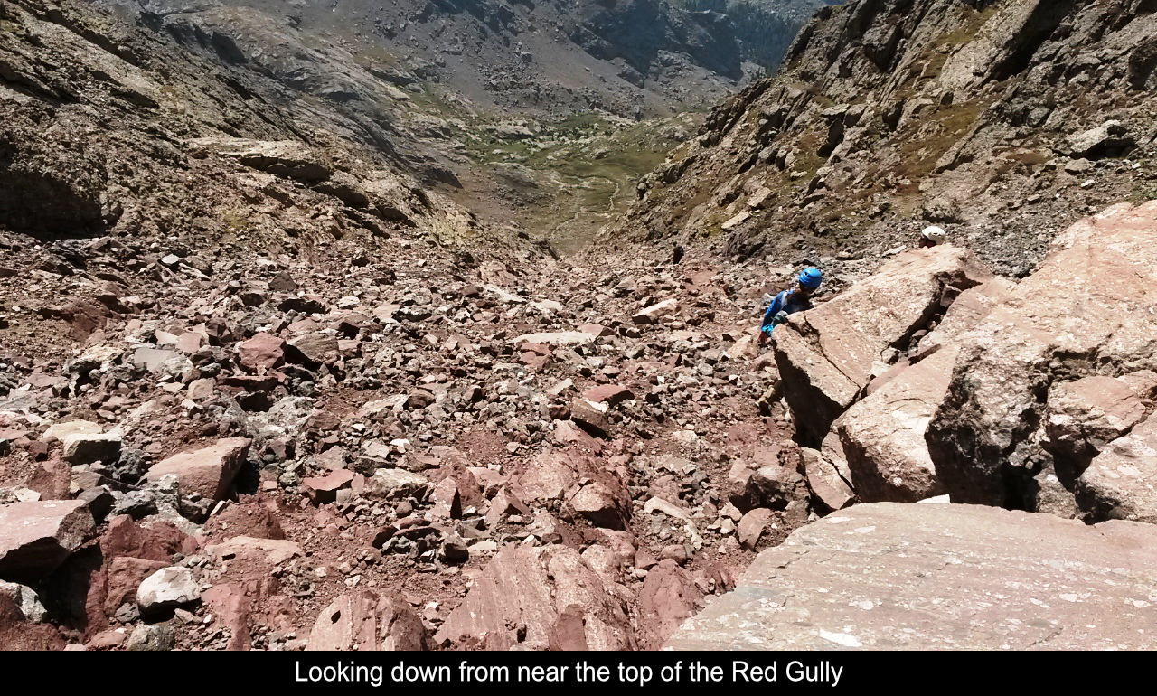
The way down was long and painful as most way downs are. Going down the Red Gully takes a
LONG time. Probably almost as long as going up as you must be careful. There are some slick
and loose spots and Tommy and I both had little slips. With adrenaline push over and tiredness
setting in, be carful! Going back through the waterfall section was fun as well as we could
really see things better later in the afternoon. Those last 3 miles really hurt once you are
on a somewhat boring trail after having seen what have seen earlier... UUUggggghhh. Total
stats 13.25 miles RT, 15 hours (yes, we're slow old geezers), 5800+ elev gain.
Hope this has been enjoyable and / or helpful to anyone reading it!!
Comments
| Posted By: Chuck k - 5/29/2021 |
| Comment: Super awesome read! I hope I can do all 14ers some day |
Add Comment:
Name:
Comment:
Comments ReCaptcha (to verify you are actually a person)
Please click the ReCaptcha button below. Sorry to do this but we had robots posting spam messages on this blog and this prevents that.