The Tetons! Quite simply they are some of the most beautiful mountains
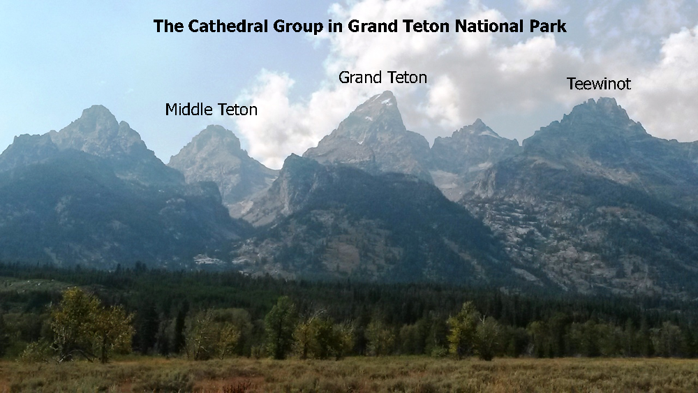
on the planet! The highest mountains in the range are the famous Cathedral Group with
the Grand Teton as the center piece. The Middle Teton is the mountain just South of the
Grand... or, in most photos, which are taken from the East, is the Mountain to the left
of the Grand. It is the 3rd highest peak in the Tetons at 12808 feet.
Being new to the sport of mountaineering, attempting the Grand was beyond the scope
of my ability. On the Grand, most people use ropes and there is serious climbing involved.
However, the Middle Teton can, well, to a degree, be hiked. I say this as making it to
the top of the Middle Teton is no walk in the park. In fact it can be quite dangerous.
But after reading about folks who had made it to the summit, I targeted the hike (or climb)
as my goal for my trip to GTNP.
I ended up making two attempts at the Middle Teton. I learned a lot from my first
failed attempt. For one, I had underestimated the power of the sun at such high elevations.
Well into the 1st attempt, I was bordering on sun stroke. Secondly, being from the East
Coast, and not understanding what hiking up long, steep, glacial boulder fields was like,
the first time going into that terrain is intimidating. Thirdly, being by myself the first
time was a disadvantage. Not only from the standpoint of having someone to bounce ideas
off of and to get feedback from, but also from the pure psychological standpoint of being
safe.... what would happen if I suffered an injury? The day I went for the first attempt
was a Tuesday, and it wasn't very crowded. So, I was up in this crazy place all alone,
burning from the sun, and unfamiliar with the terrain. When a cloud popped over the horizon,
turning around was the right choice for me.
Having learned these lessons from my first attempt, and having a sweet girlfriend who
allowed us to stay one extra day so I could try again. I had stopped by the American Alpine
Climbers Ranch and happened to find a sign of someone looking for a climbing partner for the
Friday I was going. We connected by phone and I had a partner, Garrett, a young guy
from Oregon.
A trip to KMart to pick up a brimmed hat and some better sunscreen, and the knowledge
and comfort of the terrain having gone up and down once all played in together. And the
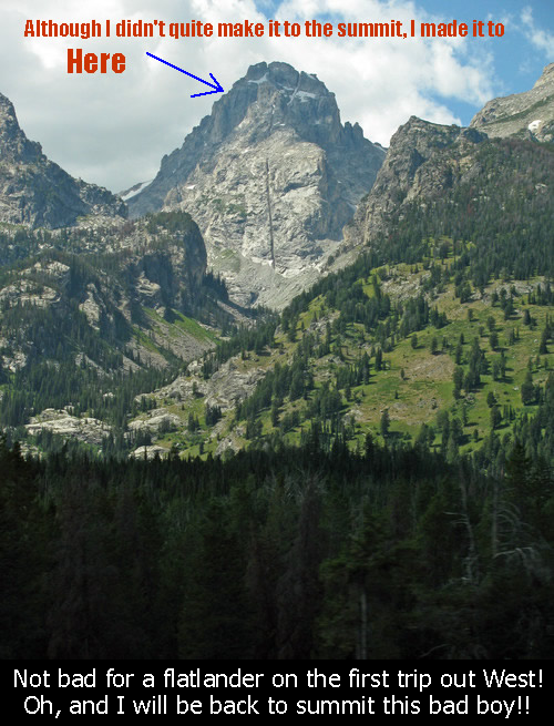
second attempt was much better. I didn't quite make the summit, but Garrett did....
and the report will give you the details. Thanks for reading!! The trip I will describe
will be the second attempt.
I met Garrett at the Trailhead at 5:45AM and we were off by 6AM.
The trail leading to the Middle Teton (and the South Teton, Grand Teton, and others)
starts at the Lupine Meadows Trailhead, just off the main GTNP road. For the 1st 3 miles,
you go through Alpine forests...first somewhat flat, and then beginning up several
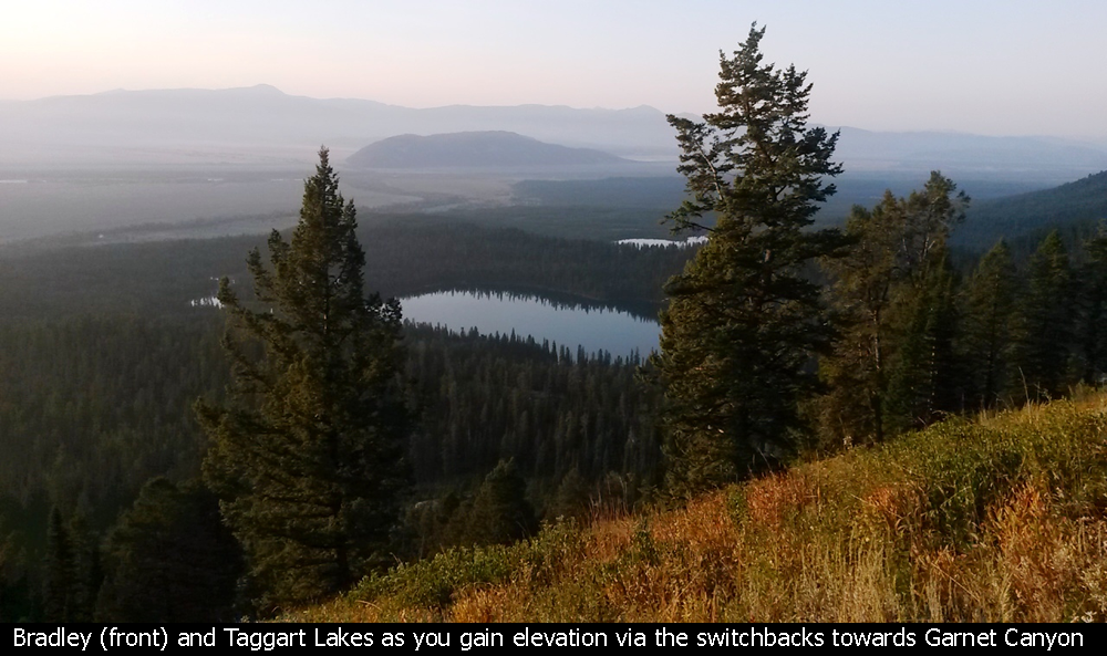
switchbacks to the entrance to Garnet Canyon. On the way up, you are treated to nice
views of Bradley and Taggart Lakes.
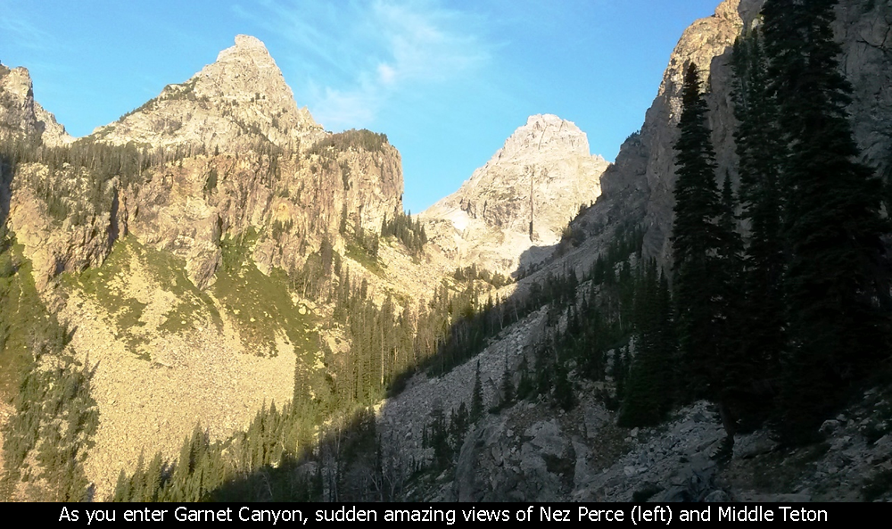
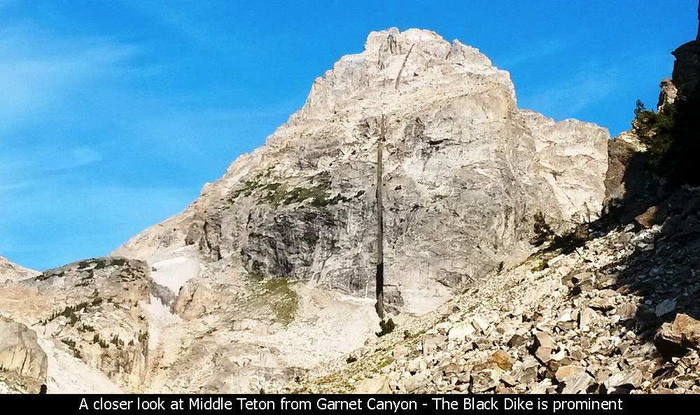
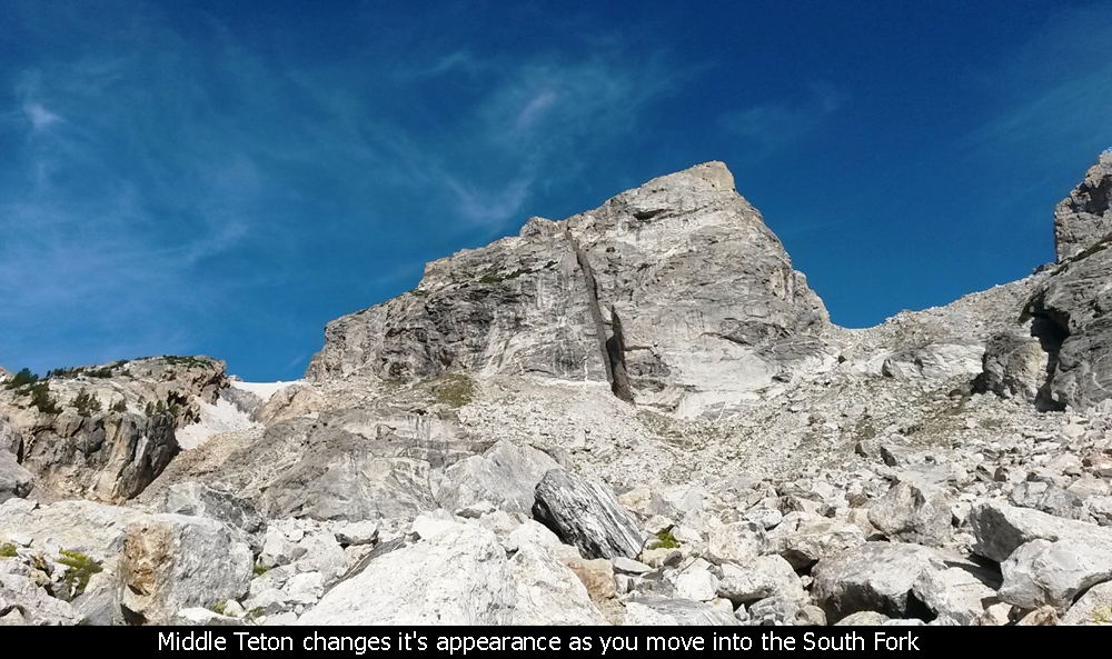
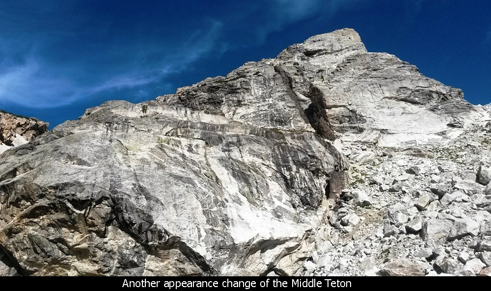
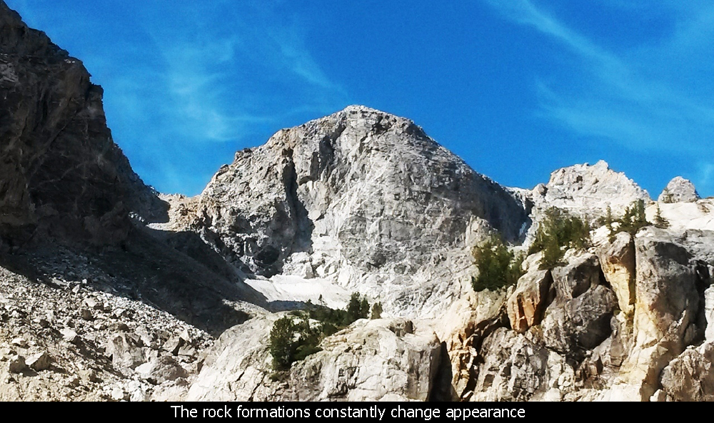
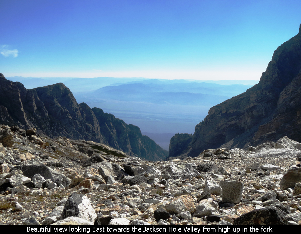
Once you enter the trail into Garnet Canyon, suddenly you see amazing views of Nez Perce and
then the Middle Teton. All the way up the canyon, the Middle Teton looms above... and you tell
yourself "I got this". Not so quick there whippersnapper.
Walking Into Garnet Canyon - Grand Teton National Park
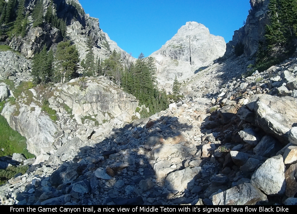
The trail into Garnet Canyon is not bad... that is.... at first. The trail is easy to
follow but make sure to follow the sign to Garnet Canyon. But before you arrive at the
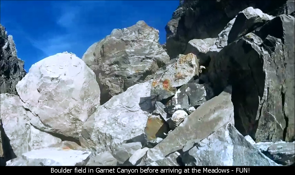
top of the canyon, you run into a field of giant boulders....many the size of your average
Volkswagen! Scrambling through these boulders was actually lots of fun as they are very
stable and it is not steep. It is not dangerous if you take your time.
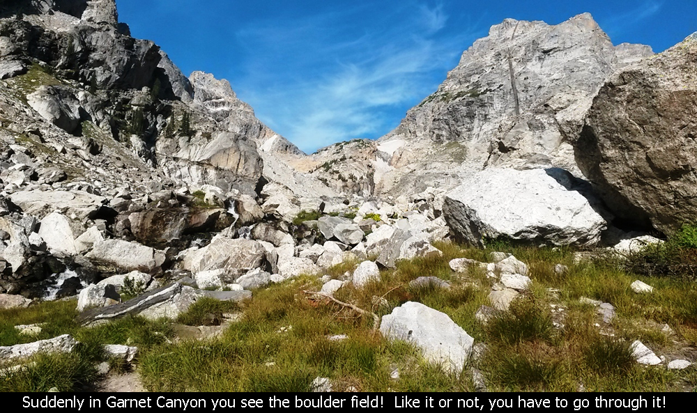
Boulder Field In Garnet Canyon - Grand Teton National Park
View Of Middle Teton Before Meadows - Grand Teton National Park
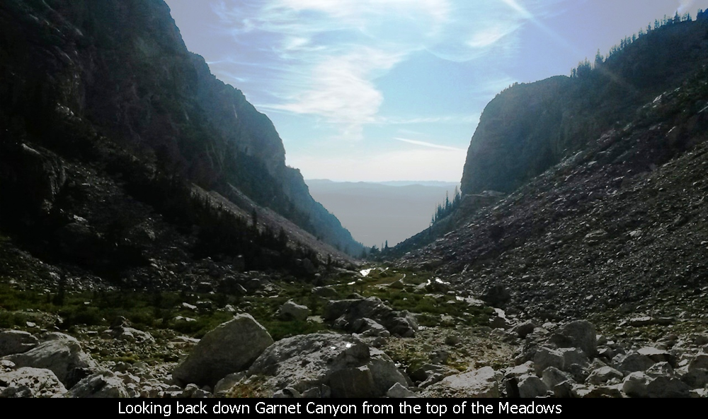
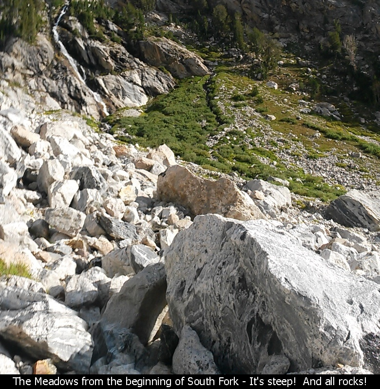
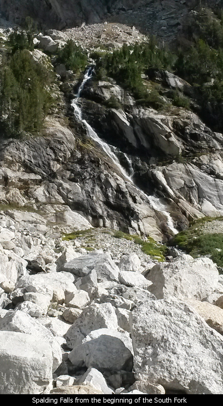
Once you pass the boulder field, you arrive at one of prettiest places I think I have
ever seen... the Meadows. If you can imagine a gorgeous meadow with a beautiful waterfall
above it, a nice creek flowing through it, with the most beautiful canyon walls completely
surrounding you, it would be this. If I had to pick a spot on earth that I really think
is closest to heaven, it would likely be the Meadows in Garnet Canyon. But this was the
beauty before the beast!!
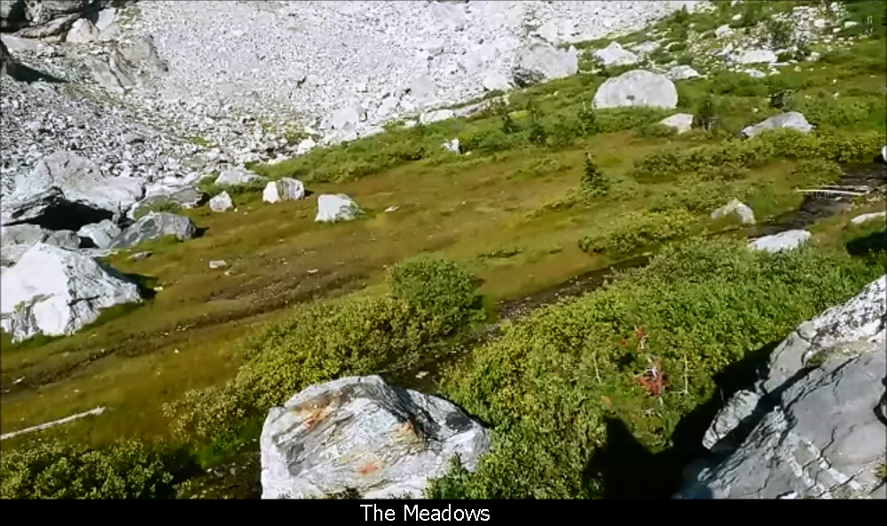
Arriving At The Meadows - Grand Teton National Park
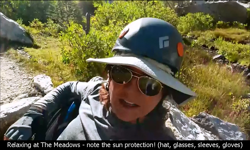
Hanging Out At The Meadows - Grand Teton National Park
I would imaging most people stop at the Meadows to take a refresher break as we did.
It was around 9AM then, and we basically had a mini-lunch break and relaxed for 15 or 20 minutes.
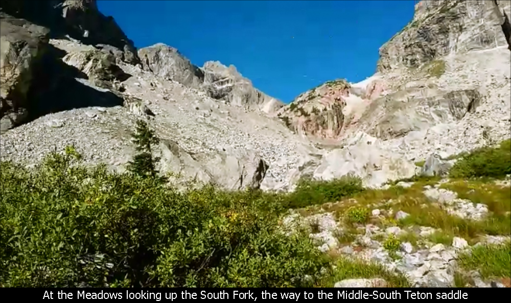
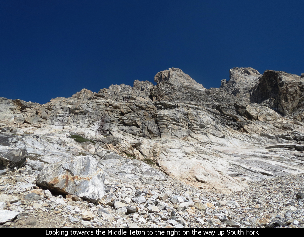
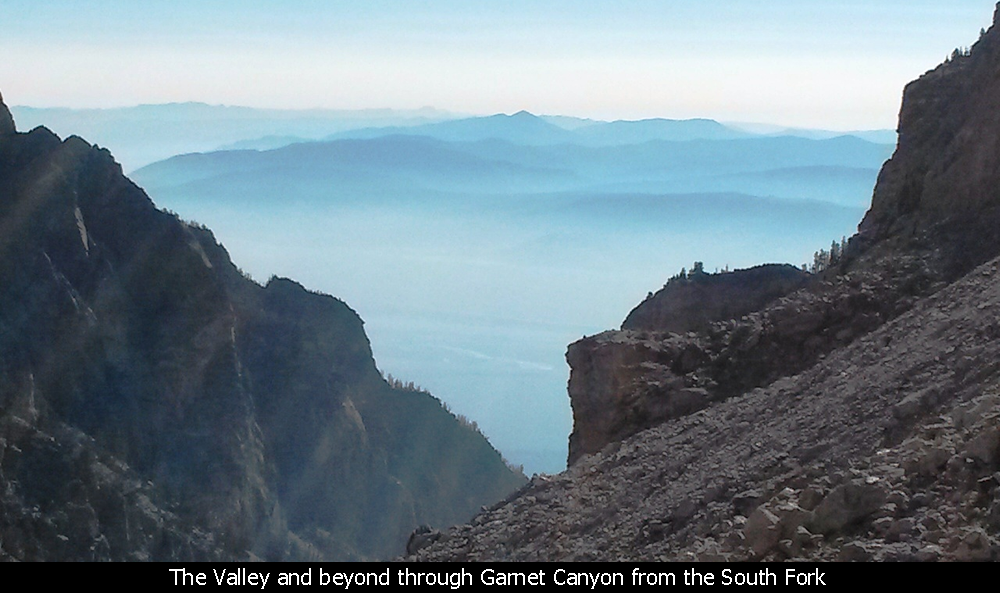
The canyon splits into two forks. The North Fork is where folks go when heading towards
the Grand Teton. And to go to the Middle or South Teton, you use the South Fork, which is
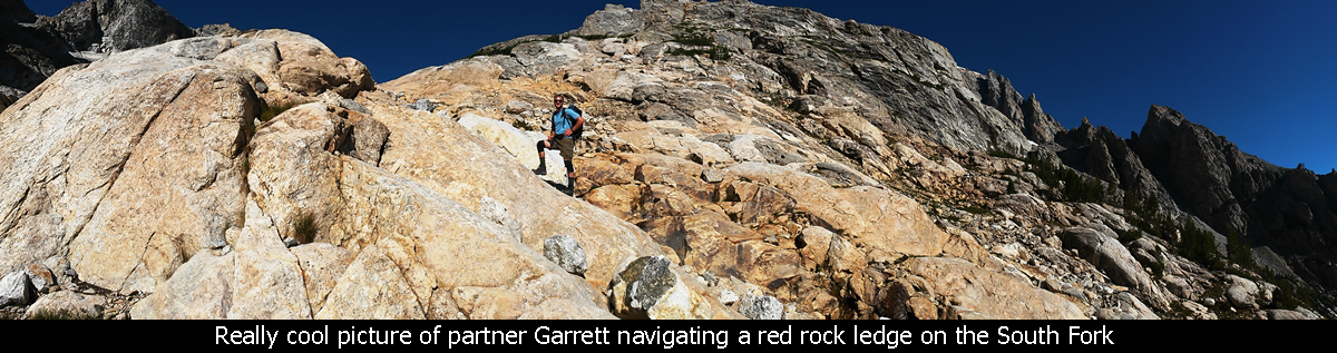
to the left. It was time to start heading up the South Fork.
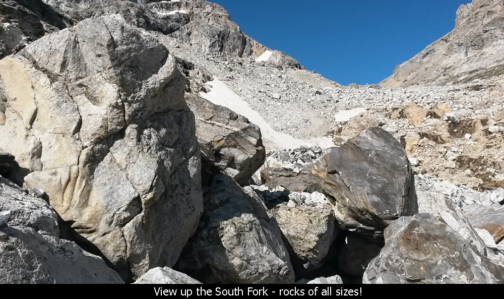
If you attempt this hike, do not underestimate the length of this fork. In sections it is
very steep, and overall it is probably a mile or more... all walking uphill over rocks of all
shapes and sizes. I guess you might call it talus, but the rocks were so mixed I call it
more 'variety rock!'.
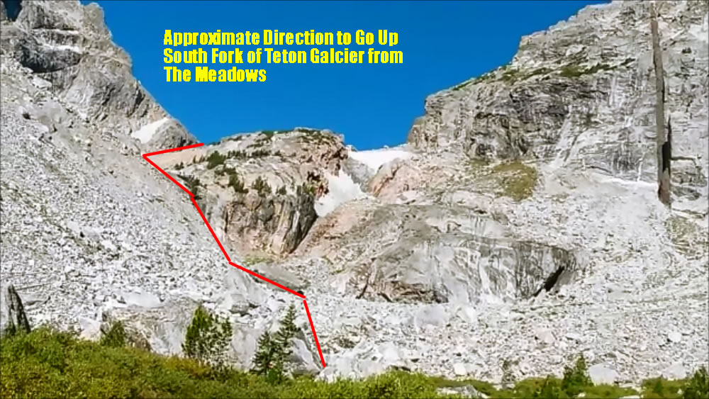
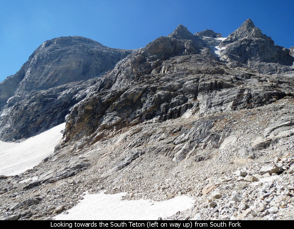
The Middle Teton can be climbed a number of different ways with varying degrees of difficulty.
But the standard route is via the Southwest Couloir. To reach the Southwest Couloir, follow
the South Fork until it ends at the saddle between the Middle Teton and the South Teton.
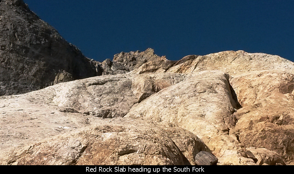
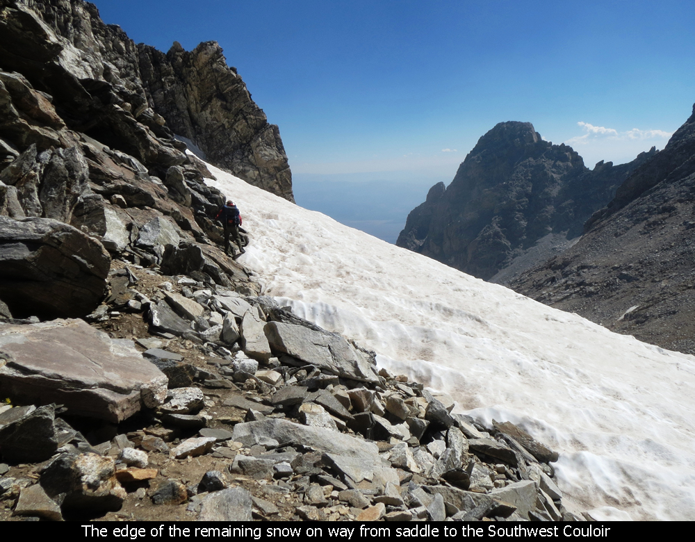
When you begin the trek up the South Fork, note (and this was late August) there is a snow
covered area in the gully closest to the Meadows. While there are many different routes,
sticking close to the snow area on the left side is probably the easiest way to get past this
first section. You could go up the steep wall to the left and then traverse across (which
was the way I went the first time) but it is a lot longer that way.
Heading Into The South Fork - Grand Teton National Park
Steepness Of The South Fork Trail - Grand Teton National Park
The whole way up the South Fork, the best way is probably the path of least resistance.
But avoiding any late summer snow is a good idea (in my opinion).
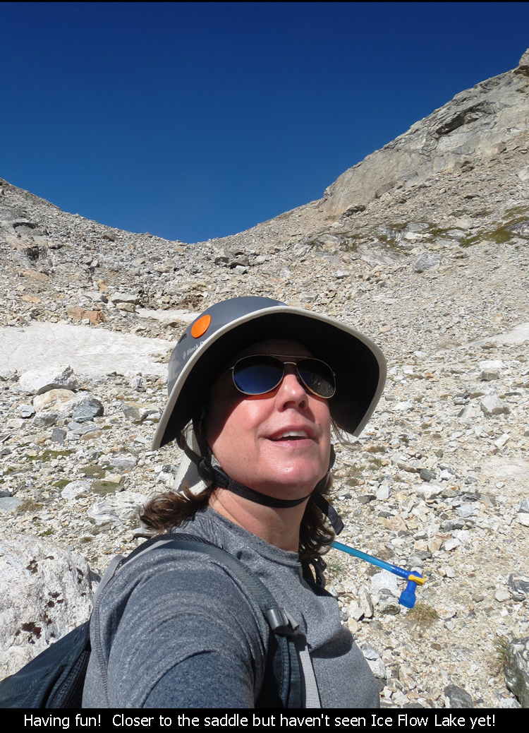
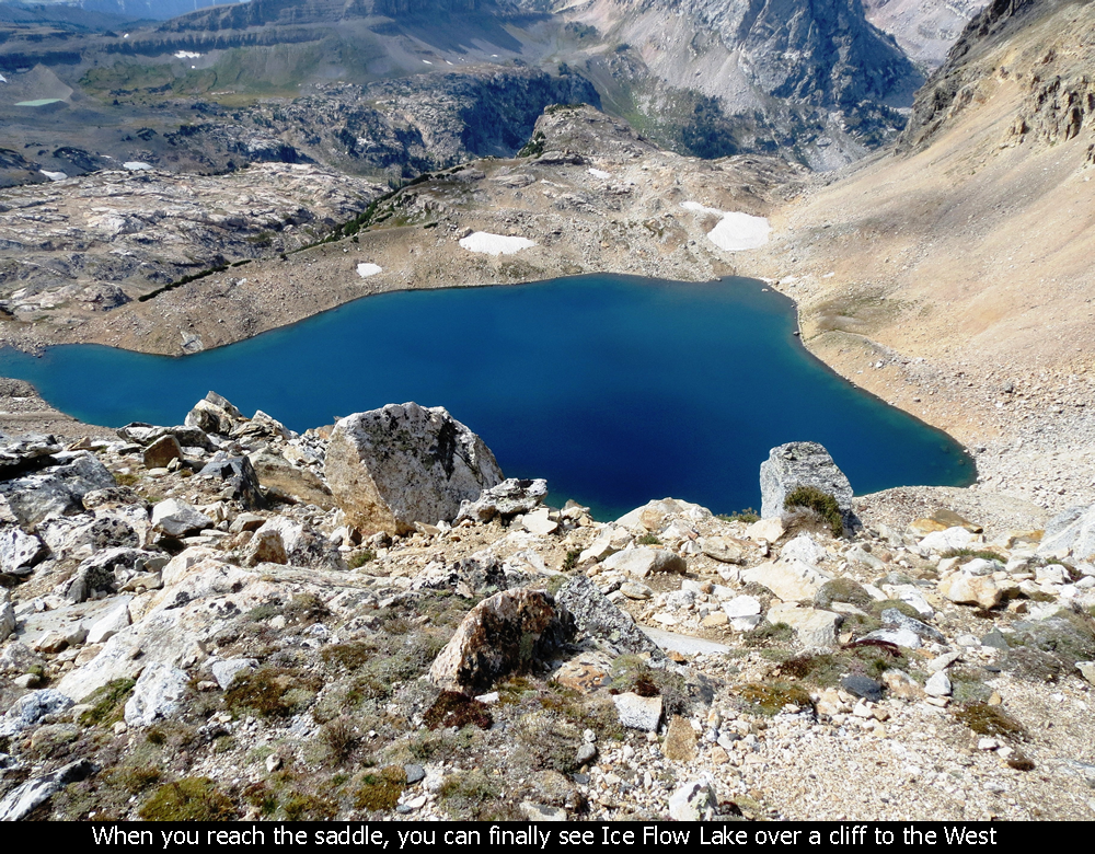
The documentation all says to not be fooled by any of the several false saddles and to
continue until you see Ice Flow Lake past the saddle (and over the cliff) before beginning
to go up the final portion of the Middle Teton. Personally none of the false saddles had
me fooled that they were the real saddle.... but then again, I knew I had to see Ice Flow Lake!
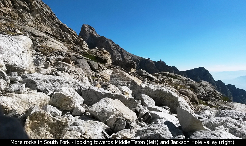
Upper Part Of The South Fork - Grand Teton National Park
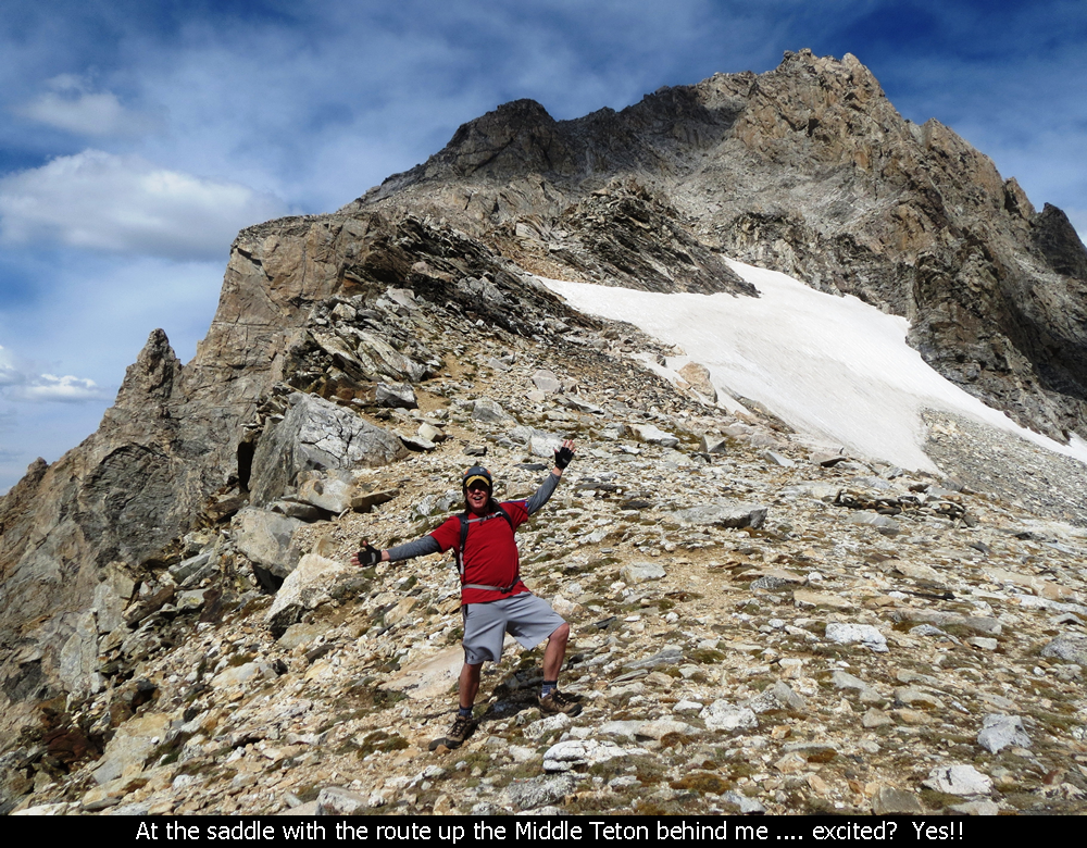
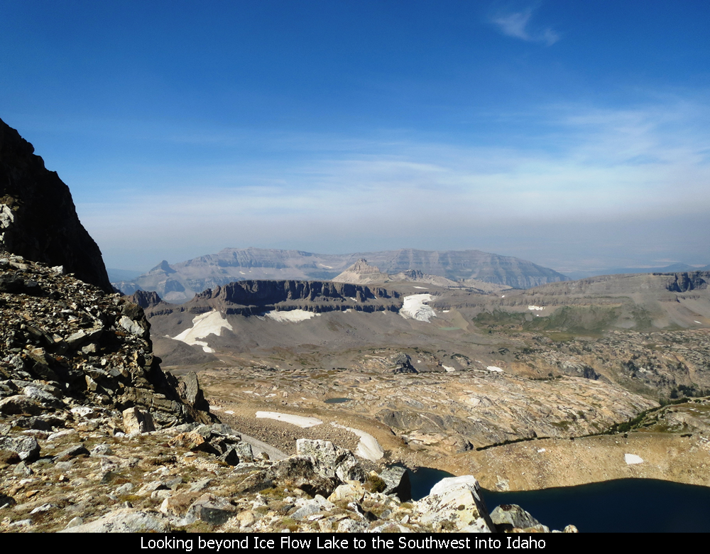
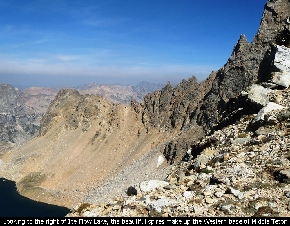
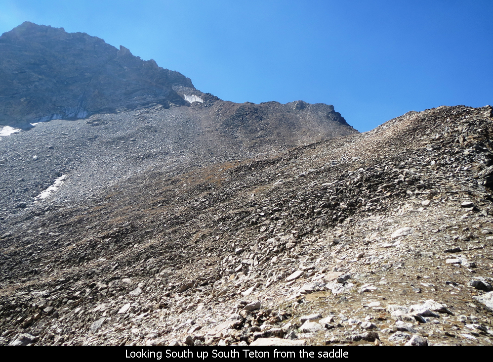
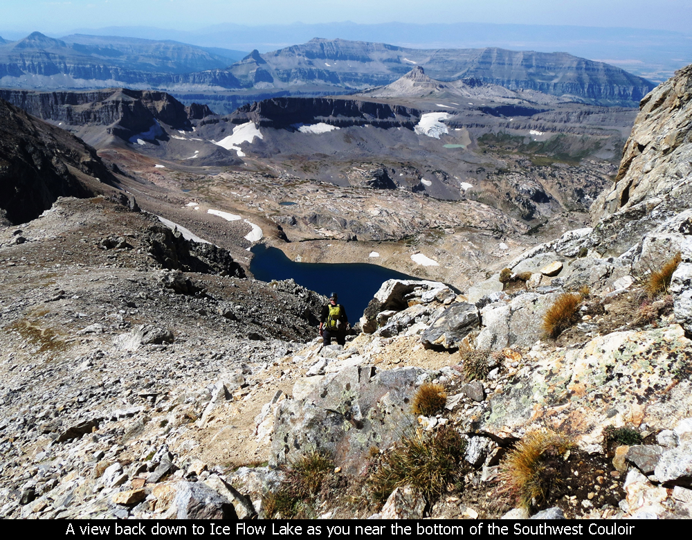
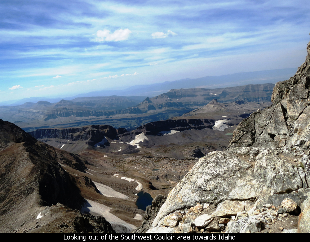
Reaching the saddle between the Middle Teton and South Teton, which is at the top of the
South Fork, is breathtaking. Suddenly you see the beautiful blue Ice Flow Lake a thousand
feet below you with gorgeous views out into Idaho. The scenery is so stunning I'm sure
everybody who does this hike stops at the saddle for a break to take in the view and snap
some photos.
Arriving At The Saddle - South Fork - Grand Teton National Park
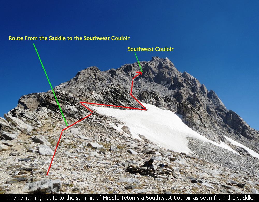
From the saddle, take a right to head up the Middle Teton. You would go left to go up
South Teton. Once on the way, there is another snow field and a steep section before reaching
the base of the final mountain block and the Southwest Couloir. Be careful to avoid the snow
and the steep section has some nice ledgy switchbacks but still requires caution.
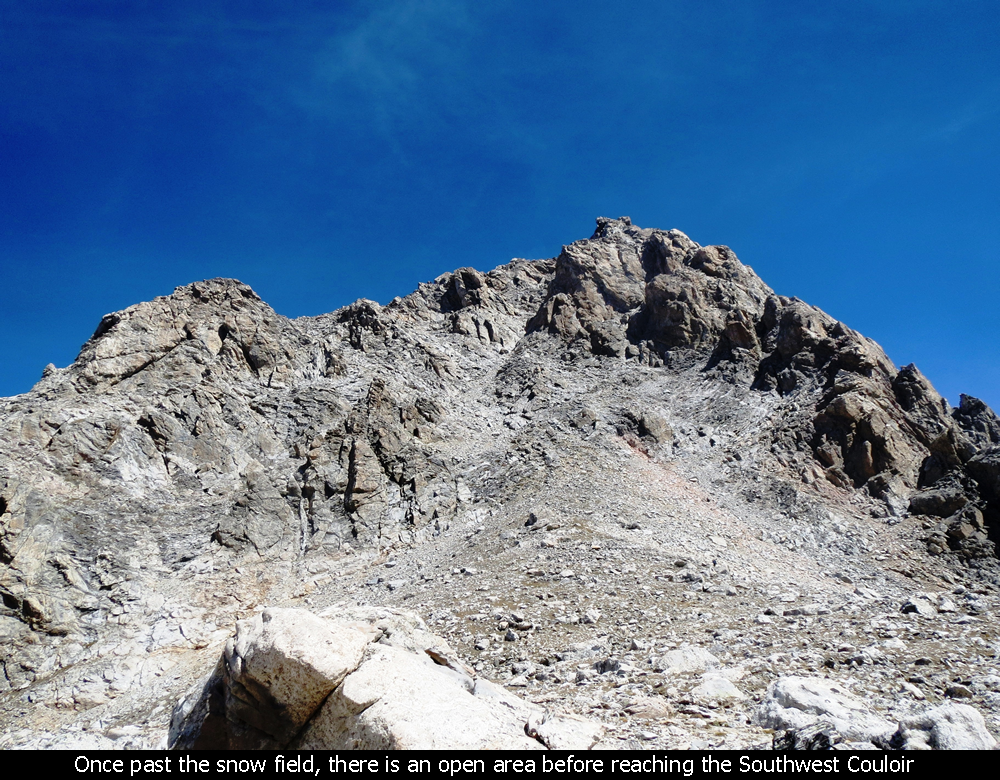
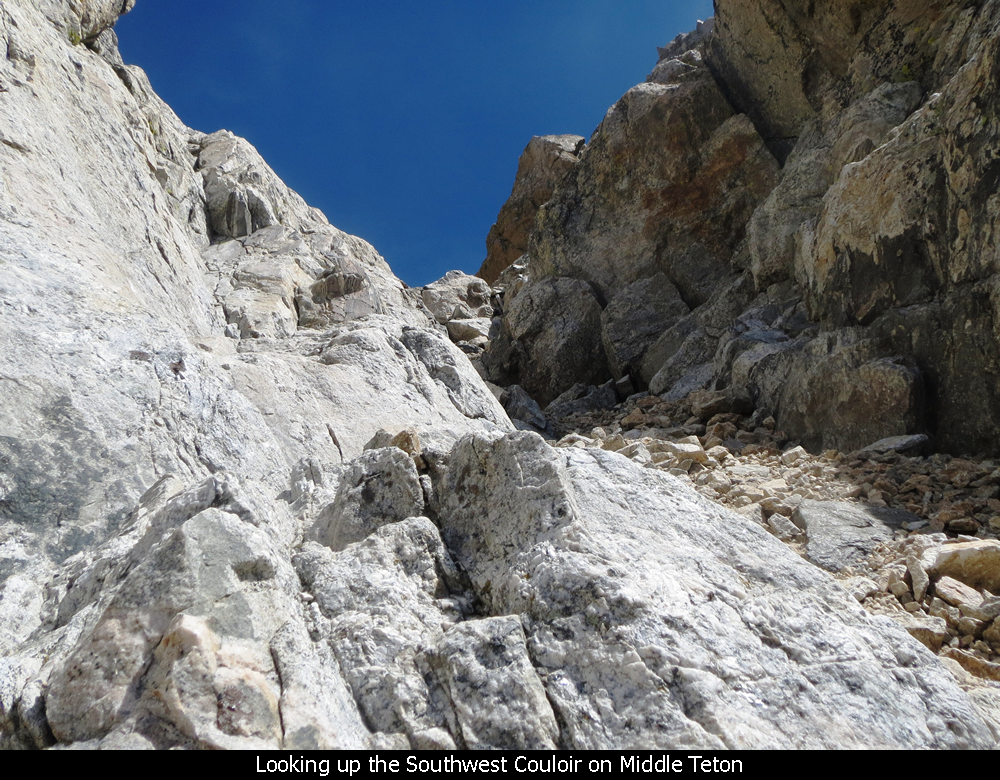
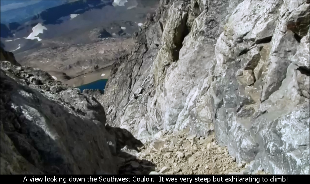
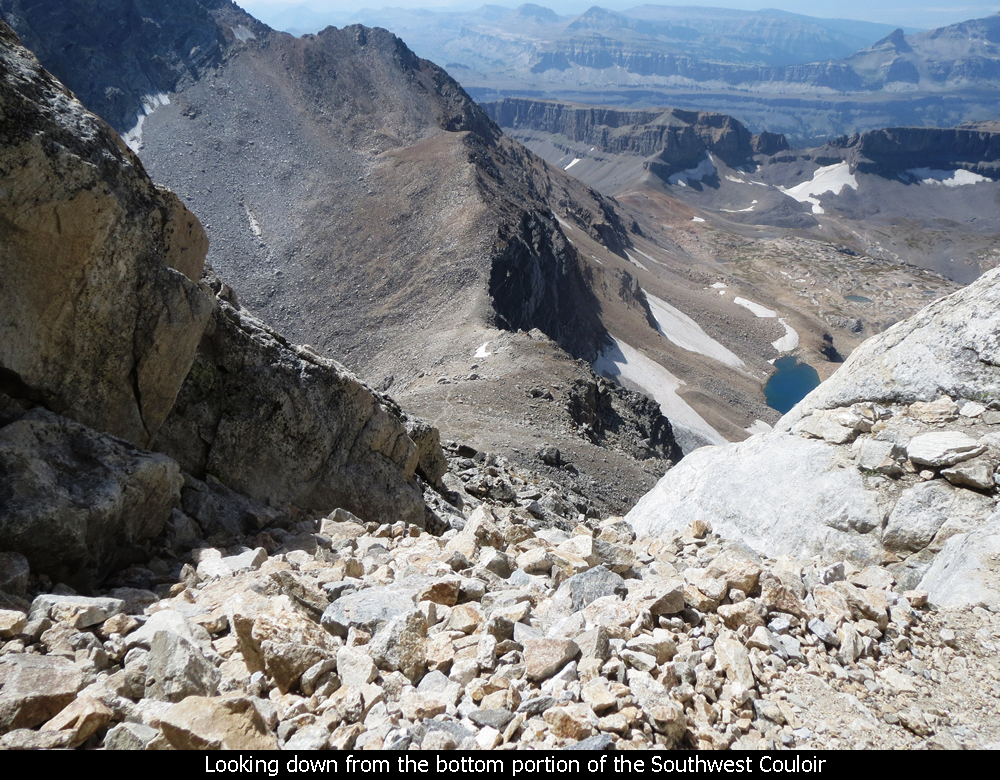
Views Out From Southwest Couloir - Middle Teton - Grand Teton National Park
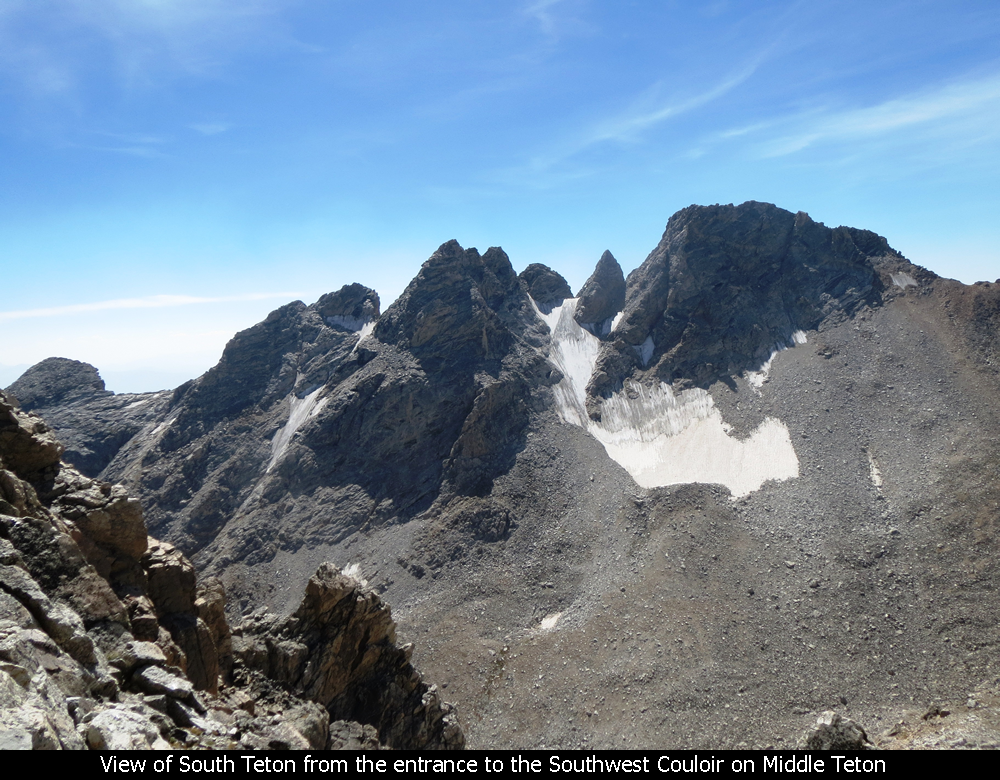
Once reaching the Southwest Couloir, the terrain becomes very steep. And in the Couloir
itself there is loose rock and dirt for many parts. There is nice solid rock along the sides
of the couloir you can grab to steady yourself. And I have read some reports about
people just climbing the rock instead of staying in the couloir proper. But BE VERY
CAREFUL up on these mountains! I have read that going off route on the Middle Teton can get
you into some very dangerous spots. And two girls died the day before my trip on Teewinot
Mountain in GTNP because they went off route and got stuck in a cliff area (and then fell).
About half-way up the couloir, you run into a small Class 4 area. It is probably no big
deal for most experienced climbers. But with the exhaustion of having already hiked 7 hours
and 6000 feet up, and given the fact that the steepness of the couloir was so new to me, I
just did not feel comfortable attempting the Class 4 pitch, and had no other way to continue
up. In retrospect, I probably should have asked my partner or one of the other hikers nearby
for a spot, but I didn't. In the end though, it is always better to turn around and try another
day than to attempt something outside of your comfort zone. If the Class 4 pitch would have
been on flat ground, it was no problem as it is only about 8 feet tall. But the fact that it
is right in the middle of this steep couloir is what gave me pause.
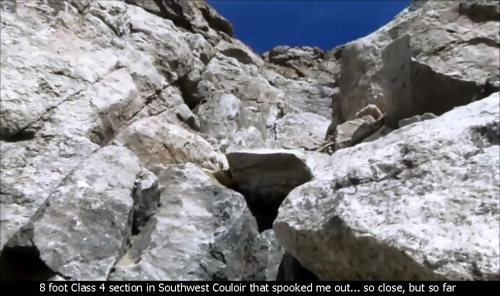
Class 4 Pitch In Southwest Couloir - Grand Teton National Park
My partner Garrett made is past the Class 4 pitch and to the summit. He notes, as other
hikers did, that when you get near the top, stay to the left. If you go right you will be
looking over a gnarly 1000 foot drop. There is also exposure beyond the summit on the
northern side (towards the Grand), but this is to
be expected on any summit in the Tetons. Garrett had never been to a summit in the Tetons
and he did say it was frightening for him. So, he tagged the survey marker, took a quick
picture and headed back down. A lot of the comfort level for something like this most likely
comes from experience. So, if you are comfortable with exposure, it is probably no problem.
For those of us just learning... well, just take your time and be careful!!
The way down the couloir and the South Fork is not as bad as I thought it would be.
The sit-down-butt-maneuver seems to come in handy in many spots where it gets a little steeper.
It is definitely quicker than the long trek up.
Some Wildlife On The Way Down - Garnet Canyon - Grand Teton National Park
We finally made it back to the Trailhead at about 7PM but we had taken some time to chat with
folks on the way down. So, it could have been somewhat shorter if necessary.
In an overall sense, doing this hike is unbelievable. It puts you into an entirely
different state of consciousness. Almost as if you have gone to another planet and back.
It is long. And if you don't like rocks, you won't like it. And if you plan to try it,
do your best to get in really good shape and try some other steep stuff and get used to some
exposure if you can. A little climbing training / experience would be helpful as well.
You don't need ropes to do this climb, but they might come in handy for the baby
Class 4 pitch .... but experienced folks will breeze right through this section. Even
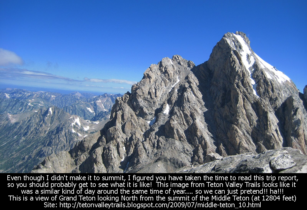
if you just make it to the Meadows or even to the saddle, it is just unbelievable gorgeous
up there....no pictures tell the real story. Oh!! And we were lucky to be in a stable
weather pattern, but be very careful about afternoon T-Storms.
Hope this has been enjoyable and / or helpful to anyone reading it!!
Comments
| Posted By: Paul - 8/3/2025 |
| Comment: Just got back from this trip. This report helped as we prepared for this hike. Very thorough. Very full parking lot at the trailhead. One of our party had a hard time with his knees but hiking poles helped a lot especially going down. He ended up resting and had a few slow stretches and left his helmet that 2 of us went back to look for so the full thing took us 14 hours (leave early, take a headlamp). We made a stash at the saddle for the final push where we left a few things (bear spray and hiking poles). One hiker used Strava to show the route that most people take. From the Meadows to the saddle, we veered too far left above the snowfields and it was sketchier than the Couloir itself. Beautiful day and just a few minutes of rain. Saw a bear in the dark on the way out, but no trouble at all. The black bears here are very rarely aggresive. Thanks for your post. |
| Posted By: Jim T - 11/13/2023 |
| Comment: Climbed a long time ago. 1985. Camped overnight in the meadows. Don't know that is an option still. From parking lot all the way up is a long day. Great description |
| Posted By: Jamie - 10/28/2023 |
| Comment: Thank you so much for posting a detailed account. I want to share that a couple months ago, my stepdad climbed it, made it to the top (not sure about the very tip), and maybe halfway down, but fell somewhere... he did not make it. (I will add that he had no climbing partner, which I believe is so important!) I felt your warning was a good one... to wait until you're ready. He was trained but on the East Coast Adirondacks only... nothing like these Tetons. Thank you for posting this; I think it will help many people. These mountains are no joke. But so beautiful! |
| Posted By: Jeff (MN) - 6/17/2021 |
| Comment: Climbed the Middle Teton in 1976. Your photos look the same as it did back then. The boulder trail was tough to navigate but the meadows made it worth it. Like so many I did not reach summit but got damn close. Snow storm came in and rock(s) surfaces became very slippery. Thanks for your detailed travel and climbing log. |
| Posted By: Joe in Maryland - 6/2/2021 |
| Comment: Amazing photos and written account. Heading that way in September and now want to try this. I’m pretty conservative when get near exposure so understand why you might need more than one attempt here. |
| Posted By: BG - 7/30/2020 |
| Comment: Thanks for the write up and pics! Taking the wifey and attempting to summit middle of next month:) |
| Posted By: Neature - 6/25/2020 |
| Comment: Nice pics and info. However, it is Icefloe* Lake ;) |
| Posted By: Tim - 1/9/2020 |
| Comment: Thanks for posting this, it's the best information I've seen as to what the hike to Middle Teton will actually be like. I'll be there in September of 2020 and have been debating if I want to attempt this. After reading this I think I'm going to give it a try. |
| Posted By: Jake Michaud - 7/24/2019 |
| Comment: Have been doing a lot of research on this route, and yours was by far the most in depth account. Cant wait to do this in a few weeks, thanks for all the great information and videos! |
| Posted By: Dale - 7/5/2019 |
| Comment: I hiked it about 15 years ago with five of our kids, the youngest about 12. Made it to the saddle and everyone except the youngest was ready to call it good. He wanted to keep going so we decided to give it a go. I was the last one to the top. I remember the couloir was steep but navigable and I remember pulling myself up to peak down on the valley. Ran short of the water on the way down but we were able to filter more and rest when we reached a stream. Probably my most memorable hike. |
| Posted By: AJ - 3/14/2019 |
| Comment: Nice work - this one has been on my bucket list for a few years. Maybe 2019 will be the magic - Thanks again |
| Posted By: Albert - 9/13/2018 |
| Comment: Nice Trip report. I summited via the SW couloir in July of 2007, it was great! |
| Posted By: Nancy - 7/19/2018 |
| Comment: Thanks for the detailed story and pictures/videos of your hike. It made me feel like it was okay to just go as far as I felt safe and that would be okay. |
| Posted By: JRCD - 2/25/2018 |
| Comment: Thanks for the pictures and story line. I climbed the Middle Teton as a flatlander back in the late 80's -- my first real summit. I don't recall any 4th class stuff, but I fully respect your choice to stay safe. Great choice. While I was on the Middle alone a climber came up from the Black Dike on to the false summit. He was there for a couple of minutes before he started yelling. His partner had unroped near the top but fell when a chockstone moved on him. He died. It was a very long day for everyone. But, your choice reminded me of that trip and how stunningly beautiful it was, just as you described/reported. I love being in the mountains, but still choose -- as you did -- to err on the cautious side. Again, thanks for the write up. |
| Posted By: Courtney - 2/4/2018 |
| Comment: Really enjoyed reading about your trek!
What is the total mileage of this hike? I’m thinking about it this summer, with my 13 year old daughter. Maybe we will make the Meadows our goal?
Best,
Courtney
Burlington,Vt
|
| Posted By: hong son - 1/24/2016 |
| Comment: really enjoyed your story. and pictures!
I too attempted the Middle twice. first time, turned around due to motion sickness from flashing headlamp (would you believe that?) and second time, just about where you were below the summit.
time was about 3pm and my wife was way below at the saddle.
so turned around.
perhaps this summer.....
|
Add Comment:
Name:
Comment:
Comments ReCaptcha (to verify you are actually a person)
Please click the ReCaptcha button below. Sorry to do this but we had robots posting spam messages on this blog and this prevents that.