The Three Ridges Hike in the George Washington National Forest is amazing. This
area of the Appalachians, near the North end of the Blue Ridge Parkway has
rugged, (relatively, for the area) higher elevation mountains. This loop hike can be done two
ways and this report describes starting from the South at the Route 56
intersection of the Appalachian Trail. Then the route goes clockwise, going up
Three Ridges Mountain first, then down the Mau-Har trail.
I was trying to get some strenuous hiking before I went out West, and this hike
fit the bill. It was a 14.4 mile hike with 4300 feet elevation gain. I was lured
into doing the hike as it was posted with the Mid-Atlantic Group. Given my unfamiliarity
with the area, I figured it would be good to be with a group. Let me say that folks
from these hiking groups are pretty much maniacs. They go really fast!
We started the hike at 9AM. Just after leaving the parking area, you cross a
suspension bridge over the Tye River.
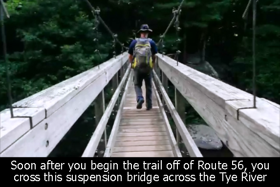
Getting Started On Bridge Over Tye River - Three Ridges Mountain - GWNF
Then, it is on up 1.5 miles to the first
intersection. Head to the right to the Three Ridges Mountain trail, which stays
on the white blazed Appalachian Trail. There is a small ridge to clear, then down and across a creek,
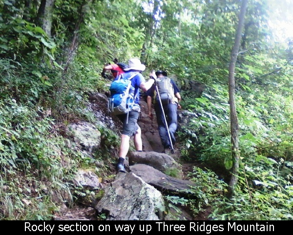
and then you begin heading up from the base of the Three Ridges Mountain. This hike is tough! Lots
of interesting (sometimes rocky) trail that goes straight up for about 4 miles. It is just a
big long mountain!
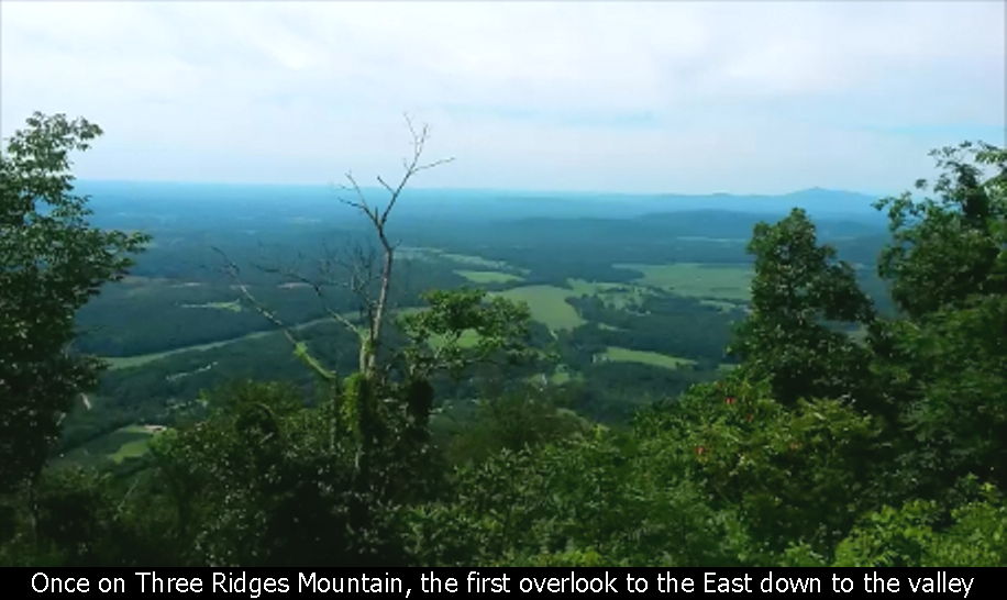
The first overlook on Three Ridges Mountain is on a rock slab looking to the
East.
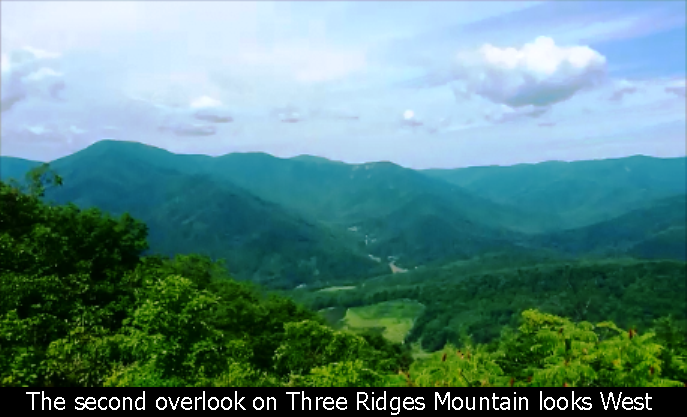
Then you arrive at another overlook which looks to the West.
After the second overlook, the next section towards the summit is very steep,
with lots of switchbacks and steps. The summit itself doesn't have
any overlooks.
The Second Overlook - Three Ridges Mountain - GWNF
Steep Rocky Trail Near Summit - Three Ridges Mountain - GWNF
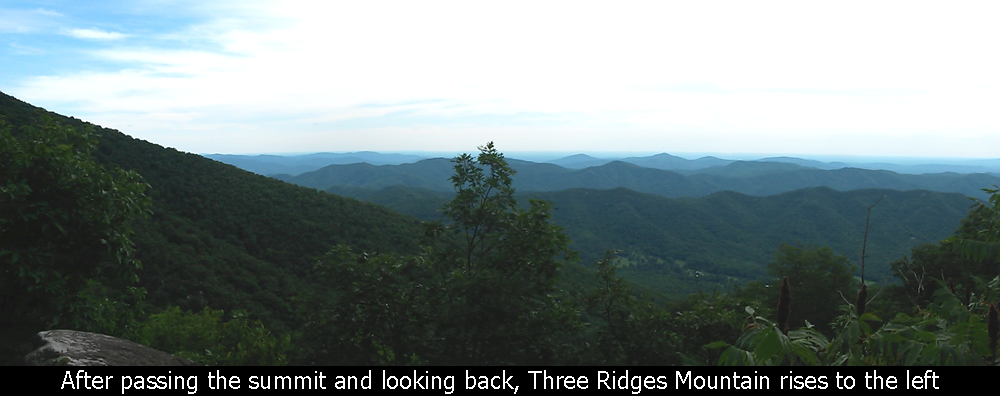
Over the summit the trail continues on the Appalachian Trail and eventually bends
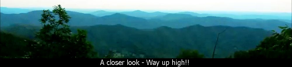
over onto Bee Mountain. This is where you hit the 3rd, and best (spectacular!)
overlook. The overlook from Bee Mountain looks directly to the South at The
Priest with views East, South and West. The giant open rock slab sits as if it is
hovering on air. It's a great place to stop and rest up.
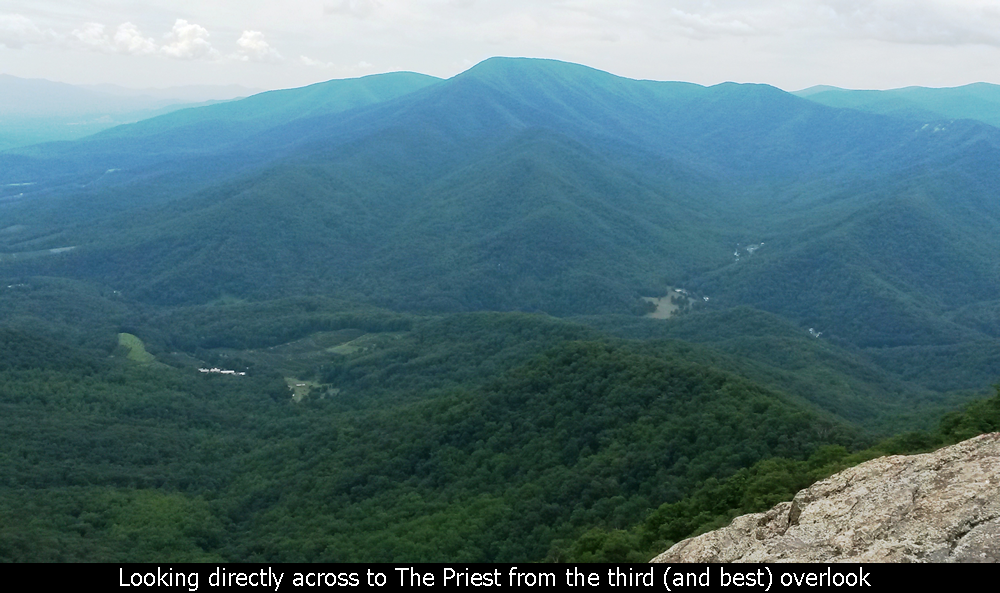
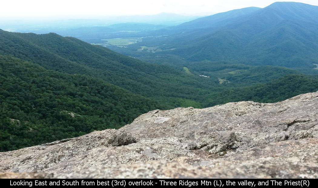
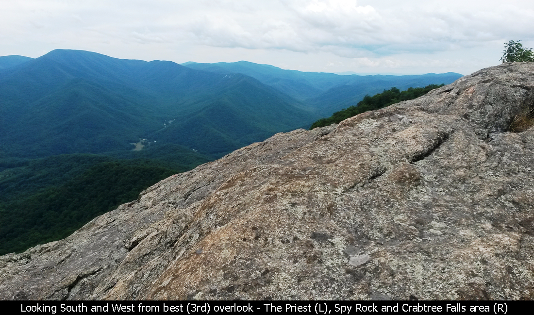
Views From The Best Overlook - Three Ridges Mountain - GWNF
The trail continues down Bee Mountain and is quite pleasant.
The trail then hits an intersection where there is a
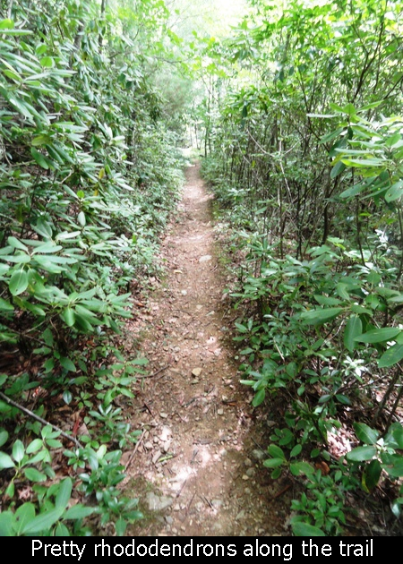
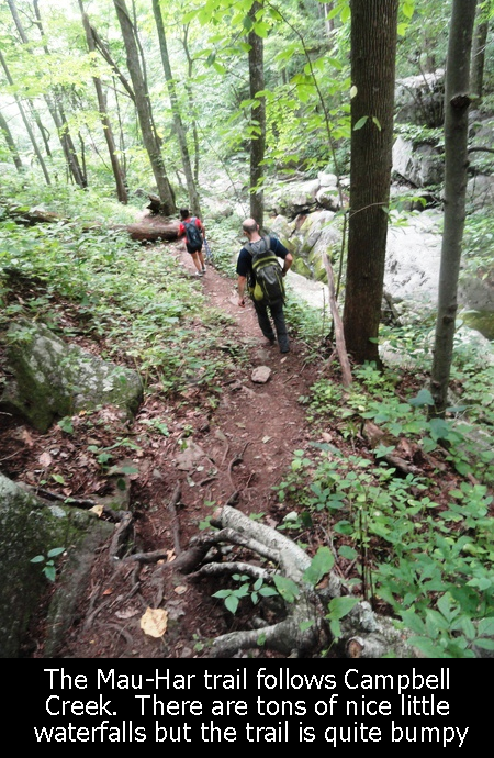
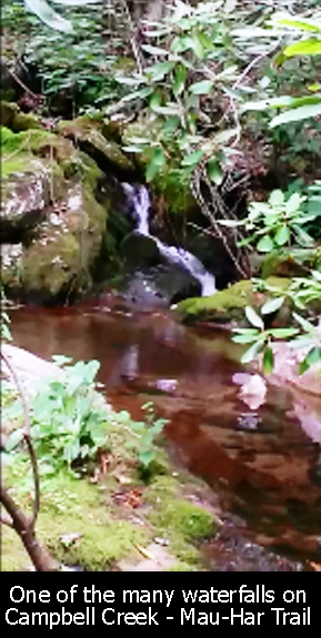
shelter, some campsites, and the beginning of the Mau-Har trail. This trail is
really neat as it follows Campbell Creek for a good 1.5 mile stretch. The creek
is covering a quite steep section so there are lots of little baby waterfalls
alongside the trail. And the trail itself is also quite bumpy as it flows over
rocks and ledges alongside the creek. It definitely takes more time to navigate
this trail. Even though it is downhill, the technical portions make it slow
going. Beautiful though!
When you reach the bottom of the Mau-Har trail, get ready for some pain, as there
is a 600 ft uphill to go over another ridge to meet back with the intersection
of the Appalachian Trail. This is about the time you start wishing this long
hike was finished! But no, after navigating the section over the ridge to the
intersection, you still have another 1.5 miles back down to Route 56!
All in all this is a great hike if you are looking for a strenuous hike to get
you in shape. The sheer size of the mountains, along with the beautiful overlook
and gorgeous Mau-Har trail make it well worth it. But bring lots of water and
lots of food. And make sure to get in some training hikes before you try this
one! It took us 8 hours.
Butterfly Bush - Three Ridges Mountain - GWNF
Hope this has been enjoyable and / or helpful to anyone reading it!!
Additional information about this hike can be found here:
http://www.hikingupward.com/GWNF/ThreeRidges
http://midatlantichikes.com/at-mauhar.htm
Comments
Add Comment:
Name:
Comment:
Comments ReCaptcha (to verify you are actually a person)
Please click the ReCaptcha button below. Sorry to do this but we had robots posting spam messages on this blog and this prevents that.