Maryland Heights is one of the most popular mountain hikes in the DC - Baltimore Region.
It is in the Harpers Ferry WV area. There are two basic hikes, one which is just to the
beautiful overlook and back. The other branches off to an additional (and more strenuous)
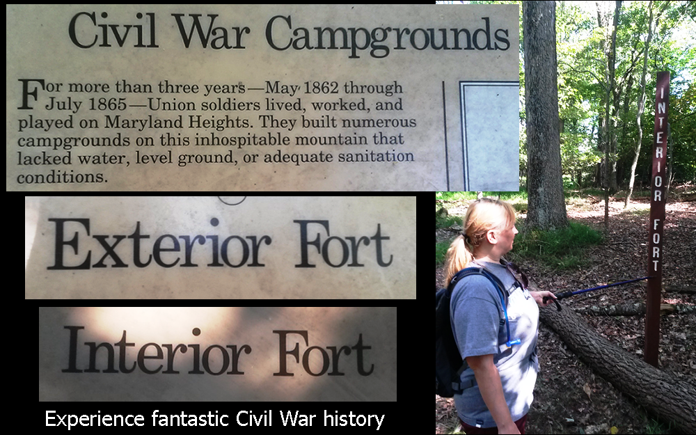
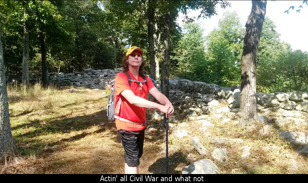
leg to the top of the Mountain and visits the Civil War Stone Fort area, which is also very enjoyable.
Directions and information on where to park for this hike are at the bottom of this page.
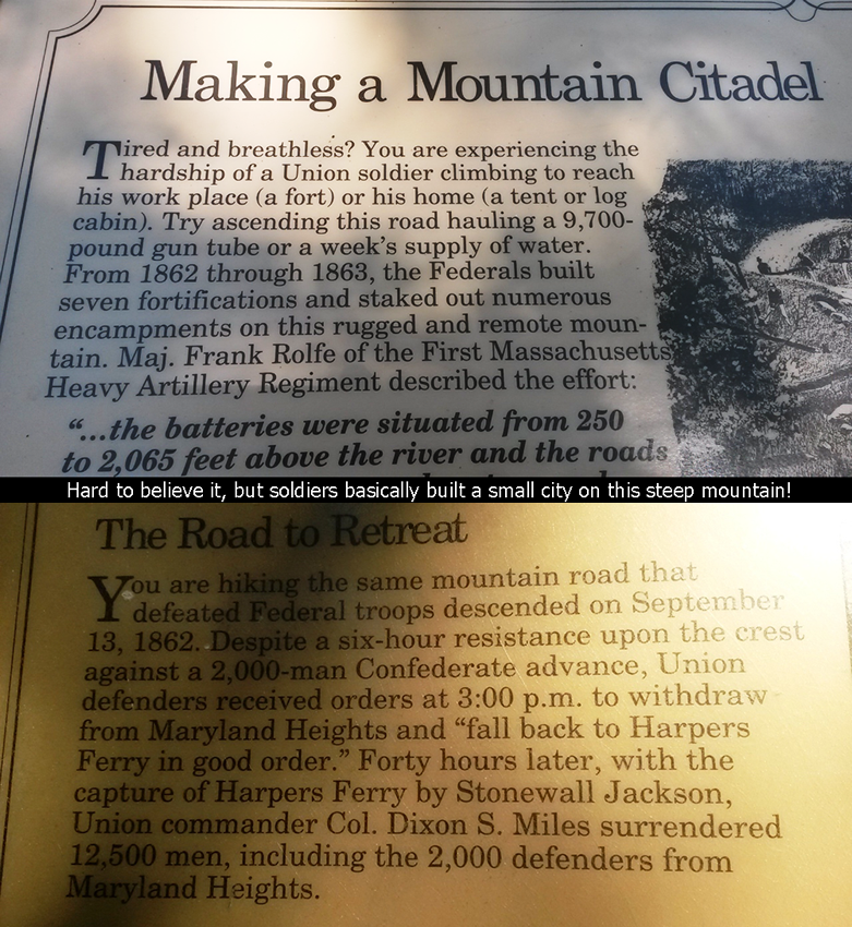
The first section of the Maryland Heights trail is an old road that was actually built
by the civil war troops that inhabited the area. Back then they didn't really consider
switchbacks, so the trail just basically goes straight up! So, even though it isn't long,
especially the first time you do it, you will notice the steepness! On the way up, the
trail goes two different ways, but if you stay right, you will pass the Naval Battery
(one of several batteries on the mountain) that was used to shoot the munitions towards
the West and the town of Harpers Ferry.
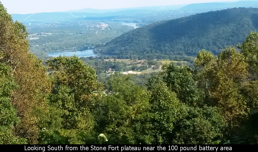
You will then come to an intersection where you can go left towards the Stone Fort
or stay right which takes you towards the overlook. The overlook trail is about 3 miles
total and if you take the loop to the Stone Fort, it adds another 2-3 miles (with a
lot more of the steepness).
To only go to the overlook, continue right at the intersection, the hill will
eventually top out and then begin to head down. The trail will become more single track
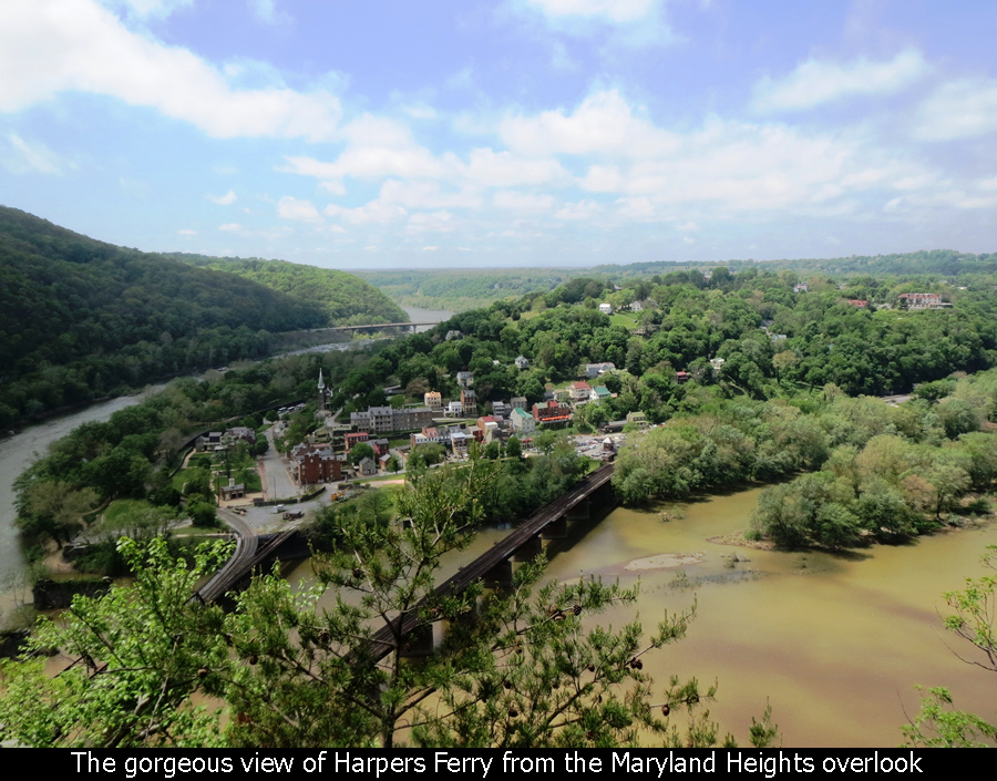
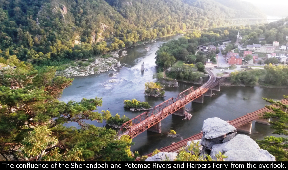
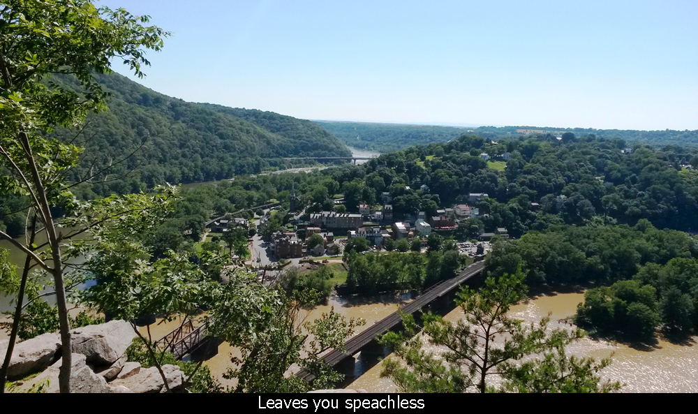
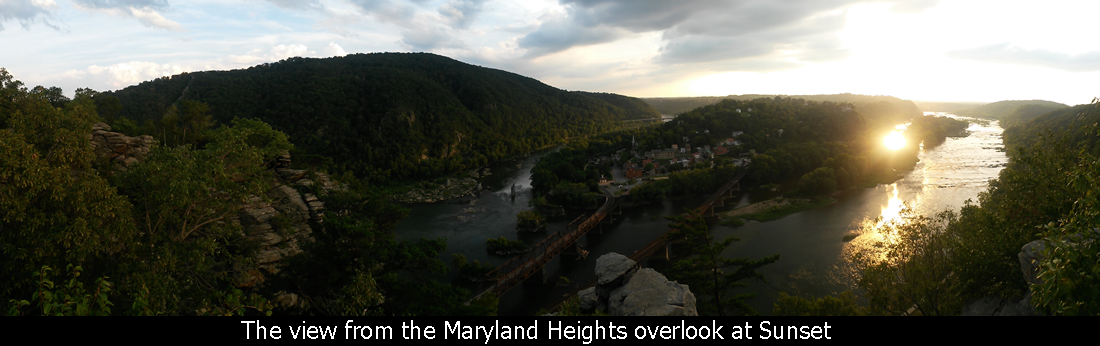
and it is about 1/4-1/2 mile down to the overlook. What a fantastic view!! Hiking
Upward rates this one a 6 out of 5!! It really has got to be one of the most gorgeous
overlooks on the East Coast. It not only sits right above the historic (and hilly and
really neat to look at ) town of Harpers Ferry, but it also gives views up both the
Potomac (right) and Shenandoah (left) rivers as well as the confluence below. There is
an active train system through the area so you are guaranteed to hear the trains and
see them cross the train bridges from Harpers Ferry into MD as well. There is lots of
room on top of the overlook area and to the left are some
interesting scrambles if you so choose. Watch out though as there is a huge cliff!
Once you have soaked up the views, head back the same way you came. Overall (if you
park on Sandy Hook Road), the hike to the overlook and back should be about 2 hours
(including about 1/2 hour to take in the views).

If you choose to go to the Stone Fort, you will be rewarded with some awesome Civil War
history.
Harpers Ferry was a strategic area in the 1860s and was an important center of attention
for both sides in the war. The Union was so concerned about keeping it, that they build this
MASSIVE fort complex on top of this remote mountain to protect the area. The trail that takes
you up the mountain (after the intersection) has great information signs. Apparently there were
2000 Union troops living up on this mountain!
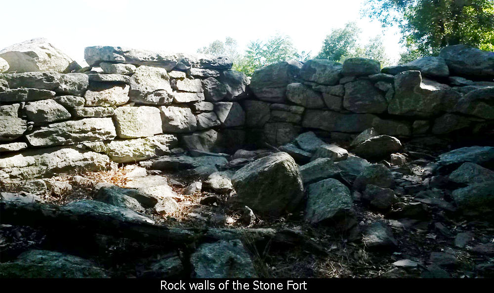
When you get towards the top, you go through a campsite area, and see where they stored
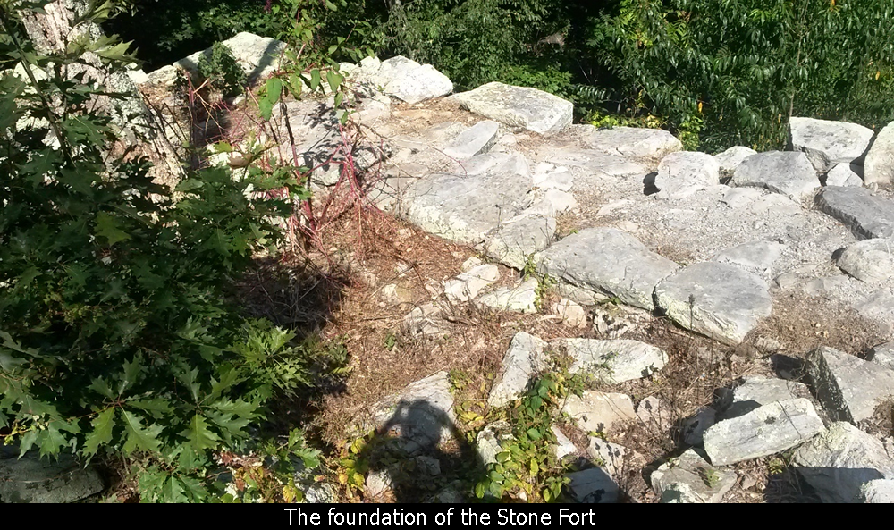
ammunition. The Union built these unbelievably long barrier fences out of rock that are
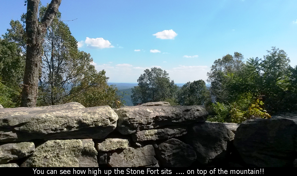
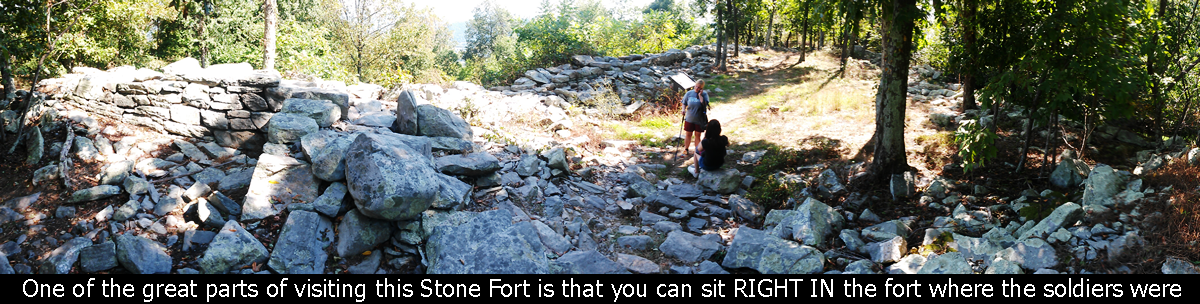
still there. Finally you get the actual Stone Fort and the foundation area still exists. To
me, what is so neat about it, is that because of the remoteness of
the location, nobody since has even wanted to do anything with that land. So, it
basically sits there as it was in the war...untouched!! And the fact that you can
just sit there right in the fort and on the rocks that the soldiers (obviously
painstakingly) put into place, it just really give you an eery feeling that there
are spirits of these guys right there with you.
We are not talking about
a little dinky fort like a kid would build. The whole area is huge for being in the
middle of nowhere! The trail is technically a loop so there are two legs that go up
to the fort and back to the main trail. As you walk down the return trail (doing the
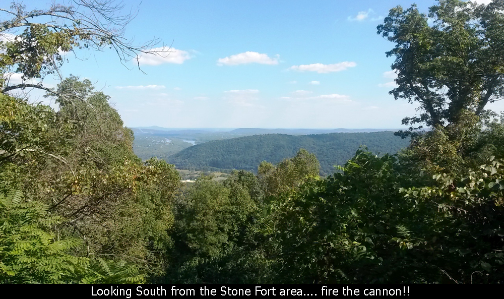
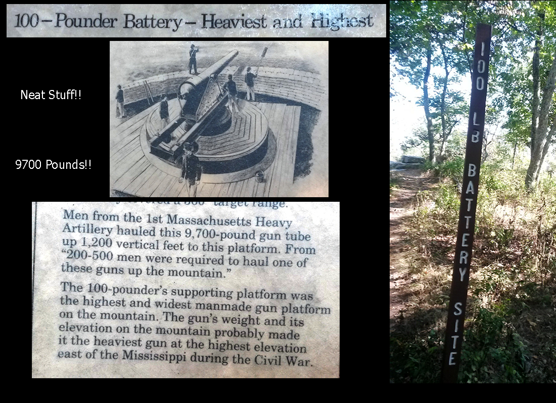
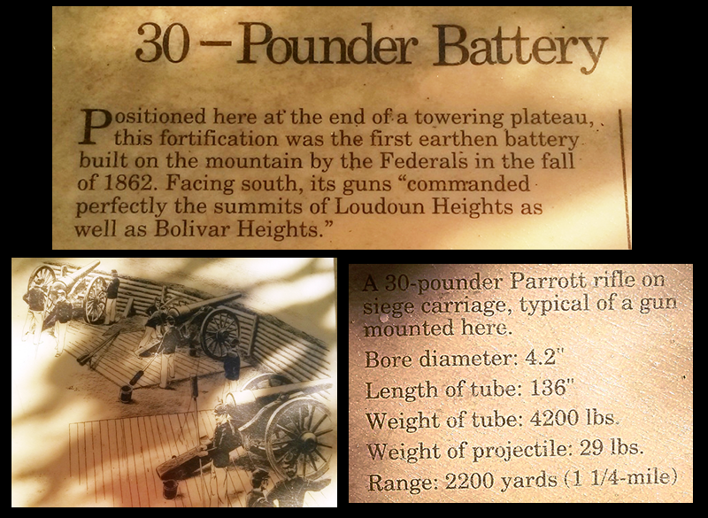
loop clockwise), you will pass some battery
stations that look out to the South and there is great information about them on the signs.
When you see read about the weight of the cannons they manually hauled up onto this
mountain it will blow you away. The biggest one took 200-500 men to pull this 9700
pound cannon up this steep trail. There is a sign which talks about how Lincoln had
tried to visit the troops there a few day before the battle of Antietam broke out.
Apparently though with his health, he could not make it up the steep hill.
Overall, only being a mild Civil War buff myself, I was blown away by the history
that you take in on this hike. And it's a great workout and beautiful. I would
absolutely recommend it to anyone in the DC-Baltimore area. While they state the
extra length to the Stone Fort is very strenuous, I personally did not think it
was all that bad. You would not want to be in poor health to try this, but if you
take your time up the hills, it is no problem. Overall it took us about 4 hours
to do the whole hike to the Stone Fort and back.
Directions and information about where to park:
On a nice weekend day, parking can be a pain in the area, but normally there
are a couple of options. You can park in Harpers Ferry proper at the train station,
then walk down to the Appalachian Trail footbridge, cross the river, then head up-river
(left) towards the trailhead. This adds another 2 miles of flat distance to the hike.
If you are coming on Route 340 from MD, one disadvantage of parking in town is that
it is a much longer drive to go over both bridges, and all the way down and into
town to the train station. Surely this is the reason Harpers Ferry (in modern times
that is!) does not have much economy outside of tourism. It is just a pain to get
in and out of!
To drive straight to the trailhead, as you near the Harpers Ferry area and before
you cross the Potomac River bridge, take a left hand turn onto Valley Road and then
an immediate left onto Keep Tryst Rd (you will see an old Motel there). Be on the
lookout for the left hand turn off of 340 as it comes up on you fast as the speed
limit it high in that area and you have to be ready for that left. If you hit the
big bridge, you went too far! Take Keep Tryst road for a 1/4 mile and take a right
onto Sandy Hook Rd. Continue down this road over a couple of narrow bridges until
you have past where you see the entrance to one of the railroad tunnels in the area.
After that the you will see the trailhead on the right and the dirt parking area is
just on the right past that. If the first parking area is full, drive a short
distance and there is another parking area on the right. Be careful about parking
anywhere outside of these two lots, especially on a busy day, as Rangers will
drive by and ticket and tow. One day we had to stalk spots for a half-hour.
Hope this has been enjoyable and / or helpful to anyone reading it!!
Comments
Add Comment:
Name:
Comment:
Comments ReCaptcha (to verify you are actually a person)
Please click the ReCaptcha button below. Sorry to do this but we had robots posting spam messages on this blog and this prevents that.